
The spin axis of the Moon is tilted by only 1.5° (compared with the Earth's 23.5°), leaving some areas near the poles in permanent shadow, while other nearby regions remain sunlit for the majority of the year. Theory, radar data, neutron measurements, and Lunar CRater Observation and Sensing Satellite (LCROSS) observations suggest that volatiles may be present in cold traps in permanently shadowed regions. Thus, areas of near permanent illumination are prime locations for future lunar outposts due to their benign thermal conditions and near constant accessibility to solar power.
One of the primary scientific objectives of the Lunar Reconnaissance Orbiter Camera (LROC) is to unambiguously identify regions of permanent shadow and near permanent illumination using its two imaging systems that provide medium and high-resolution views of the poles. While in a 50-km polar orbit (September 2009 to December 2011), LRO acquired thousands of Wide Angle Camera (WAC) images of each pole every ~2 hours. Occasional spacecraft and instrument disturbances caused some imaging opportunities to be missed, however the average time between WAC observations remained at 2.3 hours.
When LRO passes over each pole, the WAC images from 80° to 90° on the dayside and back to 80° on the night side. The WAC 90° field of view (monochrome mode) allows for a 104-km region within 2° of the pole to be acquired at a resolution of 100 m/pixel. Speyerer and Robinson (2013) compiled these images into a year-long illumination movie in order to identify regions near each pole that remained illuminated for a majority of the year.
As part of this Reduced Data Record (RDR) product, we have included 8109 WAC images of the
north pole acquired between 2009-09-23 and 2011-12-11. Each file is named with the following pattern:
WAC_MOVIE_[N|S]YYYYMMDDThhmm
where:
- [N|S] indicates the map pole (N=North or S=South)
- YYYY indicates the year of the observation
- MM indicates the month of the observation
- DD indicates the day of the observation
- T is a date and time separator
- hh indicates the hour of the observation (24-hour format)
- mm indicates the minute of the observation
The times used in the naming scheme are the start times of the WAC observations in UTC. All north pole products are map projected in polar stereographic with the center latitude of +90° and center longitude of 0° sampled at 100 m/pixel covering +80° to +90°. A LOLA shape model (Smith et al. 2010) was used to remove mapping distortions due to topography. Each WAC image was processed using the latest camera model available (Speyerer et al., 2014) with improved spacecraft ephemeris provided by the LOLA/GRAIL team (Mazarico et al., 2013). The image header includes the mapping information, start and stop times, along with the WAC image name used to make the individual product.
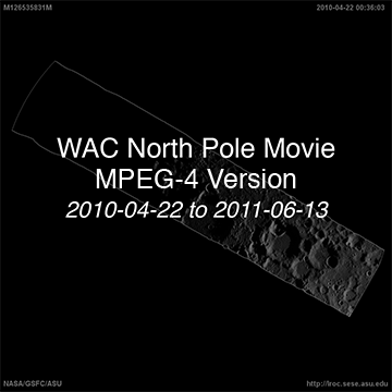
In addition, we have compiled QuickTime (.mov) and MPEG-4 (.mp4) movie files using 4124 WAC images acquired between 2010-04-22 and 2011-06-13. This time period is ideal, since there are not many long temporal gaps between WAC observations. The movie files are available in two sizes: cropped and reduced. The cropped version is sampled at 100 m/pixel and is centered at the north pole. The reduced resolution version is sampled at ~560 m/pixel to enable the entire WAC image out to 80°N to be displayed within a 1080x1080 pixel area.
Low-resolution 8-bit browse products in PNG format for this product, along with full-resolution 8-bit GeoTIFFs, are availablãe at the following location, with names matching those of the full-resolution IMG files: http://lroc.sese.asu.edu/data/LRO-L-LROC-5-RDR-V1.0/LROLRC_2001/EXTRAS/BROWSE/WAC_POLE/WAC_POLE_MOVIE_NORTH/
A partial lunar eclipse is visible on 2010-06-26 at 11:34:17 UTC.
When citing this product, use the following reference: Speyerer, E. J., & Robinson, M. S. (2013). Persistently illuminated regions at the lunar poles: Ideal sites for future exploration. Icarus, 222(1), 122-136. doi:10.1016/j.icarus.2012.10.010
The 8109 WAC polar movie frames are archived here.
| Product | File Size | Date Range | Number of WAC Images |
| Cropped version (QuickTime) | 2.33 GB | 2010-04-22 to 2011-06-13 | 4124 |
| Cropped version (MPEG-4) | 1.04 GB | 2010-04-22 to 2011-06-13 | 4124 |
| Reduced version (QuickTime) | 444 MB | 2010-04-22 to 2011-06-13 | 4124 |
| Reduced version (MPEG-4) | 262 MB | 2010-04-22 to 2011-06-13 | 4124 |
References:
D. E. Smith et al. (2010). Initial observations from the lunar orbiter laser altimeter (LOLA). Geophysical Research Letters, 37(18). doi:10.1029/2010GL043751
E. Mazarico et al. (2013) Improved Orbit Determination of Lunar Orbiters with Lunar Gravity Fields Obtained by the GRAIL Mission, 44th Lunar and Planetary Science Conference, Abstract #2414.
E.J. Speyerer and M.S. Robinson (2013) Persistently illuminated regions at the lunar poles: Ideal sites for future exploration, Icarus 222, pp. 122-136. doi:10.1016/j.icarus.2012.10.010
E.J. Speyerer et al. (2014) Pre-flight and On-orbit Geometric Calibration of the Lunar Reconnaissance Orbiter Camera, Space Science Reviews. doi:10.1007/s11214-014-0073-3
For more information on LROC Reduced Data Records (RDRs), please refer to the LROC RDR Software Interface Specification (SIS).
WAC North Pole Movie


Extra Downloads
Frames
- WAC_MOVIE_N20090923T0926
- WAC_MOVIE_N20090923T1119
- WAC_MOVIE_N20090923T1312
- WAC_MOVIE_N20090923T1505
- WAC_MOVIE_N20090923T1658
- WAC_MOVIE_N20090923T1852
- WAC_MOVIE_N20090923T2045
- WAC_MOVIE_N20090923T2238
- WAC_MOVIE_N20090924T0031
- WAC_MOVIE_N20090924T0224
- WAC_MOVIE_N20090924T0610
- WAC_MOVIE_N20090924T0804
- WAC_MOVIE_N20090924T0957
- WAC_MOVIE_N20090924T1150
- WAC_MOVIE_N20090924T1536
- WAC_MOVIE_N20090924T1729
- WAC_MOVIE_N20090924T1923
- WAC_MOVIE_N20090924T2116
- WAC_MOVIE_N20090924T2309
- WAC_MOVIE_N20090925T0102
- WAC_MOVIE_N20090925T0255
- WAC_MOVIE_N20090925T0448
- WAC_MOVIE_N20090925T0642
- WAC_MOVIE_N20090925T0835
- WAC_MOVIE_N20090925T1028
- WAC_MOVIE_N20090925T1221
- WAC_MOVIE_N20090925T1414
- WAC_MOVIE_N20090925T1955
- WAC_MOVIE_N20090925T2149
- WAC_MOVIE_N20090925T2343
- WAC_MOVIE_N20090926T0138
- WAC_MOVIE_N20090926T0332
- WAC_MOVIE_N20090926T0526
- WAC_MOVIE_N20090926T0720
- WAC_MOVIE_N20090926T0915
- WAC_MOVIE_N20090926T1109
- WAC_MOVIE_N20090926T1304
- WAC_MOVIE_N20090926T1458
- WAC_MOVIE_N20091004T1335
- WAC_MOVIE_N20091004T1529
- WAC_MOVIE_N20091004T1722
- WAC_MOVIE_N20091004T1915
- WAC_MOVIE_N20091004T2108
- WAC_MOVIE_N20091004T2301
- WAC_MOVIE_N20091005T0055
- WAC_MOVIE_N20091005T0248
- WAC_MOVIE_N20091005T0441
- WAC_MOVIE_N20091005T0634
- WAC_MOVIE_N20091005T0828
- WAC_MOVIE_N20091005T1021
- WAC_MOVIE_N20091005T1214
- WAC_MOVIE_N20091005T1407
- WAC_MOVIE_N20091005T1600
- WAC_MOVIE_N20091005T1754
- WAC_MOVIE_N20091005T1947
- WAC_MOVIE_N20091005T2140
- WAC_MOVIE_N20091005T2333
- WAC_MOVIE_N20091006T0127
- WAC_MOVIE_N20091006T0320
- WAC_MOVIE_N20091006T0513
- WAC_MOVIE_N20091006T0706
- WAC_MOVIE_N20091006T0859
- WAC_MOVIE_N20091006T1053
- WAC_MOVIE_N20091006T1246
- WAC_MOVIE_N20091006T1439
- WAC_MOVIE_N20091006T1632
- WAC_MOVIE_N20091006T1826
- WAC_MOVIE_N20091006T2019
- WAC_MOVIE_N20091006T2212
- WAC_MOVIE_N20091007T0005
- WAC_MOVIE_N20091007T0159
- WAC_MOVIE_N20091007T0352
- WAC_MOVIE_N20091007T0545
- WAC_MOVIE_N20091007T0738
- WAC_MOVIE_N20091007T0932
- WAC_MOVIE_N20091007T1125
- WAC_MOVIE_N20091007T1318
- WAC_MOVIE_N20091007T1511
- WAC_MOVIE_N20091007T1705
- WAC_MOVIE_N20091007T2051
- WAC_MOVIE_N20091009T0108
- WAC_MOVIE_N20091009T0302
- WAC_MOVIE_N20091009T0455
- WAC_MOVIE_N20091009T0648
- WAC_MOVIE_N20091009T0841
- WAC_MOVIE_N20091009T1034
- WAC_MOVIE_N20091009T1227
- WAC_MOVIE_N20091009T1421
- WAC_MOVIE_N20091009T1614
- WAC_MOVIE_N20091009T1807
- WAC_MOVIE_N20091009T2000
- WAC_MOVIE_N20091009T2153
- WAC_MOVIE_N20091009T2346
- WAC_MOVIE_N20091010T0139
- WAC_MOVIE_N20091010T0333
- WAC_MOVIE_N20091010T0526
- WAC_MOVIE_N20091010T0719
- WAC_MOVIE_N20091010T0912
- WAC_MOVIE_N20091010T1105
- WAC_MOVIE_N20091010T1258
- WAC_MOVIE_N20091010T1451
- WAC_MOVIE_N20091011T0017
- WAC_MOVIE_N20091011T0210
- WAC_MOVIE_N20091011T0404
- WAC_MOVIE_N20091011T0557
- WAC_MOVIE_N20091011T0750
- WAC_MOVIE_N20091011T0943
- WAC_MOVIE_N20091011T1136
- WAC_MOVIE_N20091011T1329
- WAC_MOVIE_N20091011T1523
- WAC_MOVIE_N20091011T1716
- WAC_MOVIE_N20091011T1909
- WAC_MOVIE_N20091011T2102
- WAC_MOVIE_N20091011T2255
- WAC_MOVIE_N20091012T0048
- WAC_MOVIE_N20091012T0242
- WAC_MOVIE_N20091012T0435
- WAC_MOVIE_N20091012T0628
- WAC_MOVIE_N20091012T0821
- WAC_MOVIE_N20091012T1014
- WAC_MOVIE_N20091012T1207
- WAC_MOVIE_N20091012T1400
- WAC_MOVIE_N20091012T1554
- WAC_MOVIE_N20091012T1747
- WAC_MOVIE_N20091012T1940
- WAC_MOVIE_N20091012T2326
- WAC_MOVIE_N20091013T0119
- WAC_MOVIE_N20091013T0312
- WAC_MOVIE_N20091013T0506
- WAC_MOVIE_N20091013T0659
- WAC_MOVIE_N20091013T0852
- WAC_MOVIE_N20091013T1045
- WAC_MOVIE_N20091013T1238
- WAC_MOVIE_N20091013T1431
- WAC_MOVIE_N20091013T1624
- WAC_MOVIE_N20091013T1818
- WAC_MOVIE_N20091013T2011
- WAC_MOVIE_N20091013T2204
- WAC_MOVIE_N20091013T2357
- WAC_MOVIE_N20091014T0150
- WAC_MOVIE_N20091014T0343
- WAC_MOVIE_N20091014T0730
- WAC_MOVIE_N20091014T0923
- WAC_MOVIE_N20091014T1116
- WAC_MOVIE_N20091014T1309
- WAC_MOVIE_N20091014T1502
- WAC_MOVIE_N20091014T1656
- WAC_MOVIE_N20091014T1849
- WAC_MOVIE_N20091014T2042
- WAC_MOVIE_N20091014T2235
- WAC_MOVIE_N20091015T0221
- WAC_MOVIE_N20091015T0414
- WAC_MOVIE_N20091015T0607
- WAC_MOVIE_N20091015T0800
- WAC_MOVIE_N20091015T0954
- WAC_MOVIE_N20091015T1147
- WAC_MOVIE_N20091015T1340
- WAC_MOVIE_N20091015T1533
- WAC_MOVIE_N20091015T1726
- WAC_MOVIE_N20091015T1919
- WAC_MOVIE_N20091015T2112
- WAC_MOVIE_N20091015T2305
- WAC_MOVIE_N20091017T0129
- WAC_MOVIE_N20091017T0322
- WAC_MOVIE_N20091017T0515
- WAC_MOVIE_N20091017T0709
- WAC_MOVIE_N20091017T0902
- WAC_MOVIE_N20091017T1055
- WAC_MOVIE_N20091017T1248
- WAC_MOVIE_N20091017T1441
- WAC_MOVIE_N20091017T1634
- WAC_MOVIE_N20091017T1827
- WAC_MOVIE_N20091017T2021
- WAC_MOVIE_N20091017T2214
- WAC_MOVIE_N20091018T0007
- WAC_MOVIE_N20091018T0200
- WAC_MOVIE_N20091018T0353
- WAC_MOVIE_N20091018T0546
- WAC_MOVIE_N20091018T0739
- WAC_MOVIE_N20091018T1126
- WAC_MOVIE_N20091018T1319
- WAC_MOVIE_N20091018T1512
- WAC_MOVIE_N20091018T1705
- WAC_MOVIE_N20091018T1858
- WAC_MOVIE_N20091018T2051
- WAC_MOVIE_N20091018T2245
- WAC_MOVIE_N20091019T0038
- WAC_MOVIE_N20091019T0231
- WAC_MOVIE_N20091019T0424
- WAC_MOVIE_N20091019T0617
- WAC_MOVIE_N20091019T0810
- WAC_MOVIE_N20091019T1156
- WAC_MOVIE_N20091019T1350
- WAC_MOVIE_N20091019T1543
- WAC_MOVIE_N20091019T1736
- WAC_MOVIE_N20091019T1929
- WAC_MOVIE_N20091019T2122
- WAC_MOVIE_N20091019T2315
- WAC_MOVIE_N20091020T0108
- WAC_MOVIE_N20091020T0301
- WAC_MOVIE_N20091020T0455
- WAC_MOVIE_N20091020T0648
- WAC_MOVIE_N20091020T0841
- WAC_MOVIE_N20091020T1034
- WAC_MOVIE_N20091020T1227
- WAC_MOVIE_N20091020T1420
- WAC_MOVIE_N20091020T1613
- WAC_MOVIE_N20091020T1806
- WAC_MOVIE_N20091020T2153
- WAC_MOVIE_N20091020T2346
- WAC_MOVIE_N20091021T0139
- WAC_MOVIE_N20091021T0332
- WAC_MOVIE_N20091021T0525
- WAC_MOVIE_N20091021T0718
- WAC_MOVIE_N20091021T0911
- WAC_MOVIE_N20091021T1105
- WAC_MOVIE_N20091021T1258
- WAC_MOVIE_N20091021T1451
- WAC_MOVIE_N20091021T1644
- WAC_MOVIE_N20091021T1837
- WAC_MOVIE_N20091021T2030
- WAC_MOVIE_N20091021T2225
- WAC_MOVIE_N20091022T0017
- WAC_MOVIE_N20091022T0211
- WAC_MOVIE_N20091022T0404
- WAC_MOVIE_N20091022T0557
- WAC_MOVIE_N20091022T0750
- WAC_MOVIE_N20091022T0944
- WAC_MOVIE_N20091022T1136
- WAC_MOVIE_N20091022T1330
- WAC_MOVIE_N20091022T1523
- WAC_MOVIE_N20091022T1716
- WAC_MOVIE_N20091022T1909
- WAC_MOVIE_N20091022T2103
- WAC_MOVIE_N20091022T2255
- WAC_MOVIE_N20091023T0048
- WAC_MOVIE_N20091023T0241
- WAC_MOVIE_N20091023T1942
- WAC_MOVIE_N20091023T2135
- WAC_MOVIE_N20091023T2328
- WAC_MOVIE_N20091024T0314
- WAC_MOVIE_N20091024T0507
- WAC_MOVIE_N20091024T0700
- WAC_MOVIE_N20091024T0853
- WAC_MOVIE_N20091024T1046
- WAC_MOVIE_N20091024T1432
- WAC_MOVIE_N20091024T1626
- WAC_MOVIE_N20091024T1819
- WAC_MOVIE_N20091024T2012
- WAC_MOVIE_N20091024T2205
- WAC_MOVIE_N20091025T0152
- WAC_MOVIE_N20091025T0346
- WAC_MOVIE_N20091025T0539
- WAC_MOVIE_N20091025T0732
- WAC_MOVIE_N20091025T0925
- WAC_MOVIE_N20091025T1118
- WAC_MOVIE_N20091025T1311
- WAC_MOVIE_N20091025T1505
- WAC_MOVIE_N20091025T1658
- WAC_MOVIE_N20091025T1851
- WAC_MOVIE_N20091025T2044
- WAC_MOVIE_N20091025T2237
- WAC_MOVIE_N20091026T0030
- WAC_MOVIE_N20091026T0223
- WAC_MOVIE_N20091026T0417
- WAC_MOVIE_N20091026T0610
- WAC_MOVIE_N20091026T0803
- WAC_MOVIE_N20091026T0956
- WAC_MOVIE_N20091026T1342
- WAC_MOVIE_N20091026T1536
- WAC_MOVIE_N20091026T1729
- WAC_MOVIE_N20091026T1922
- WAC_MOVIE_N20091026T2115
- WAC_MOVIE_N20091027T0101
- WAC_MOVIE_N20091027T0255
- WAC_MOVIE_N20091027T0448
- WAC_MOVIE_N20091027T0641
- WAC_MOVIE_N20091027T0834
- WAC_MOVIE_N20091027T1027
- WAC_MOVIE_N20091027T1414
- WAC_MOVIE_N20091027T1607
- WAC_MOVIE_N20091027T1800
- WAC_MOVIE_N20091027T1953
- WAC_MOVIE_N20091027T2146
- WAC_MOVIE_N20091030T0234
- WAC_MOVIE_N20091030T0427
- WAC_MOVIE_N20091030T0620
- WAC_MOVIE_N20091030T0813
- WAC_MOVIE_N20091030T1007
- WAC_MOVIE_N20091030T1353
- WAC_MOVIE_N20091030T1546
- WAC_MOVIE_N20091030T1739
- WAC_MOVIE_N20091030T1932
- WAC_MOVIE_N20091030T2125
- WAC_MOVIE_N20091031T0112
- WAC_MOVIE_N20091031T0305
- WAC_MOVIE_N20091031T0458
- WAC_MOVIE_N20091031T0651
- WAC_MOVIE_N20091031T0844
- WAC_MOVIE_N20091031T1231
- WAC_MOVIE_N20091031T1424
- WAC_MOVIE_N20091031T1617
- WAC_MOVIE_N20091031T1810
- WAC_MOVIE_N20091031T2003
- WAC_MOVIE_N20091031T2350
- WAC_MOVIE_N20091101T0143
- WAC_MOVIE_N20091101T0336
- WAC_MOVIE_N20091101T0529
- WAC_MOVIE_N20091101T0722
- WAC_MOVIE_N20091101T1108
- WAC_MOVIE_N20091101T1302
- WAC_MOVIE_N20091101T1455
- WAC_MOVIE_N20091101T1648
- WAC_MOVIE_N20091101T1841
- WAC_MOVIE_N20091101T2227
- WAC_MOVIE_N20091102T0020
- WAC_MOVIE_N20091102T0214
- WAC_MOVIE_N20091102T0407
- WAC_MOVIE_N20091102T0600
- WAC_MOVIE_N20091102T0753
- WAC_MOVIE_N20091102T0946
- WAC_MOVIE_N20091102T1139
- WAC_MOVIE_N20091102T1332
- WAC_MOVIE_N20091102T1525
- WAC_MOVIE_N20091102T1719
- WAC_MOVIE_N20091102T1912
- WAC_MOVIE_N20091102T2105
- WAC_MOVIE_N20091102T2258
- WAC_MOVIE_N20091103T0051
- WAC_MOVIE_N20091103T0244
- WAC_MOVIE_N20091103T0630
- WAC_MOVIE_N20091103T0824
- WAC_MOVIE_N20091103T1017
- WAC_MOVIE_N20091103T1210
- WAC_MOVIE_N20091103T1403
- WAC_MOVIE_N20091103T1556
- WAC_MOVIE_N20091103T1942
- WAC_MOVIE_N20091103T2136
- WAC_MOVIE_N20091103T2329
- WAC_MOVIE_N20091104T0122
- WAC_MOVIE_N20091104T0315
- WAC_MOVIE_N20091104T0508
- WAC_MOVIE_N20091104T0701
- WAC_MOVIE_N20091104T0855
- WAC_MOVIE_N20091104T1048
- WAC_MOVIE_N20091104T1241
- WAC_MOVIE_N20091104T1434
- WAC_MOVIE_N20091104T1820
- WAC_MOVIE_N20091104T2013
- WAC_MOVIE_N20091104T2207
- WAC_MOVIE_N20091105T0000
- WAC_MOVIE_N20091105T0153
- WAC_MOVIE_N20091105T0346
- WAC_MOVIE_N20091105T0539
- WAC_MOVIE_N20091105T0733
- WAC_MOVIE_N20091105T0926
- WAC_MOVIE_N20091105T1119
- WAC_MOVIE_N20091105T1312
- WAC_MOVIE_N20091105T1505
- WAC_MOVIE_N20091105T1658
- WAC_MOVIE_N20091105T1852
- WAC_MOVIE_N20091105T2045
- WAC_MOVIE_N20091105T2238
- WAC_MOVIE_N20091106T0031
- WAC_MOVIE_N20091106T1923
- WAC_MOVIE_N20091106T2116
- WAC_MOVIE_N20091107T0102
- WAC_MOVIE_N20091107T0256
- WAC_MOVIE_N20091107T0449
- WAC_MOVIE_N20091107T0642
- WAC_MOVIE_N20091107T0835
- WAC_MOVIE_N20091107T1028
- WAC_MOVIE_N20091107T1222
- WAC_MOVIE_N20091107T1608
- WAC_MOVIE_N20091107T1801
- WAC_MOVIE_N20091107T1955
- WAC_MOVIE_N20091109T0013
- WAC_MOVIE_N20091109T0206
- WAC_MOVIE_N20091109T0359
- WAC_MOVIE_N20091109T0552
- WAC_MOVIE_N20091109T0745
- WAC_MOVIE_N20091109T1905
- WAC_MOVIE_N20091109T2058
- WAC_MOVIE_N20091109T2251
- WAC_MOVIE_N20091110T0044
- WAC_MOVIE_N20091110T0238
- WAC_MOVIE_N20091110T0431
- WAC_MOVIE_N20091110T0624
- WAC_MOVIE_N20091110T0817
- WAC_MOVIE_N20091110T1010
- WAC_MOVIE_N20091110T1204
- WAC_MOVIE_N20091110T1357
- WAC_MOVIE_N20091110T1550
- WAC_MOVIE_N20091110T1936
- WAC_MOVIE_N20091110T2130
- WAC_MOVIE_N20091110T2323
- WAC_MOVIE_N20091111T0116
- WAC_MOVIE_N20091111T0309
- WAC_MOVIE_N20091111T0502
- WAC_MOVIE_N20091111T0656
- WAC_MOVIE_N20091111T1042
- WAC_MOVIE_N20091111T1235
- WAC_MOVIE_N20091111T1428
- WAC_MOVIE_N20091111T1622
- WAC_MOVIE_N20091111T1815
- WAC_MOVIE_N20091111T2201
- WAC_MOVIE_N20091111T2354
- WAC_MOVIE_N20091112T0148
- WAC_MOVIE_N20091112T0341
- WAC_MOVIE_N20091112T0534
- WAC_MOVIE_N20091112T0727
- WAC_MOVIE_N20091112T0920
- WAC_MOVIE_N20091112T1113
- WAC_MOVIE_N20091112T1307
- WAC_MOVIE_N20091112T1653
- WAC_MOVIE_N20091112T2039
- WAC_MOVIE_N20091112T2233
- WAC_MOVIE_N20091113T0026
- WAC_MOVIE_N20091113T0219
- WAC_MOVIE_N20091113T0412
- WAC_MOVIE_N20091113T0605
- WAC_MOVIE_N20091113T0758
- WAC_MOVIE_N20091113T0952
- WAC_MOVIE_N20091113T1145
- WAC_MOVIE_N20091113T1338
- WAC_MOVIE_N20091113T1531
- WAC_MOVIE_N20091113T1724
- WAC_MOVIE_N20091113T1918
- WAC_MOVIE_N20091113T2111
- WAC_MOVIE_N20091113T2304
- WAC_MOVIE_N20091114T0057
- WAC_MOVIE_N20091114T0250
- WAC_MOVIE_N20091114T0444
- WAC_MOVIE_N20091114T0637
- WAC_MOVIE_N20091114T0830
- WAC_MOVIE_N20091114T1023
- WAC_MOVIE_N20091114T1216
- WAC_MOVIE_N20091114T1410
- WAC_MOVIE_N20091114T1603
- WAC_MOVIE_N20091114T1756
- WAC_MOVIE_N20091114T2142
- WAC_MOVIE_N20091114T2336
- WAC_MOVIE_N20091115T0129
- WAC_MOVIE_N20091115T0322
- WAC_MOVIE_N20091115T0515
- WAC_MOVIE_N20091115T0708
- WAC_MOVIE_N20091115T0902
- WAC_MOVIE_N20091115T1055
- WAC_MOVIE_N20091115T1248
- WAC_MOVIE_N20091115T1441
- WAC_MOVIE_N20091115T1634
- WAC_MOVIE_N20091115T1828
- WAC_MOVIE_N20091115T2021
- WAC_MOVIE_N20091115T2214
- WAC_MOVIE_N20091116T0007
- WAC_MOVIE_N20091116T0200
- WAC_MOVIE_N20091116T0353
- WAC_MOVIE_N20091116T0547
- WAC_MOVIE_N20091116T0740
- WAC_MOVIE_N20091116T0933
- WAC_MOVIE_N20091116T1126
- WAC_MOVIE_N20091116T1319
- WAC_MOVIE_N20091116T1513
- WAC_MOVIE_N20091116T1706
- WAC_MOVIE_N20091116T1859
- WAC_MOVIE_N20091116T2052
- WAC_MOVIE_N20091116T2245
- WAC_MOVIE_N20091117T0425
- WAC_MOVIE_N20091117T0618
- WAC_MOVIE_N20091117T0811
- WAC_MOVIE_N20091117T1004
- WAC_MOVIE_N20091117T1158
- WAC_MOVIE_N20091117T1351
- WAC_MOVIE_N20091117T1544
- WAC_MOVIE_N20091117T1737
- WAC_MOVIE_N20091117T1930
- WAC_MOVIE_N20091118T2002
- WAC_MOVIE_N20091119T0142
- WAC_MOVIE_N20091119T0335
- WAC_MOVIE_N20091119T0722
- WAC_MOVIE_N20091119T0915
- WAC_MOVIE_N20091119T1108
- WAC_MOVIE_N20091119T1454
- WAC_MOVIE_N20091119T1648
- WAC_MOVIE_N20091119T2034
- WAC_MOVIE_N20091120T0020
- WAC_MOVIE_N20091120T0214
- WAC_MOVIE_N20091120T0407
- WAC_MOVIE_N20091120T0600
- WAC_MOVIE_N20091120T0753
- WAC_MOVIE_N20091120T0947
- WAC_MOVIE_N20091120T1915
- WAC_MOVIE_N20091120T2301
- WAC_MOVIE_N20091121T0054
- WAC_MOVIE_N20091121T0247
- WAC_MOVIE_N20091121T0440
- WAC_MOVIE_N20091121T0633
- WAC_MOVIE_N20091121T1019
- WAC_MOVIE_N20091121T1212
- WAC_MOVIE_N20091121T1406
- WAC_MOVIE_N20091121T1559
- WAC_MOVIE_N20091121T1752
- WAC_MOVIE_N20091121T2138
- WAC_MOVIE_N20091121T2331
- WAC_MOVIE_N20091122T0317
- WAC_MOVIE_N20091122T0510
- WAC_MOVIE_N20091122T0857
- WAC_MOVIE_N20091122T1050
- WAC_MOVIE_N20091122T1243
- WAC_MOVIE_N20091122T1436
- WAC_MOVIE_N20091122T1629
- WAC_MOVIE_N20091122T2015
- WAC_MOVIE_N20091122T2208
- WAC_MOVIE_N20091123T0001
- WAC_MOVIE_N20091123T0154
- WAC_MOVIE_N20091123T0347
- WAC_MOVIE_N20091123T0734
- WAC_MOVIE_N20091123T0927
- WAC_MOVIE_N20091123T1120
- WAC_MOVIE_N20091123T1313
- WAC_MOVIE_N20091123T1506
- WAC_MOVIE_N20091123T1852
- WAC_MOVIE_N20091123T2045
- WAC_MOVIE_N20091123T2238
- WAC_MOVIE_N20091124T0031
- WAC_MOVIE_N20091124T0225
- WAC_MOVIE_N20091124T0611
- WAC_MOVIE_N20091124T0804
- WAC_MOVIE_N20091124T0957
- WAC_MOVIE_N20091124T1150
- WAC_MOVIE_N20091124T1343
- WAC_MOVIE_N20091124T1729
- WAC_MOVIE_N20091124T1922
- WAC_MOVIE_N20091124T2115
- WAC_MOVIE_N20091124T2308
- WAC_MOVIE_N20091125T0102
- WAC_MOVIE_N20091125T0448
- WAC_MOVIE_N20091125T0641
- WAC_MOVIE_N20091125T0834
- WAC_MOVIE_N20091125T1027
- WAC_MOVIE_N20091125T1220
- WAC_MOVIE_N20091125T1606
- WAC_MOVIE_N20091125T1759
- WAC_MOVIE_N20091125T1952
- WAC_MOVIE_N20091125T2145
- WAC_MOVIE_N20091125T2338
- WAC_MOVIE_N20091126T0131
- WAC_MOVIE_N20091126T0324
- WAC_MOVIE_N20091126T0517
- WAC_MOVIE_N20091126T0710
- WAC_MOVIE_N20091126T0904
- WAC_MOVIE_N20091126T1057
- WAC_MOVIE_N20091126T1443
- WAC_MOVIE_N20091126T1636
- WAC_MOVIE_N20091126T1829
- WAC_MOVIE_N20091126T2022
- WAC_MOVIE_N20091126T2215
- WAC_MOVIE_N20091127T0201
- WAC_MOVIE_N20091127T0354
- WAC_MOVIE_N20091127T0547
- WAC_MOVIE_N20091127T0741
- WAC_MOVIE_N20091127T0934
- WAC_MOVIE_N20091127T1320
- WAC_MOVIE_N20091127T1513
- WAC_MOVIE_N20091127T1706
- WAC_MOVIE_N20091127T1859
- WAC_MOVIE_N20091127T2052
- WAC_MOVIE_N20091128T0038
- WAC_MOVIE_N20091128T0231
- WAC_MOVIE_N20091128T0424
- WAC_MOVIE_N20091128T0618
- WAC_MOVIE_N20091128T0811
- WAC_MOVIE_N20091128T1157
- WAC_MOVIE_N20091128T1350
- WAC_MOVIE_N20091128T1543
- WAC_MOVIE_N20091128T1736
- WAC_MOVIE_N20091128T1929
- WAC_MOVIE_N20091128T2315
- WAC_MOVIE_N20091129T0108
- WAC_MOVIE_N20091129T0301
- WAC_MOVIE_N20091129T0454
- WAC_MOVIE_N20091129T0647
- WAC_MOVIE_N20091129T1034
- WAC_MOVIE_N20091129T1227
- WAC_MOVIE_N20091129T1420
- WAC_MOVIE_N20091129T1613
- WAC_MOVIE_N20091129T1806
- WAC_MOVIE_N20091129T2152
- WAC_MOVIE_N20091129T2345
- WAC_MOVIE_N20091130T0138
- WAC_MOVIE_N20091130T0331
- WAC_MOVIE_N20091130T0524
- WAC_MOVIE_N20091130T0910
- WAC_MOVIE_N20091130T1103
- WAC_MOVIE_N20091130T1257
- WAC_MOVIE_N20091130T1450
- WAC_MOVIE_N20091130T1643
- WAC_MOVIE_N20091130T2029
- WAC_MOVIE_N20091130T2222
- WAC_MOVIE_N20091201T0015
- WAC_MOVIE_N20091201T0208
- WAC_MOVIE_N20091201T0401
- WAC_MOVIE_N20091201T0747
- WAC_MOVIE_N20091201T0940
- WAC_MOVIE_N20091201T1133
- WAC_MOVIE_N20091201T1326
- WAC_MOVIE_N20091201T1520
- WAC_MOVIE_N20091201T1906
- WAC_MOVIE_N20091201T2059
- WAC_MOVIE_N20091201T2252
- WAC_MOVIE_N20091202T0045
- WAC_MOVIE_N20091202T0238
- WAC_MOVIE_N20091202T0431
- WAC_MOVIE_N20091202T0624
- WAC_MOVIE_N20091202T0817
- WAC_MOVIE_N20091202T1011
- WAC_MOVIE_N20091202T1204
- WAC_MOVIE_N20091202T1357
- WAC_MOVIE_N20091202T1743
- WAC_MOVIE_N20091202T1936
- WAC_MOVIE_N20091202T2129
- WAC_MOVIE_N20091202T2322
- WAC_MOVIE_N20091203T0115
- WAC_MOVIE_N20091203T0308
- WAC_MOVIE_N20091203T0501
- WAC_MOVIE_N20091203T0655
- WAC_MOVIE_N20091203T0848
- WAC_MOVIE_N20091203T1041
- WAC_MOVIE_N20091203T1234
- WAC_MOVIE_N20091203T1620
- WAC_MOVIE_N20091203T1813
- WAC_MOVIE_N20091203T2006
- WAC_MOVIE_N20091203T2159
- WAC_MOVIE_N20091203T2352
- WAC_MOVIE_N20091204T0145
- WAC_MOVIE_N20091204T0339
- WAC_MOVIE_N20091204T0532
- WAC_MOVIE_N20091204T0725
- WAC_MOVIE_N20091204T0918
- WAC_MOVIE_N20091204T1111
- WAC_MOVIE_N20091204T1304
- WAC_MOVIE_N20091204T1457
- WAC_MOVIE_N20091204T1650
- WAC_MOVIE_N20091208T0927
- WAC_MOVIE_N20091208T1120
- WAC_MOVIE_N20091208T1313
- WAC_MOVIE_N20091209T0031
- WAC_MOVIE_N20091209T0224
- WAC_MOVIE_N20091209T0417
- WAC_MOVIE_N20091209T0611
- WAC_MOVIE_N20091209T0804
- WAC_MOVIE_N20091209T0957
- WAC_MOVIE_N20091209T1150
- WAC_MOVIE_N20091209T1343
- WAC_MOVIE_N20091209T1536
- WAC_MOVIE_N20091209T1729
- WAC_MOVIE_N20091209T1922
- WAC_MOVIE_N20091209T2115
- WAC_MOVIE_N20091209T2308
- WAC_MOVIE_N20091210T0101
- WAC_MOVIE_N20091210T0254
- WAC_MOVIE_N20091210T0448
- WAC_MOVIE_N20091210T0641
- WAC_MOVIE_N20091210T0834
- WAC_MOVIE_N20091210T1027
- WAC_MOVIE_N20091210T1220
- WAC_MOVIE_N20091210T1413
- WAC_MOVIE_N20091210T1606
- WAC_MOVIE_N20091210T1759
- WAC_MOVIE_N20091210T1952
- WAC_MOVIE_N20091210T2145
- WAC_MOVIE_N20091210T2339
- WAC_MOVIE_N20091211T0132
- WAC_MOVIE_N20091211T0325
- WAC_MOVIE_N20091211T0518
- WAC_MOVIE_N20091211T0711
- WAC_MOVIE_N20091211T0904
- WAC_MOVIE_N20091211T1057
- WAC_MOVIE_N20091211T1250
- WAC_MOVIE_N20091211T1443
- WAC_MOVIE_N20091211T1636
- WAC_MOVIE_N20091211T1830
- WAC_MOVIE_N20091211T2023
- WAC_MOVIE_N20091211T2216
- WAC_MOVIE_N20091212T0009
- WAC_MOVIE_N20091212T0202
- WAC_MOVIE_N20091212T0355
- WAC_MOVIE_N20091212T0548
- WAC_MOVIE_N20091212T0741
- WAC_MOVIE_N20091212T0934
- WAC_MOVIE_N20091212T1127
- WAC_MOVIE_N20091212T1321
- WAC_MOVIE_N20091212T1514
- WAC_MOVIE_N20091212T1707
- WAC_MOVIE_N20091212T1900
- WAC_MOVIE_N20091212T2053
- WAC_MOVIE_N20091212T2246
- WAC_MOVIE_N20091213T0039
- WAC_MOVIE_N20091213T0232
- WAC_MOVIE_N20091213T0425
- WAC_MOVIE_N20091213T0618
- WAC_MOVIE_N20091213T0811
- WAC_MOVIE_N20091213T1005
- WAC_MOVIE_N20091213T1158
- WAC_MOVIE_N20091213T1351
- WAC_MOVIE_N20091213T1544
- WAC_MOVIE_N20091213T1737
- WAC_MOVIE_N20091213T1930
- WAC_MOVIE_N20091213T2123
- WAC_MOVIE_N20091213T2316
- WAC_MOVIE_N20091214T0109
- WAC_MOVIE_N20091214T0302
- WAC_MOVIE_N20091214T0455
- WAC_MOVIE_N20091214T0649
- WAC_MOVIE_N20091214T0842
- WAC_MOVIE_N20091214T1035
- WAC_MOVIE_N20091214T1228
- WAC_MOVIE_N20091214T1421
- WAC_MOVIE_N20091214T1614
- WAC_MOVIE_N20091214T1807
- WAC_MOVIE_N20091214T2000
- WAC_MOVIE_N20091214T2153
- WAC_MOVIE_N20091214T2346
- WAC_MOVIE_N20091215T0139
- WAC_MOVIE_N20091215T0333
- WAC_MOVIE_N20091215T0526
- WAC_MOVIE_N20091215T0719
- WAC_MOVIE_N20091215T0912
- WAC_MOVIE_N20091215T1451
- WAC_MOVIE_N20091215T1644
- WAC_MOVIE_N20091215T1837
- WAC_MOVIE_N20091215T2031
- WAC_MOVIE_N20091215T2224
- WAC_MOVIE_N20091216T0017
- WAC_MOVIE_N20091216T0210
- WAC_MOVIE_N20091216T0403
- WAC_MOVIE_N20091216T0749
- WAC_MOVIE_N20091216T0942
- WAC_MOVIE_N20091216T1136
- WAC_MOVIE_N20091216T1522
- WAC_MOVIE_N20091216T1715
- WAC_MOVIE_N20091216T1908
- WAC_MOVIE_N20091216T2101
- WAC_MOVIE_N20091216T2254
- WAC_MOVIE_N20091217T0047
- WAC_MOVIE_N20091217T0240
- WAC_MOVIE_N20091217T0434
- WAC_MOVIE_N20091217T0627
- WAC_MOVIE_N20091217T0820
- WAC_MOVIE_N20091217T1013
- WAC_MOVIE_N20091217T1206
- WAC_MOVIE_N20091217T1359
- WAC_MOVIE_N20091217T2327
- WAC_MOVIE_N20091218T0120
- WAC_MOVIE_N20091218T0313
- WAC_MOVIE_N20091218T0659
- WAC_MOVIE_N20091218T0852
- WAC_MOVIE_N20091218T1046
- WAC_MOVIE_N20091218T1239
- WAC_MOVIE_N20091218T1432
- WAC_MOVIE_N20091218T1625
- WAC_MOVIE_N20091218T1818
- WAC_MOVIE_N20091218T2011
- WAC_MOVIE_N20091218T2204
- WAC_MOVIE_N20091218T2357
- WAC_MOVIE_N20091219T0151
- WAC_MOVIE_N20091219T0344
- WAC_MOVIE_N20091219T0537
- WAC_MOVIE_N20091219T0730
- WAC_MOVIE_N20091219T0923
- WAC_MOVIE_N20091219T1116
- WAC_MOVIE_N20091219T1309
- WAC_MOVIE_N20091219T1502
- WAC_MOVIE_N20091219T1655
- WAC_MOVIE_N20091219T1848
- WAC_MOVIE_N20091219T2041
- WAC_MOVIE_N20091219T2235
- WAC_MOVIE_N20091220T0028
- WAC_MOVIE_N20091220T0221
- WAC_MOVIE_N20091220T0414
- WAC_MOVIE_N20091220T0607
- WAC_MOVIE_N20091220T0800
- WAC_MOVIE_N20091220T0953
- WAC_MOVIE_N20091220T1146
- WAC_MOVIE_N20091220T1339
- WAC_MOVIE_N20091220T1533
- WAC_MOVIE_N20091220T1726
- WAC_MOVIE_N20091220T1919
- WAC_MOVIE_N20091220T2112
- WAC_MOVIE_N20091220T2305
- WAC_MOVIE_N20091221T0058
- WAC_MOVIE_N20091221T0251
- WAC_MOVIE_N20091221T0444
- WAC_MOVIE_N20091221T0637
- WAC_MOVIE_N20091221T0831
- WAC_MOVIE_N20091221T1024
- WAC_MOVIE_N20091221T1217
- WAC_MOVIE_N20091221T1410
- WAC_MOVIE_N20091221T1603
- WAC_MOVIE_N20091221T1756
- WAC_MOVIE_N20091221T1949
- WAC_MOVIE_N20091221T2142
- WAC_MOVIE_N20091221T2335
- WAC_MOVIE_N20091222T0128
- WAC_MOVIE_N20091222T0321
- WAC_MOVIE_N20091222T0515
- WAC_MOVIE_N20091222T0708
- WAC_MOVIE_N20091222T0901
- WAC_MOVIE_N20091222T1054
- WAC_MOVIE_N20091222T1247
- WAC_MOVIE_N20091222T1440
- WAC_MOVIE_N20091222T1633
- WAC_MOVIE_N20091222T1826
- WAC_MOVIE_N20091222T2019
- WAC_MOVIE_N20091222T2212
- WAC_MOVIE_N20091223T0005
- WAC_MOVIE_N20091223T0158
- WAC_MOVIE_N20091223T0352
- WAC_MOVIE_N20091223T0545
- WAC_MOVIE_N20091223T0738
- WAC_MOVIE_N20091223T0931
- WAC_MOVIE_N20091223T1124
- WAC_MOVIE_N20091223T1317
- WAC_MOVIE_N20091223T1510
- WAC_MOVIE_N20091223T1703
- WAC_MOVIE_N20091223T1856
- WAC_MOVIE_N20091223T2049
- WAC_MOVIE_N20091223T2242
- WAC_MOVIE_N20091224T0035
- WAC_MOVIE_N20091224T0228
- WAC_MOVIE_N20091224T0421
- WAC_MOVIE_N20091224T0615
- WAC_MOVIE_N20091224T0808
- WAC_MOVIE_N20091224T1001
- WAC_MOVIE_N20091224T1154
- WAC_MOVIE_N20091224T1347
- WAC_MOVIE_N20091224T1540
- WAC_MOVIE_N20091224T1733
- WAC_MOVIE_N20091224T1926
- WAC_MOVIE_N20091224T2119
- WAC_MOVIE_N20091224T2312
- WAC_MOVIE_N20091225T0105
- WAC_MOVIE_N20091225T0259
- WAC_MOVIE_N20091225T0452
- WAC_MOVIE_N20091225T0645
- WAC_MOVIE_N20091225T0838
- WAC_MOVIE_N20091225T1031
- WAC_MOVIE_N20091225T1224
- WAC_MOVIE_N20091225T1417
- WAC_MOVIE_N20091225T1610
- WAC_MOVIE_N20091225T1803
- WAC_MOVIE_N20091225T1956
- WAC_MOVIE_N20091225T2149
- WAC_MOVIE_N20091225T2343
- WAC_MOVIE_N20091226T0136
- WAC_MOVIE_N20091226T0329
- WAC_MOVIE_N20091226T0522
- WAC_MOVIE_N20091226T0715
- WAC_MOVIE_N20091226T0908
- WAC_MOVIE_N20091226T1101
- WAC_MOVIE_N20091226T1254
- WAC_MOVIE_N20091226T1447
- WAC_MOVIE_N20091226T1640
- WAC_MOVIE_N20091226T1833
- WAC_MOVIE_N20091226T2026
- WAC_MOVIE_N20091226T2220
- WAC_MOVIE_N20091227T0013
- WAC_MOVIE_N20091227T0206
- WAC_MOVIE_N20091227T0359
- WAC_MOVIE_N20091227T0552
- WAC_MOVIE_N20091227T0745
- WAC_MOVIE_N20091227T0938
- WAC_MOVIE_N20091227T1131
- WAC_MOVIE_N20091227T1324
- WAC_MOVIE_N20091227T1517
- WAC_MOVIE_N20091227T1710
- WAC_MOVIE_N20091227T1903
- WAC_MOVIE_N20091227T2056
- WAC_MOVIE_N20091227T2249
- WAC_MOVIE_N20091228T0043
- WAC_MOVIE_N20091228T0236
- WAC_MOVIE_N20091228T0429
- WAC_MOVIE_N20091228T0622
- WAC_MOVIE_N20091228T0815
- WAC_MOVIE_N20091228T1008
- WAC_MOVIE_N20091228T1201
- WAC_MOVIE_N20091228T1354
- WAC_MOVIE_N20091228T1547
- WAC_MOVIE_N20091228T1740
- WAC_MOVIE_N20091228T1933
- WAC_MOVIE_N20091228T2127
- WAC_MOVIE_N20091228T2320
- WAC_MOVIE_N20091229T0113
- WAC_MOVIE_N20091229T0306
- WAC_MOVIE_N20091229T0459
- WAC_MOVIE_N20091229T0652
- WAC_MOVIE_N20091229T0845
- WAC_MOVIE_N20091229T1038
- WAC_MOVIE_N20091229T1231
- WAC_MOVIE_N20091229T1424
- WAC_MOVIE_N20091229T1618
- WAC_MOVIE_N20091229T1811
- WAC_MOVIE_N20091229T2004
- WAC_MOVIE_N20091229T2350
- WAC_MOVIE_N20091230T0143
- WAC_MOVIE_N20091230T0336
- WAC_MOVIE_N20091230T0529
- WAC_MOVIE_N20091230T0723
- WAC_MOVIE_N20091230T0916
- WAC_MOVIE_N20091230T1109
- WAC_MOVIE_N20091231T0020
- WAC_MOVIE_N20091231T0214
- WAC_MOVIE_N20091231T0407
- WAC_MOVIE_N20091231T0600
- WAC_MOVIE_N20091231T0753
- WAC_MOVIE_N20091231T0946
- WAC_MOVIE_N20091231T1139
- WAC_MOVIE_N20091231T1332
- WAC_MOVIE_N20091231T1526
- WAC_MOVIE_N20091231T2105
- WAC_MOVIE_N20091231T2258
- WAC_MOVIE_N20100101T0051
- WAC_MOVIE_N20100101T0244
- WAC_MOVIE_N20100101T0437
- WAC_MOVIE_N20100101T0630
- WAC_MOVIE_N20100101T0823
- WAC_MOVIE_N20100101T1016
- WAC_MOVIE_N20100101T1209
- WAC_MOVIE_N20100101T1403
- WAC_MOVIE_N20100101T1556
- WAC_MOVIE_N20100101T1749
- WAC_MOVIE_N20100101T1942
- WAC_MOVIE_N20100101T2135
- WAC_MOVIE_N20100101T2328
- WAC_MOVIE_N20100102T0121
- WAC_MOVIE_N20100102T0314
- WAC_MOVIE_N20100102T0507
- WAC_MOVIE_N20100102T0701
- WAC_MOVIE_N20100102T0853
- WAC_MOVIE_N20100102T1046
- WAC_MOVIE_N20100102T1240
- WAC_MOVIE_N20100102T1433
- WAC_MOVIE_N20100102T1626
- WAC_MOVIE_N20100102T1819
- WAC_MOVIE_N20100102T2012
- WAC_MOVIE_N20100102T2205
- WAC_MOVIE_N20100102T2358
- WAC_MOVIE_N20100103T0151
- WAC_MOVIE_N20100103T0344
- WAC_MOVIE_N20100103T0538
- WAC_MOVIE_N20100103T0731
- WAC_MOVIE_N20100103T0924
- WAC_MOVIE_N20100103T1117
- WAC_MOVIE_N20100103T1310
- WAC_MOVIE_N20100103T1656
- WAC_MOVIE_N20100103T1849
- WAC_MOVIE_N20100103T2042
- WAC_MOVIE_N20100103T2236
- WAC_MOVIE_N20100104T0029
- WAC_MOVIE_N20100104T0222
- WAC_MOVIE_N20100104T0415
- WAC_MOVIE_N20100104T0608
- WAC_MOVIE_N20100104T0801
- WAC_MOVIE_N20100104T0954
- WAC_MOVIE_N20100104T1147
- WAC_MOVIE_N20100104T1340
- WAC_MOVIE_N20100104T1534
- WAC_MOVIE_N20100104T1727
- WAC_MOVIE_N20100104T1919
- WAC_MOVIE_N20100104T2113
- WAC_MOVIE_N20100104T2306
- WAC_MOVIE_N20100105T0059
- WAC_MOVIE_N20100105T0252
- WAC_MOVIE_N20100105T0445
- WAC_MOVIE_N20100105T0638
- WAC_MOVIE_N20100105T0831
- WAC_MOVIE_N20100105T1024
- WAC_MOVIE_N20100105T1217
- WAC_MOVIE_N20100105T1411
- WAC_MOVIE_N20100105T1604
- WAC_MOVIE_N20100105T1756
- WAC_MOVIE_N20100105T1950
- WAC_MOVIE_N20100105T2143
- WAC_MOVIE_N20100105T2336
- WAC_MOVIE_N20100106T0129
- WAC_MOVIE_N20100106T0322
- WAC_MOVIE_N20100106T0515
- WAC_MOVIE_N20100106T0708
- WAC_MOVIE_N20100106T0901
- WAC_MOVIE_N20100106T1054
- WAC_MOVIE_N20100106T1248
- WAC_MOVIE_N20100106T1633
- WAC_MOVIE_N20100106T1827
- WAC_MOVIE_N20100106T2020
- WAC_MOVIE_N20100106T2213
- WAC_MOVIE_N20100107T0006
- WAC_MOVIE_N20100107T0159
- WAC_MOVIE_N20100107T0352
- WAC_MOVIE_N20100107T0545
- WAC_MOVIE_N20100107T0738
- WAC_MOVIE_N20100107T0931
- WAC_MOVIE_N20100107T1125
- WAC_MOVIE_N20100107T1318
- WAC_MOVIE_N20100107T1511
- WAC_MOVIE_N20100107T1704
- WAC_MOVIE_N20100107T1857
- WAC_MOVIE_N20100107T2050
- WAC_MOVIE_N20100107T2243
- WAC_MOVIE_N20100108T0036
- WAC_MOVIE_N20100108T0229
- WAC_MOVIE_N20100108T0423
- WAC_MOVIE_N20100108T0615
- WAC_MOVIE_N20100108T0808
- WAC_MOVIE_N20100108T1002
- WAC_MOVIE_N20100108T1155
- WAC_MOVIE_N20100108T1348
- WAC_MOVIE_N20100108T1541
- WAC_MOVIE_N20100108T1734
- WAC_MOVIE_N20100108T1927
- WAC_MOVIE_N20100108T2120
- WAC_MOVIE_N20100108T2313
- WAC_MOVIE_N20100109T0106
- WAC_MOVIE_N20100109T0300
- WAC_MOVIE_N20100109T0453
- WAC_MOVIE_N20100109T0645
- WAC_MOVIE_N20100109T0839
- WAC_MOVIE_N20100109T1032
- WAC_MOVIE_N20100109T1225
- WAC_MOVIE_N20100109T1418
- WAC_MOVIE_N20100109T1611
- WAC_MOVIE_N20100109T1804
- WAC_MOVIE_N20100109T1957
- WAC_MOVIE_N20100109T2150
- WAC_MOVIE_N20100109T2343
- WAC_MOVIE_N20100110T0137
- WAC_MOVIE_N20100110T0329
- WAC_MOVIE_N20100110T0522
- WAC_MOVIE_N20100110T0716
- WAC_MOVIE_N20100110T0909
- WAC_MOVIE_N20100110T1102
- WAC_MOVIE_N20100110T1255
- WAC_MOVIE_N20100110T1448
- WAC_MOVIE_N20100110T1641
- WAC_MOVIE_N20100110T1834
- WAC_MOVIE_N20100110T2027
- WAC_MOVIE_N20100110T2220
- WAC_MOVIE_N20100111T0014
- WAC_MOVIE_N20100111T0206
- WAC_MOVIE_N20100111T0359
- WAC_MOVIE_N20100111T0553
- WAC_MOVIE_N20100111T0746
- WAC_MOVIE_N20100111T1325
- WAC_MOVIE_N20100111T1518
- WAC_MOVIE_N20100111T1711
- WAC_MOVIE_N20100111T1904
- WAC_MOVIE_N20100111T2057
- WAC_MOVIE_N20100111T2251
- WAC_MOVIE_N20100112T0044
- WAC_MOVIE_N20100112T0237
- WAC_MOVIE_N20100112T0430
- WAC_MOVIE_N20100112T0623
- WAC_MOVIE_N20100112T0816
- WAC_MOVIE_N20100112T2321
- WAC_MOVIE_N20100113T0114
- WAC_MOVIE_N20100114T0147
- WAC_MOVIE_N20100114T0340
- WAC_MOVIE_N20100114T0533
- WAC_MOVIE_N20100114T0726
- WAC_MOVIE_N20100114T0919
- WAC_MOVIE_N20100114T1112
- WAC_MOVIE_N20100114T1305
- WAC_MOVIE_N20100114T1458
- WAC_MOVIE_N20100114T1651
- WAC_MOVIE_N20100114T1845
- WAC_MOVIE_N20100114T2038
- WAC_MOVIE_N20100114T2231
- WAC_MOVIE_N20100115T0024
- WAC_MOVIE_N20100115T0217
- WAC_MOVIE_N20100115T0410
- WAC_MOVIE_N20100115T0603
- WAC_MOVIE_N20100115T0756
- WAC_MOVIE_N20100115T0949
- WAC_MOVIE_N20100115T1143
- WAC_MOVIE_N20100115T1336
- WAC_MOVIE_N20100115T1528
- WAC_MOVIE_N20100115T1722
- WAC_MOVIE_N20100115T1915
- WAC_MOVIE_N20100115T2108
- WAC_MOVIE_N20100115T2301
- WAC_MOVIE_N20100116T0054
- WAC_MOVIE_N20100116T0247
- WAC_MOVIE_N20100116T0441
- WAC_MOVIE_N20100116T0633
- WAC_MOVIE_N20100116T0826
- WAC_MOVIE_N20100116T1020
- WAC_MOVIE_N20100116T1213
- WAC_MOVIE_N20100116T1406
- WAC_MOVIE_N20100116T1559
- WAC_MOVIE_N20100116T1752
- WAC_MOVIE_N20100116T1945
- WAC_MOVIE_N20100116T2138
- WAC_MOVIE_N20100116T2331
- WAC_MOVIE_N20100117T0124
- WAC_MOVIE_N20100117T0318
- WAC_MOVIE_N20100117T0511
- WAC_MOVIE_N20100117T0704
- WAC_MOVIE_N20100117T0857
- WAC_MOVIE_N20100117T1050
- WAC_MOVIE_N20100117T1243
- WAC_MOVIE_N20100117T1436
- WAC_MOVIE_N20100117T1629
- WAC_MOVIE_N20100117T1822
- WAC_MOVIE_N20100117T2016
- WAC_MOVIE_N20100117T2209
- WAC_MOVIE_N20100118T0002
- WAC_MOVIE_N20100118T0155
- WAC_MOVIE_N20100118T0348
- WAC_MOVIE_N20100118T0541
- WAC_MOVIE_N20100118T0927
- WAC_MOVIE_N20100118T1120
- WAC_MOVIE_N20100118T1314
- WAC_MOVIE_N20100118T1506
- WAC_MOVIE_N20100118T1659
- WAC_MOVIE_N20100118T1853
- WAC_MOVIE_N20100118T2046
- WAC_MOVIE_N20100118T2239
- WAC_MOVIE_N20100119T0032
- WAC_MOVIE_N20100119T0225
- WAC_MOVIE_N20100119T0418
- WAC_MOVIE_N20100119T0611
- WAC_MOVIE_N20100119T0804
- WAC_MOVIE_N20100119T0957
- WAC_MOVIE_N20100119T1150
- WAC_MOVIE_N20100119T1343
- WAC_MOVIE_N20100119T1536
- WAC_MOVIE_N20100119T1730
- WAC_MOVIE_N20100119T1922
- WAC_MOVIE_N20100119T2115
- WAC_MOVIE_N20100119T2309
- WAC_MOVIE_N20100120T0102
- WAC_MOVIE_N20100120T0255
- WAC_MOVIE_N20100120T0448
- WAC_MOVIE_N20100120T0641
- WAC_MOVIE_N20100120T0834
- WAC_MOVIE_N20100120T1027
- WAC_MOVIE_N20100120T1220
- WAC_MOVIE_N20100120T1413
- WAC_MOVIE_N20100120T1606
- WAC_MOVIE_N20100120T1759
- WAC_MOVIE_N20100120T1952
- WAC_MOVIE_N20100120T2146
- WAC_MOVIE_N20100120T2339
- WAC_MOVIE_N20100121T0132
- WAC_MOVIE_N20100121T0325
- WAC_MOVIE_N20100121T0518
- WAC_MOVIE_N20100121T0711
- WAC_MOVIE_N20100121T0904
- WAC_MOVIE_N20100121T1057
- WAC_MOVIE_N20100121T1250
- WAC_MOVIE_N20100121T1443
- WAC_MOVIE_N20100121T1636
- WAC_MOVIE_N20100121T1829
- WAC_MOVIE_N20100121T2023
- WAC_MOVIE_N20100121T2216
- WAC_MOVIE_N20100122T0009
- WAC_MOVIE_N20100122T0202
- WAC_MOVIE_N20100122T0355
- WAC_MOVIE_N20100122T0548
- WAC_MOVIE_N20100122T0741
- WAC_MOVIE_N20100122T0934
- WAC_MOVIE_N20100122T1127
- WAC_MOVIE_N20100122T1320
- WAC_MOVIE_N20100122T1513
- WAC_MOVIE_N20100122T1706
- WAC_MOVIE_N20100122T1900
- WAC_MOVIE_N20100122T2053
- WAC_MOVIE_N20100122T2245
- WAC_MOVIE_N20100123T0039
- WAC_MOVIE_N20100123T0232
- WAC_MOVIE_N20100123T0425
- WAC_MOVIE_N20100123T0618
- WAC_MOVIE_N20100123T0811
- WAC_MOVIE_N20100123T1004
- WAC_MOVIE_N20100123T1157
- WAC_MOVIE_N20100123T1350
- WAC_MOVIE_N20100123T1543
- WAC_MOVIE_N20100123T1736
- WAC_MOVIE_N20100123T1929
- WAC_MOVIE_N20100123T2122
- WAC_MOVIE_N20100123T2316
- WAC_MOVIE_N20100124T0109
- WAC_MOVIE_N20100124T0302
- WAC_MOVIE_N20100124T0455
- WAC_MOVIE_N20100124T0648
- WAC_MOVIE_N20100124T0841
- WAC_MOVIE_N20100124T1034
- WAC_MOVIE_N20100124T1227
- WAC_MOVIE_N20100124T1420
- WAC_MOVIE_N20100124T1613
- WAC_MOVIE_N20100124T1806
- WAC_MOVIE_N20100124T1959
- WAC_MOVIE_N20100124T2153
- WAC_MOVIE_N20100124T2346
- WAC_MOVIE_N20100125T0138
- WAC_MOVIE_N20100125T0332
- WAC_MOVIE_N20100125T0525
- WAC_MOVIE_N20100125T0718
- WAC_MOVIE_N20100125T0911
- WAC_MOVIE_N20100125T1104
- WAC_MOVIE_N20100125T1257
- WAC_MOVIE_N20100125T1450
- WAC_MOVIE_N20100125T1643
- WAC_MOVIE_N20100125T1836
- WAC_MOVIE_N20100125T2030
- WAC_MOVIE_N20100125T2223
- WAC_MOVIE_N20100126T0016
- WAC_MOVIE_N20100126T0209
- WAC_MOVIE_N20100126T0402
- WAC_MOVIE_N20100126T0555
- WAC_MOVIE_N20100126T0748
- WAC_MOVIE_N20100126T0941
- WAC_MOVIE_N20100126T1134
- WAC_MOVIE_N20100126T1328
- WAC_MOVIE_N20100126T1521
- WAC_MOVIE_N20100126T1714
- WAC_MOVIE_N20100126T1907
- WAC_MOVIE_N20100126T2100
- WAC_MOVIE_N20100126T2253
- WAC_MOVIE_N20100127T0046
- WAC_MOVIE_N20100127T0239
- WAC_MOVIE_N20100127T0432
- WAC_MOVIE_N20100127T0626
- WAC_MOVIE_N20100127T0819
- WAC_MOVIE_N20100127T1205
- WAC_MOVIE_N20100127T1358
- WAC_MOVIE_N20100127T1551
- WAC_MOVIE_N20100127T1744
- WAC_MOVIE_N20100127T1937
- WAC_MOVIE_N20100127T2130
- WAC_MOVIE_N20100127T2324
- WAC_MOVIE_N20100128T0116
- WAC_MOVIE_N20100128T0309
- WAC_MOVIE_N20100128T0503
- WAC_MOVIE_N20100128T0656
- WAC_MOVIE_N20100128T0849
- WAC_MOVIE_N20100128T1042
- WAC_MOVIE_N20100128T1621
- WAC_MOVIE_N20100128T1814
- WAC_MOVIE_N20100128T2007
- WAC_MOVIE_N20100128T2201
- WAC_MOVIE_N20100128T2354
- WAC_MOVIE_N20100129T0147
- WAC_MOVIE_N20100129T0340
- WAC_MOVIE_N20100129T0533
- WAC_MOVIE_N20100129T0726
- WAC_MOVIE_N20100129T0919
- WAC_MOVIE_N20100129T1113
- WAC_MOVIE_N20100129T1306
- WAC_MOVIE_N20100129T1459
- WAC_MOVIE_N20100129T1652
- WAC_MOVIE_N20100129T1845
- WAC_MOVIE_N20100129T2038
- WAC_MOVIE_N20100129T2231
- WAC_MOVIE_N20100130T0024
- WAC_MOVIE_N20100130T0217
- WAC_MOVIE_N20100130T0411
- WAC_MOVIE_N20100130T0604
- WAC_MOVIE_N20100130T0757
- WAC_MOVIE_N20100130T0950
- WAC_MOVIE_N20100130T1143
- WAC_MOVIE_N20100130T1336
- WAC_MOVIE_N20100130T1529
- WAC_MOVIE_N20100130T1723
- WAC_MOVIE_N20100130T1915
- WAC_MOVIE_N20100130T2109
- WAC_MOVIE_N20100130T2302
- WAC_MOVIE_N20100131T0055
- WAC_MOVIE_N20100131T0248
- WAC_MOVIE_N20100131T0441
- WAC_MOVIE_N20100131T0634
- WAC_MOVIE_N20100131T0828
- WAC_MOVIE_N20100131T1021
- WAC_MOVIE_N20100131T1214
- WAC_MOVIE_N20100131T1407
- WAC_MOVIE_N20100131T1600
- WAC_MOVIE_N20100131T1753
- WAC_MOVIE_N20100131T1946
- WAC_MOVIE_N20100131T2140
- WAC_MOVIE_N20100131T2332
- WAC_MOVIE_N20100201T0126
- WAC_MOVIE_N20100201T0319
- WAC_MOVIE_N20100201T0512
- WAC_MOVIE_N20100201T0705
- WAC_MOVIE_N20100201T0858
- WAC_MOVIE_N20100201T1051
- WAC_MOVIE_N20100201T1244
- WAC_MOVIE_N20100201T1438
- WAC_MOVIE_N20100201T1824
- WAC_MOVIE_N20100201T2017
- WAC_MOVIE_N20100201T2210
- WAC_MOVIE_N20100202T0003
- WAC_MOVIE_N20100202T0156
- WAC_MOVIE_N20100202T0349
- WAC_MOVIE_N20100202T0542
- WAC_MOVIE_N20100202T0735
- WAC_MOVIE_N20100202T0928
- WAC_MOVIE_N20100202T1122
- WAC_MOVIE_N20100202T1315
- WAC_MOVIE_N20100202T1508
- WAC_MOVIE_N20100202T1701
- WAC_MOVIE_N20100202T1854
- WAC_MOVIE_N20100202T2047
- WAC_MOVIE_N20100202T2240
- WAC_MOVIE_N20100203T0033
- WAC_MOVIE_N20100203T0226
- WAC_MOVIE_N20100203T0419
- WAC_MOVIE_N20100203T0613
- WAC_MOVIE_N20100203T0806
- WAC_MOVIE_N20100203T0959
- WAC_MOVIE_N20100203T1152
- WAC_MOVIE_N20100203T1345
- WAC_MOVIE_N20100203T1538
- WAC_MOVIE_N20100203T1731
- WAC_MOVIE_N20100203T1924
- WAC_MOVIE_N20100203T2117
- WAC_MOVIE_N20100203T2311
- WAC_MOVIE_N20100204T0104
- WAC_MOVIE_N20100204T0257
- WAC_MOVIE_N20100204T0450
- WAC_MOVIE_N20100204T0643
- WAC_MOVIE_N20100204T0836
- WAC_MOVIE_N20100204T1029
- WAC_MOVIE_N20100204T1222
- WAC_MOVIE_N20100204T1415
- WAC_MOVIE_N20100204T1609
- WAC_MOVIE_N20100204T1802
- WAC_MOVIE_N20100204T1955
- WAC_MOVIE_N20100204T2148
- WAC_MOVIE_N20100204T2341
- WAC_MOVIE_N20100205T0134
- WAC_MOVIE_N20100205T0327
- WAC_MOVIE_N20100205T0520
- WAC_MOVIE_N20100205T0713
- WAC_MOVIE_N20100205T0907
- WAC_MOVIE_N20100205T1100
- WAC_MOVIE_N20100205T1253
- WAC_MOVIE_N20100205T1446
- WAC_MOVIE_N20100205T1639
- WAC_MOVIE_N20100205T1832
- WAC_MOVIE_N20100205T2025
- WAC_MOVIE_N20100205T2218
- WAC_MOVIE_N20100206T0011
- WAC_MOVIE_N20100206T0205
- WAC_MOVIE_N20100206T0358
- WAC_MOVIE_N20100206T0551
- WAC_MOVIE_N20100206T0744
- WAC_MOVIE_N20100206T0937
- WAC_MOVIE_N20100206T1130
- WAC_MOVIE_N20100206T1323
- WAC_MOVIE_N20100206T1709
- WAC_MOVIE_N20100206T1903
- WAC_MOVIE_N20100206T2056
- WAC_MOVIE_N20100206T2249
- WAC_MOVIE_N20100207T0042
- WAC_MOVIE_N20100207T0235
- WAC_MOVIE_N20100207T0428
- WAC_MOVIE_N20100207T0814
- WAC_MOVIE_N20100207T1007
- WAC_MOVIE_N20100207T1201
- WAC_MOVIE_N20100207T1354
- WAC_MOVIE_N20100207T1546
- WAC_MOVIE_N20100207T1933
- WAC_MOVIE_N20100207T2126
- WAC_MOVIE_N20100207T2319
- WAC_MOVIE_N20100208T0112
- WAC_MOVIE_N20100208T0305
- WAC_MOVIE_N20100208T0652
- WAC_MOVIE_N20100208T0845
- WAC_MOVIE_N20100208T1038
- WAC_MOVIE_N20100208T1231
- WAC_MOVIE_N20100208T1424
- WAC_MOVIE_N20100215T1950
- WAC_MOVIE_N20100215T2143
- WAC_MOVIE_N20100215T2336
- WAC_MOVIE_N20100216T0129
- WAC_MOVIE_N20100216T0322
- WAC_MOVIE_N20100216T0515
- WAC_MOVIE_N20100216T0708
- WAC_MOVIE_N20100216T0901
- WAC_MOVIE_N20100216T1247
- WAC_MOVIE_N20100216T1440
- WAC_MOVIE_N20100216T1633
- WAC_MOVIE_N20100216T1826
- WAC_MOVIE_N20100216T2019
- WAC_MOVIE_N20100217T0005
- WAC_MOVIE_N20100217T0158
- WAC_MOVIE_N20100217T0352
- WAC_MOVIE_N20100217T0545
- WAC_MOVIE_N20100217T0738
- WAC_MOVIE_N20100217T1124
- WAC_MOVIE_N20100217T1317
- WAC_MOVIE_N20100217T1510
- WAC_MOVIE_N20100217T1703
- WAC_MOVIE_N20100217T1856
- WAC_MOVIE_N20100217T2242
- WAC_MOVIE_N20100218T0035
- WAC_MOVIE_N20100218T0228
- WAC_MOVIE_N20100218T0421
- WAC_MOVIE_N20100218T0614
- WAC_MOVIE_N20100218T1001
- WAC_MOVIE_N20100218T1153
- WAC_MOVIE_N20100218T1347
- WAC_MOVIE_N20100218T1540
- WAC_MOVIE_N20100218T1733
- WAC_MOVIE_N20100218T2119
- WAC_MOVIE_N20100218T2312
- WAC_MOVIE_N20100219T0105
- WAC_MOVIE_N20100219T0258
- WAC_MOVIE_N20100219T0451
- WAC_MOVIE_N20100219T0837
- WAC_MOVIE_N20100219T1030
- WAC_MOVIE_N20100219T1223
- WAC_MOVIE_N20100219T1416
- WAC_MOVIE_N20100219T1609
- WAC_MOVIE_N20100219T1955
- WAC_MOVIE_N20100219T2148
- WAC_MOVIE_N20100219T2342
- WAC_MOVIE_N20100220T0135
- WAC_MOVIE_N20100220T0327
- WAC_MOVIE_N20100220T0714
- WAC_MOVIE_N20100220T0907
- WAC_MOVIE_N20100220T1100
- WAC_MOVIE_N20100220T1253
- WAC_MOVIE_N20100220T1446
- WAC_MOVIE_N20100220T1832
- WAC_MOVIE_N20100220T2025
- WAC_MOVIE_N20100220T2218
- WAC_MOVIE_N20100221T0011
- WAC_MOVIE_N20100221T0204
- WAC_MOVIE_N20100221T0550
- WAC_MOVIE_N20100221T0743
- WAC_MOVIE_N20100221T0937
- WAC_MOVIE_N20100221T1130
- WAC_MOVIE_N20100221T1709
- WAC_MOVIE_N20100221T1902
- WAC_MOVIE_N20100221T2055
- WAC_MOVIE_N20100221T2248
- WAC_MOVIE_N20100222T0041
- WAC_MOVIE_N20100222T0427
- WAC_MOVIE_N20100222T0620
- WAC_MOVIE_N20100222T0814
- WAC_MOVIE_N20100222T1006
- WAC_MOVIE_N20100222T1159
- WAC_MOVIE_N20100222T1546
- WAC_MOVIE_N20100222T1739
- WAC_MOVIE_N20100222T1932
- WAC_MOVIE_N20100222T2125
- WAC_MOVIE_N20100222T2318
- WAC_MOVIE_N20100223T0304
- WAC_MOVIE_N20100223T0457
- WAC_MOVIE_N20100223T0650
- WAC_MOVIE_N20100223T0843
- WAC_MOVIE_N20100223T1036
- WAC_MOVIE_N20100223T1423
- WAC_MOVIE_N20100223T1615
- WAC_MOVIE_N20100223T1809
- WAC_MOVIE_N20100223T2002
- WAC_MOVIE_N20100223T2155
- WAC_MOVIE_N20100224T0141
- WAC_MOVIE_N20100224T0334
- WAC_MOVIE_N20100224T0528
- WAC_MOVIE_N20100224T0721
- WAC_MOVIE_N20100224T0913
- WAC_MOVIE_N20100224T1300
- WAC_MOVIE_N20100224T1453
- WAC_MOVIE_N20100224T1646
- WAC_MOVIE_N20100224T1839
- WAC_MOVIE_N20100224T2032
- WAC_MOVIE_N20100225T0019
- WAC_MOVIE_N20100225T0212
- WAC_MOVIE_N20100225T0405
- WAC_MOVIE_N20100225T0558
- WAC_MOVIE_N20100225T0751
- WAC_MOVIE_N20100225T1138
- WAC_MOVIE_N20100225T1331
- WAC_MOVIE_N20100225T1524
- WAC_MOVIE_N20100225T1717
- WAC_MOVIE_N20100225T1910
- WAC_MOVIE_N20100225T2257
- WAC_MOVIE_N20100226T0049
- WAC_MOVIE_N20100226T0243
- WAC_MOVIE_N20100226T0436
- WAC_MOVIE_N20100226T0629
- WAC_MOVIE_N20100226T1015
- WAC_MOVIE_N20100226T1208
- WAC_MOVIE_N20100226T1402
- WAC_MOVIE_N20100226T1555
- WAC_MOVIE_N20100226T1748
- WAC_MOVIE_N20100226T2134
- WAC_MOVIE_N20100226T2327
- WAC_MOVIE_N20100227T0120
- WAC_MOVIE_N20100227T0313
- WAC_MOVIE_N20100227T0506
- WAC_MOVIE_N20100227T0853
- WAC_MOVIE_N20100227T1046
- WAC_MOVIE_N20100227T1239
- WAC_MOVIE_N20100227T1432
- WAC_MOVIE_N20100227T1625
- WAC_MOVIE_N20100227T2012
- WAC_MOVIE_N20100227T2205
- WAC_MOVIE_N20100227T2358
- WAC_MOVIE_N20100228T0151
- WAC_MOVIE_N20100228T0344
- WAC_MOVIE_N20100228T0730
- WAC_MOVIE_N20100228T0923
- WAC_MOVIE_N20100228T1117
- WAC_MOVIE_N20100228T1310
- WAC_MOVIE_N20100228T1503
- WAC_MOVIE_N20100228T1849
- WAC_MOVIE_N20100228T2042
- WAC_MOVIE_N20100228T2235
- WAC_MOVIE_N20100301T0028
- WAC_MOVIE_N20100301T0221
- WAC_MOVIE_N20100301T0608
- WAC_MOVIE_N20100301T0801
- WAC_MOVIE_N20100301T0954
- WAC_MOVIE_N20100301T1147
- WAC_MOVIE_N20100301T1340
- WAC_MOVIE_N20100301T1726
- WAC_MOVIE_N20100301T1919
- WAC_MOVIE_N20100301T2113
- WAC_MOVIE_N20100301T2306
- WAC_MOVIE_N20100302T0059
- WAC_MOVIE_N20100302T0445
- WAC_MOVIE_N20100302T0638
- WAC_MOVIE_N20100302T0831
- WAC_MOVIE_N20100302T1024
- WAC_MOVIE_N20100302T1217
- WAC_MOVIE_N20100302T1604
- WAC_MOVIE_N20100302T1757
- WAC_MOVIE_N20100302T1950
- WAC_MOVIE_N20100302T2143
- WAC_MOVIE_N20100302T2336
- WAC_MOVIE_N20100303T0322
- WAC_MOVIE_N20100303T0515
- WAC_MOVIE_N20100303T0709
- WAC_MOVIE_N20100303T0902
- WAC_MOVIE_N20100303T1055
- WAC_MOVIE_N20100303T1441
- WAC_MOVIE_N20100303T1634
- WAC_MOVIE_N20100303T1828
- WAC_MOVIE_N20100303T2020
- WAC_MOVIE_N20100303T2213
- WAC_MOVIE_N20100304T0200
- WAC_MOVIE_N20100304T0353
- WAC_MOVIE_N20100304T0546
- WAC_MOVIE_N20100304T1319
- WAC_MOVIE_N20100304T1512
- WAC_MOVIE_N20100304T1705
- WAC_MOVIE_N20100304T1858
- WAC_MOVIE_N20100304T2051
- WAC_MOVIE_N20100305T0037
- WAC_MOVIE_N20100305T0230
- WAC_MOVIE_N20100305T0423
- WAC_MOVIE_N20100305T0617
- WAC_MOVIE_N20100305T0810
- WAC_MOVIE_N20100305T1156
- WAC_MOVIE_N20100305T1349
- WAC_MOVIE_N20100305T1542
- WAC_MOVIE_N20100305T1735
- WAC_MOVIE_N20100305T1928
- WAC_MOVIE_N20100305T2314
- WAC_MOVIE_N20100306T0108
- WAC_MOVIE_N20100306T0301
- WAC_MOVIE_N20100306T0454
- WAC_MOVIE_N20100306T0647
- WAC_MOVIE_N20100306T1033
- WAC_MOVIE_N20100306T1226
- WAC_MOVIE_N20100306T1419
- WAC_MOVIE_N20100306T1612
- WAC_MOVIE_N20100306T1806
- WAC_MOVIE_N20100306T2152
- WAC_MOVIE_N20100306T2345
- WAC_MOVIE_N20100307T0524
- WAC_MOVIE_N20100307T0911
- WAC_MOVIE_N20100307T1104
- WAC_MOVIE_N20100307T1257
- WAC_MOVIE_N20100307T1450
- WAC_MOVIE_N20100307T1643
- WAC_MOVIE_N20100307T2029
- WAC_MOVIE_N20100307T2223
- WAC_MOVIE_N20100308T0015
- WAC_MOVIE_N20100308T0209
- WAC_MOVIE_N20100308T0402
- WAC_MOVIE_N20100308T0748
- WAC_MOVIE_N20100308T0942
- WAC_MOVIE_N20100308T1134
- WAC_MOVIE_N20100308T1328
- WAC_MOVIE_N20100308T1521
- WAC_MOVIE_N20100308T1907
- WAC_MOVIE_N20100308T2100
- WAC_MOVIE_N20100308T2253
- WAC_MOVIE_N20100309T0046
- WAC_MOVIE_N20100309T0240
- WAC_MOVIE_N20100309T0626
- WAC_MOVIE_N20100309T0819
- WAC_MOVIE_N20100309T1012
- WAC_MOVIE_N20100309T1205
- WAC_MOVIE_N20100309T1940
- WAC_MOVIE_N20100309T2133
- WAC_MOVIE_N20100309T2326
- WAC_MOVIE_N20100310T0119
- WAC_MOVIE_N20100310T0505
- WAC_MOVIE_N20100310T0659
- WAC_MOVIE_N20100310T0851
- WAC_MOVIE_N20100310T1045
- WAC_MOVIE_N20100310T1238
- WAC_MOVIE_N20100310T1624
- WAC_MOVIE_N20100310T1817
- WAC_MOVIE_N20100310T2010
- WAC_MOVIE_N20100310T2203
- WAC_MOVIE_N20100310T2357
- WAC_MOVIE_N20100311T0343
- WAC_MOVIE_N20100311T0536
- WAC_MOVIE_N20100311T0729
- WAC_MOVIE_N20100311T0922
- WAC_MOVIE_N20100311T1115
- WAC_MOVIE_N20100311T1501
- WAC_MOVIE_N20100311T1654
- WAC_MOVIE_N20100311T1847
- WAC_MOVIE_N20100311T2040
- WAC_MOVIE_N20100311T2234
- WAC_MOVIE_N20100312T0219
- WAC_MOVIE_N20100312T0412
- WAC_MOVIE_N20100312T0605
- WAC_MOVIE_N20100312T0758
- WAC_MOVIE_N20100312T0952
- WAC_MOVIE_N20100312T1338
- WAC_MOVIE_N20100312T1531
- WAC_MOVIE_N20100312T1724
- WAC_MOVIE_N20100312T1917
- WAC_MOVIE_N20100312T2110
- WAC_MOVIE_N20100313T0249
- WAC_MOVIE_N20100313T0442
- WAC_MOVIE_N20100313T0635
- WAC_MOVIE_N20100313T0828
- WAC_MOVIE_N20100313T1215
- WAC_MOVIE_N20100313T1408
- WAC_MOVIE_N20100313T1601
- WAC_MOVIE_N20100313T1754
- WAC_MOVIE_N20100313T2333
- WAC_MOVIE_N20100314T0319
- WAC_MOVIE_N20100314T0512
- WAC_MOVIE_N20100314T1051
- WAC_MOVIE_N20100314T1437
- WAC_MOVIE_N20100314T1631
- WAC_MOVIE_N20100314T1824
- WAC_MOVIE_N20100314T2210
- WAC_MOVIE_N20100315T0003
- WAC_MOVIE_N20100315T0156
- WAC_MOVIE_N20100315T0349
- WAC_MOVIE_N20100315T0928
- WAC_MOVIE_N20100315T1121
- WAC_MOVIE_N20100315T1314
- WAC_MOVIE_N20100315T1507
- WAC_MOVIE_N20100315T1700
- WAC_MOVIE_N20100315T2046
- WAC_MOVIE_N20100315T2239
- WAC_MOVIE_N20100316T0032
- WAC_MOVIE_N20100316T0419
- WAC_MOVIE_N20100316T0805
- WAC_MOVIE_N20100316T0958
- WAC_MOVIE_N20100316T1151
- WAC_MOVIE_N20100316T1344
- WAC_MOVIE_N20100316T1537
- WAC_MOVIE_N20100316T1923
- WAC_MOVIE_N20100316T2116
- WAC_MOVIE_N20100316T2309
- WAC_MOVIE_N20100317T0102
- WAC_MOVIE_N20100317T0255
- WAC_MOVIE_N20100317T0449
- WAC_MOVIE_N20100317T1607
- WAC_MOVIE_N20100317T2146
- WAC_MOVIE_N20100323T0748
- WAC_MOVIE_N20100323T1327
- WAC_MOVIE_N20100323T1906
- WAC_MOVIE_N20100323T2252
- WAC_MOVIE_N20100324T0046
- WAC_MOVIE_N20100324T0432
- WAC_MOVIE_N20100324T0818
- WAC_MOVIE_N20100324T1011
- WAC_MOVIE_N20100324T1205
- WAC_MOVIE_N20100324T1357
- WAC_MOVIE_N20100324T1551
- WAC_MOVIE_N20100324T1744
- WAC_MOVIE_N20100324T2130
- WAC_MOVIE_N20100324T2323
- WAC_MOVIE_N20100325T0310
- WAC_MOVIE_N20100325T0503
- WAC_MOVIE_N20100325T0656
- WAC_MOVIE_N20100325T0850
- WAC_MOVIE_N20100325T1043
- WAC_MOVIE_N20100325T1429
- WAC_MOVIE_N20100325T1622
- WAC_MOVIE_N20100325T1815
- WAC_MOVIE_N20100325T2009
- WAC_MOVIE_N20100325T2202
- WAC_MOVIE_N20100326T0148
- WAC_MOVIE_N20100326T0921
- WAC_MOVIE_N20100326T1307
- WAC_MOVIE_N20100326T1500
- WAC_MOVIE_N20100326T2040
- WAC_MOVIE_N20100327T0026
- WAC_MOVIE_N20100327T0412
- WAC_MOVIE_N20100327T1145
- WAC_MOVIE_N20100327T1725
- WAC_MOVIE_N20100327T2304
- WAC_MOVIE_N20100328T0057
- WAC_MOVIE_N20100328T0250
- WAC_MOVIE_N20100328T0444
- WAC_MOVIE_N20100328T0637
- WAC_MOVIE_N20100328T1216
- WAC_MOVIE_N20100328T1409
- WAC_MOVIE_N20100328T1602
- WAC_MOVIE_N20100328T1756
- WAC_MOVIE_N20100328T2142
- WAC_MOVIE_N20100329T0128
- WAC_MOVIE_N20100329T0321
- WAC_MOVIE_N20100329T0515
- WAC_MOVIE_N20100329T0901
- WAC_MOVIE_N20100329T1054
- WAC_MOVIE_N20100329T1440
- WAC_MOVIE_N20100329T1633
- WAC_MOVIE_N20100329T2020
- WAC_MOVIE_N20100329T2213
- WAC_MOVIE_N20100330T0006
- WAC_MOVIE_N20100330T0159
- WAC_MOVIE_N20100330T0738
- WAC_MOVIE_N20100330T1125
- WAC_MOVIE_N20100330T1318
- WAC_MOVIE_N20100330T1511
- WAC_MOVIE_N20100330T2051
- WAC_MOVIE_N20100330T2244
- WAC_MOVIE_N20100331T0037
- WAC_MOVIE_N20100331T0230
- WAC_MOVIE_N20100331T0616
- WAC_MOVIE_N20100331T0810
- WAC_MOVIE_N20100331T1156
- WAC_MOVIE_N20100331T1735
- WAC_MOVIE_N20100331T1929
- WAC_MOVIE_N20100331T2121
- WAC_MOVIE_N20100401T0454
- WAC_MOVIE_N20100401T0647
- WAC_MOVIE_N20100401T0840
- WAC_MOVIE_N20100401T1034
- WAC_MOVIE_N20100401T1613
- WAC_MOVIE_N20100401T1959
- WAC_MOVIE_N20100401T2152
- WAC_MOVIE_N20100401T2346
- WAC_MOVIE_N20100402T0525
- WAC_MOVIE_N20100402T0718
- WAC_MOVIE_N20100402T0911
- WAC_MOVIE_N20100402T1644
- WAC_MOVIE_N20100402T1837
- WAC_MOVIE_N20100402T2030
- WAC_MOVIE_N20100402T2224
- WAC_MOVIE_N20100403T0403
- WAC_MOVIE_N20100403T0556
- WAC_MOVIE_N20100403T0749
- WAC_MOVIE_N20100403T1329
- WAC_MOVIE_N20100403T1522
- WAC_MOVIE_N20100403T1715
- WAC_MOVIE_N20100403T1908
- WAC_MOVIE_N20100404T0434
- WAC_MOVIE_N20100404T0627
- WAC_MOVIE_N20100404T0821
- WAC_MOVIE_N20100404T1400
- WAC_MOVIE_N20100404T2326
- WAC_MOVIE_N20100405T0119
- WAC_MOVIE_N20100408T1413
- WAC_MOVIE_N20100408T1952
- WAC_MOVIE_N20100409T0132
- WAC_MOVIE_N20100409T0518
- WAC_MOVIE_N20100409T0711
- WAC_MOVIE_N20100409T0904
- WAC_MOVIE_N20100409T1057
- WAC_MOVIE_N20100409T1250
- WAC_MOVIE_N20100409T1637
- WAC_MOVIE_N20100409T1830
- WAC_MOVIE_N20100409T2023
- WAC_MOVIE_N20100409T2216
- WAC_MOVIE_N20100410T0009
- WAC_MOVIE_N20100410T0355
- WAC_MOVIE_N20100410T0549
- WAC_MOVIE_N20100410T0741
- WAC_MOVIE_N20100410T0935
- WAC_MOVIE_N20100410T1128
- WAC_MOVIE_N20100410T1514
- WAC_MOVIE_N20100410T1707
- WAC_MOVIE_N20100410T1900
- WAC_MOVIE_N20100410T2053
- WAC_MOVIE_N20100410T2247
- WAC_MOVIE_N20100411T0233
- WAC_MOVIE_N20100411T0426
- WAC_MOVIE_N20100411T0619
- WAC_MOVIE_N20100411T0812
- WAC_MOVIE_N20100411T1005
- WAC_MOVIE_N20100411T1351
- WAC_MOVIE_N20100411T1545
- WAC_MOVIE_N20100411T1737
- WAC_MOVIE_N20100411T1931
- WAC_MOVIE_N20100411T2124
- WAC_MOVIE_N20100412T0110
- WAC_MOVIE_N20100412T0303
- WAC_MOVIE_N20100412T0456
- WAC_MOVIE_N20100412T0649
- WAC_MOVIE_N20100412T0843
- WAC_MOVIE_N20100412T1229
- WAC_MOVIE_N20100412T1422
- WAC_MOVIE_N20100412T1615
- WAC_MOVIE_N20100412T1808
- WAC_MOVIE_N20100412T2001
- WAC_MOVIE_N20100412T2347
- WAC_MOVIE_N20100413T0141
- WAC_MOVIE_N20100413T0334
- WAC_MOVIE_N20100413T0527
- WAC_MOVIE_N20100413T1106
- WAC_MOVIE_N20100413T1300
- WAC_MOVIE_N20100413T1452
- WAC_MOVIE_N20100413T1646
- WAC_MOVIE_N20100413T1839
- WAC_MOVIE_N20100413T2225
- WAC_MOVIE_N20100414T0018
- WAC_MOVIE_N20100414T0211
- WAC_MOVIE_N20100414T0404
- WAC_MOVIE_N20100414T0558
- WAC_MOVIE_N20100414T0944
- WAC_MOVIE_N20100414T1137
- WAC_MOVIE_N20100414T1330
- WAC_MOVIE_N20100414T1523
- WAC_MOVIE_N20100414T1716
- WAC_MOVIE_N20100414T2102
- WAC_MOVIE_N20100414T2256
- WAC_MOVIE_N20100415T0048
- WAC_MOVIE_N20100415T0242
- WAC_MOVIE_N20100415T0435
- WAC_MOVIE_N20100415T0821
- WAC_MOVIE_N20100415T1014
- WAC_MOVIE_N20100415T1207
- WAC_MOVIE_N20100415T1400
- WAC_MOVIE_N20100415T1554
- WAC_MOVIE_N20100415T1940
- WAC_MOVIE_N20100415T2133
- WAC_MOVIE_N20100415T2326
- WAC_MOVIE_N20100416T0119
- WAC_MOVIE_N20100416T0312
- WAC_MOVIE_N20100416T0658
- WAC_MOVIE_N20100416T0852
- WAC_MOVIE_N20100416T1044
- WAC_MOVIE_N20100416T1238
- WAC_MOVIE_N20100416T1431
- WAC_MOVIE_N20100416T1817
- WAC_MOVIE_N20100416T2010
- WAC_MOVIE_N20100416T2203
- WAC_MOVIE_N20100416T2356
- WAC_MOVIE_N20100417T0150
- WAC_MOVIE_N20100417T0536
- WAC_MOVIE_N20100417T0729
- WAC_MOVIE_N20100417T0922
- WAC_MOVIE_N20100417T1115
- WAC_MOVIE_N20100417T1309
- WAC_MOVIE_N20100417T1655
- WAC_MOVIE_N20100417T1848
- WAC_MOVIE_N20100417T2041
- WAC_MOVIE_N20100417T2234
- WAC_MOVIE_N20100418T0027
- WAC_MOVIE_N20100418T0414
- WAC_MOVIE_N20100418T0607
- WAC_MOVIE_N20100418T0953
- WAC_MOVIE_N20100418T1146
- WAC_MOVIE_N20100418T1532
- WAC_MOVIE_N20100418T1726
- WAC_MOVIE_N20100418T1919
- WAC_MOVIE_N20100418T2112
- WAC_MOVIE_N20100422T0036
- WAC_MOVIE_N20100422T0228
- WAC_MOVIE_N20100422T0422
- WAC_MOVIE_N20100422T0615
- WAC_MOVIE_N20100422T1001
- WAC_MOVIE_N20100422T1154
- WAC_MOVIE_N20100422T1347
- WAC_MOVIE_N20100422T1540
- WAC_MOVIE_N20100422T1733
- WAC_MOVIE_N20100422T2119
- WAC_MOVIE_N20100422T2313
- WAC_MOVIE_N20100423T0105
- WAC_MOVIE_N20100423T0259
- WAC_MOVIE_N20100423T0452
- WAC_MOVIE_N20100423T0838
- WAC_MOVIE_N20100423T1031
- WAC_MOVIE_N20100423T1224
- WAC_MOVIE_N20100423T1417
- WAC_MOVIE_N20100423T1610
- WAC_MOVIE_N20100423T1956
- WAC_MOVIE_N20100423T2149
- WAC_MOVIE_N20100423T2342
- WAC_MOVIE_N20100424T0135
- WAC_MOVIE_N20100424T0908
- WAC_MOVIE_N20100424T1100
- WAC_MOVIE_N20100424T1254
- WAC_MOVIE_N20100424T1447
- WAC_MOVIE_N20100424T1833
- WAC_MOVIE_N20100424T2026
- WAC_MOVIE_N20100424T2219
- WAC_MOVIE_N20100425T0012
- WAC_MOVIE_N20100425T0205
- WAC_MOVIE_N20100425T0551
- WAC_MOVIE_N20100425T0744
- WAC_MOVIE_N20100425T0937
- WAC_MOVIE_N20100425T1130
- WAC_MOVIE_N20100425T1323
- WAC_MOVIE_N20100425T1709
- WAC_MOVIE_N20100425T1903
- WAC_MOVIE_N20100425T2055
- WAC_MOVIE_N20100425T2248
- WAC_MOVIE_N20100426T0042
- WAC_MOVIE_N20100426T0428
- WAC_MOVIE_N20100426T0621
- WAC_MOVIE_N20100426T0814
- WAC_MOVIE_N20100426T1007
- WAC_MOVIE_N20100426T1200
- WAC_MOVIE_N20100426T1546
- WAC_MOVIE_N20100426T1739
- WAC_MOVIE_N20100426T1932
- WAC_MOVIE_N20100426T2125
- WAC_MOVIE_N20100426T2318
- WAC_MOVIE_N20100427T0304
- WAC_MOVIE_N20100427T0458
- WAC_MOVIE_N20100427T0650
- WAC_MOVIE_N20100427T1037
- WAC_MOVIE_N20100427T1423
- WAC_MOVIE_N20100427T1616
- WAC_MOVIE_N20100427T1809
- WAC_MOVIE_N20100427T2002
- WAC_MOVIE_N20100427T2155
- WAC_MOVIE_N20100428T0141
- WAC_MOVIE_N20100428T0334
- WAC_MOVIE_N20100428T0527
- WAC_MOVIE_N20100428T0720
- WAC_MOVIE_N20100428T0914
- WAC_MOVIE_N20100428T1300
- WAC_MOVIE_N20100428T1453
- WAC_MOVIE_N20100428T1645
- WAC_MOVIE_N20100428T1839
- WAC_MOVIE_N20100428T2032
- WAC_MOVIE_N20100429T0018
- WAC_MOVIE_N20100429T0404
- WAC_MOVIE_N20100429T0557
- WAC_MOVIE_N20100429T0750
- WAC_MOVIE_N20100429T1136
- WAC_MOVIE_N20100429T1329
- WAC_MOVIE_N20100429T1522
- WAC_MOVIE_N20100429T1715
- WAC_MOVIE_N20100429T1908
- WAC_MOVIE_N20100429T2254
- WAC_MOVIE_N20100430T0048
- WAC_MOVIE_N20100430T0434
- WAC_MOVIE_N20100430T0627
- WAC_MOVIE_N20100430T1013
- WAC_MOVIE_N20100430T1206
- WAC_MOVIE_N20100430T1359
- WAC_MOVIE_N20100430T1552
- WAC_MOVIE_N20100430T1745
- WAC_MOVIE_N20100430T2131
- WAC_MOVIE_N20100430T2324
- WAC_MOVIE_N20100501T0504
- WAC_MOVIE_N20100501T0850
- WAC_MOVIE_N20100501T1043
- WAC_MOVIE_N20100501T1236
- WAC_MOVIE_N20100501T1429
- WAC_MOVIE_N20100501T1622
- WAC_MOVIE_N20100501T2008
- WAC_MOVIE_N20100501T2201
- WAC_MOVIE_N20100501T2354
- WAC_MOVIE_N20100502T0147
- WAC_MOVIE_N20100502T0341
- WAC_MOVIE_N20100502T0727
- WAC_MOVIE_N20100502T0920
- WAC_MOVIE_N20100502T1113
- WAC_MOVIE_N20100502T1306
- WAC_MOVIE_N20100502T1459
- WAC_MOVIE_N20100502T1845
- WAC_MOVIE_N20100502T2038
- WAC_MOVIE_N20100502T2231
- WAC_MOVIE_N20100503T0024
- WAC_MOVIE_N20100503T0217
- WAC_MOVIE_N20100503T0604
- WAC_MOVIE_N20100503T0757
- WAC_MOVIE_N20100503T0949
- WAC_MOVIE_N20100503T1143
- WAC_MOVIE_N20100503T1336
- WAC_MOVIE_N20100503T1917
- WAC_MOVIE_N20100503T2110
- WAC_MOVIE_N20100503T2303
- WAC_MOVIE_N20100504T0056
- WAC_MOVIE_N20100504T0443
- WAC_MOVIE_N20100504T0636
- WAC_MOVIE_N20100504T0829
- WAC_MOVIE_N20100504T1022
- WAC_MOVIE_N20100504T1215
- WAC_MOVIE_N20100504T1601
- WAC_MOVIE_N20100504T1754
- WAC_MOVIE_N20100504T1947
- WAC_MOVIE_N20100504T2140
- WAC_MOVIE_N20100504T2334
- WAC_MOVIE_N20100505T0320
- WAC_MOVIE_N20100505T0514
- WAC_MOVIE_N20100505T0706
- WAC_MOVIE_N20100505T0900
- WAC_MOVIE_N20100505T1053
- WAC_MOVIE_N20100505T1439
- WAC_MOVIE_N20100505T1632
- WAC_MOVIE_N20100505T1825
- WAC_MOVIE_N20100505T2018
- WAC_MOVIE_N20100505T2212
- WAC_MOVIE_N20100506T0158
- WAC_MOVIE_N20100506T0351
- WAC_MOVIE_N20100506T0544
- WAC_MOVIE_N20100506T0737
- WAC_MOVIE_N20100506T0930
- WAC_MOVIE_N20100506T1317
- WAC_MOVIE_N20100506T1510
- WAC_MOVIE_N20100506T1703
- WAC_MOVIE_N20100506T1856
- WAC_MOVIE_N20100506T2049
- WAC_MOVIE_N20100507T0035
- WAC_MOVIE_N20100507T0229
- WAC_MOVIE_N20100507T0421
- WAC_MOVIE_N20100507T0615
- WAC_MOVIE_N20100507T0808
- WAC_MOVIE_N20100507T1154
- WAC_MOVIE_N20100507T1347
- WAC_MOVIE_N20100507T1540
- WAC_MOVIE_N20100507T1733
- WAC_MOVIE_N20100507T1927
- WAC_MOVIE_N20100507T2313
- WAC_MOVIE_N20100508T0106
- WAC_MOVIE_N20100508T0259
- WAC_MOVIE_N20100508T0452
- WAC_MOVIE_N20100508T0645
- WAC_MOVIE_N20100508T1031
- WAC_MOVIE_N20100508T1224
- WAC_MOVIE_N20100508T1610
- WAC_MOVIE_N20100508T1804
- WAC_MOVIE_N20100508T2150
- WAC_MOVIE_N20100508T2343
- WAC_MOVIE_N20100509T0136
- WAC_MOVIE_N20100509T0329
- WAC_MOVIE_N20100509T0522
- WAC_MOVIE_N20100509T0908
- WAC_MOVIE_N20100509T1101
- WAC_MOVIE_N20100509T1447
- WAC_MOVIE_N20100509T1641
- WAC_MOVIE_N20100509T2027
- WAC_MOVIE_N20100509T2220
- WAC_MOVIE_N20100510T0013
- WAC_MOVIE_N20100510T0206
- WAC_MOVIE_N20100510T0359
- WAC_MOVIE_N20100510T0745
- WAC_MOVIE_N20100510T0939
- WAC_MOVIE_N20100510T1131
- WAC_MOVIE_N20100510T1325
- WAC_MOVIE_N20100510T1518
- WAC_MOVIE_N20100510T1904
- WAC_MOVIE_N20100510T2057
- WAC_MOVIE_N20100510T2250
- WAC_MOVIE_N20100511T0043
- WAC_MOVIE_N20100511T0237
- WAC_MOVIE_N20100511T0623
- WAC_MOVIE_N20100511T0816
- WAC_MOVIE_N20100511T1009
- WAC_MOVIE_N20100511T1202
- WAC_MOVIE_N20100511T1355
- WAC_MOVIE_N20100511T1741
- WAC_MOVIE_N20100511T1935
- WAC_MOVIE_N20100511T2127
- WAC_MOVIE_N20100511T2321
- WAC_MOVIE_N20100512T0114
- WAC_MOVIE_N20100512T0500
- WAC_MOVIE_N20100512T0653
- WAC_MOVIE_N20100512T0846
- WAC_MOVIE_N20100512T1039
- WAC_MOVIE_N20100512T1232
- WAC_MOVIE_N20100512T1618
- WAC_MOVIE_N20100512T1812
- WAC_MOVIE_N20100512T2158
- WAC_MOVIE_N20100512T2351
- WAC_MOVIE_N20100513T0337
- WAC_MOVIE_N20100513T0530
- WAC_MOVIE_N20100513T0723
- WAC_MOVIE_N20100513T0916
- WAC_MOVIE_N20100513T1110
- WAC_MOVIE_N20100513T1456
- WAC_MOVIE_N20100513T1649
- WAC_MOVIE_N20100513T1842
- WAC_MOVIE_N20100513T2035
- WAC_MOVIE_N20100513T2228
- WAC_MOVIE_N20100514T0214
- WAC_MOVIE_N20100514T0407
- WAC_MOVIE_N20100514T0600
- WAC_MOVIE_N20100514T0753
- WAC_MOVIE_N20100514T0947
- WAC_MOVIE_N20100514T1333
- WAC_MOVIE_N20100514T1526
- WAC_MOVIE_N20100514T1719
- WAC_MOVIE_N20100514T1912
- WAC_MOVIE_N20100514T2105
- WAC_MOVIE_N20100515T0052
- WAC_MOVIE_N20100515T0245
- WAC_MOVIE_N20100515T0438
- WAC_MOVIE_N20100515T0631
- WAC_MOVIE_N20100515T0824
- WAC_MOVIE_N20100515T1210
- WAC_MOVIE_N20100515T1404
- WAC_MOVIE_N20100515T1556
- WAC_MOVIE_N20100515T1750
- WAC_MOVIE_N20100515T1943
- WAC_MOVIE_N20100515T2329
- WAC_MOVIE_N20100516T0122
- WAC_MOVIE_N20100516T0315
- WAC_MOVIE_N20100516T0508
- WAC_MOVIE_N20100516T0702
- WAC_MOVIE_N20100516T1048
- WAC_MOVIE_N20100516T1241
- WAC_MOVIE_N20100516T1434
- WAC_MOVIE_N20100516T1627
- WAC_MOVIE_N20100516T1820
- WAC_MOVIE_N20100516T2207
- WAC_MOVIE_N20100517T0000
- WAC_MOVIE_N20100517T0153
- WAC_MOVIE_N20100517T0346
- WAC_MOVIE_N20100517T0539
- WAC_MOVIE_N20100517T0925
- WAC_MOVIE_N20100517T1119
- WAC_MOVIE_N20100517T1311
- WAC_MOVIE_N20100517T1505
- WAC_MOVIE_N20100517T1658
- WAC_MOVIE_N20100517T2044
- WAC_MOVIE_N20100517T2237
- WAC_MOVIE_N20100518T0030
- WAC_MOVIE_N20100518T0223
- WAC_MOVIE_N20100518T0417
- WAC_MOVIE_N20100518T0803
- WAC_MOVIE_N20100518T0956
- WAC_MOVIE_N20100518T1149
- WAC_MOVIE_N20100518T1342
- WAC_MOVIE_N20100518T1535
- WAC_MOVIE_N20100518T1921
- WAC_MOVIE_N20100518T2114
- WAC_MOVIE_N20100518T2307
- WAC_MOVIE_N20100519T0100
- WAC_MOVIE_N20100519T0253
- WAC_MOVIE_N20100519T0639
- WAC_MOVIE_N20100519T0833
- WAC_MOVIE_N20100519T1026
- WAC_MOVIE_N20100519T1219
- WAC_MOVIE_N20100519T1412
- WAC_MOVIE_N20100519T1758
- WAC_MOVIE_N20100519T1951
- WAC_MOVIE_N20100519T2144
- WAC_MOVIE_N20100519T2337
- WAC_MOVIE_N20100520T0131
- WAC_MOVIE_N20100520T0517
- WAC_MOVIE_N20100520T0710
- WAC_MOVIE_N20100520T0903
- WAC_MOVIE_N20100520T1056
- WAC_MOVIE_N20100520T1249
- WAC_MOVIE_N20100520T1635
- WAC_MOVIE_N20100520T1828
- WAC_MOVIE_N20100520T2021
- WAC_MOVIE_N20100520T2215
- WAC_MOVIE_N20100521T0008
- WAC_MOVIE_N20100521T0354
- WAC_MOVIE_N20100521T0547
- WAC_MOVIE_N20100521T0740
- WAC_MOVIE_N20100521T0933
- WAC_MOVIE_N20100521T1126
- WAC_MOVIE_N20100521T1512
- WAC_MOVIE_N20100521T1705
- WAC_MOVIE_N20100521T1858
- WAC_MOVIE_N20100521T2051
- WAC_MOVIE_N20100521T2245
- WAC_MOVIE_N20100522T0231
- WAC_MOVIE_N20100522T0424
- WAC_MOVIE_N20100522T0616
- WAC_MOVIE_N20100522T0810
- WAC_MOVIE_N20100522T1003
- WAC_MOVIE_N20100522T1349
- WAC_MOVIE_N20100522T1542
- WAC_MOVIE_N20100522T1735
- WAC_MOVIE_N20100522T1928
- WAC_MOVIE_N20100522T2121
- WAC_MOVIE_N20100523T0107
- WAC_MOVIE_N20100523T0300
- WAC_MOVIE_N20100523T0453
- WAC_MOVIE_N20100523T0646
- WAC_MOVIE_N20100523T0840
- WAC_MOVIE_N20100523T1226
- WAC_MOVIE_N20100523T1419
- WAC_MOVIE_N20100523T1612
- WAC_MOVIE_N20100523T1805
- WAC_MOVIE_N20100523T1958
- WAC_MOVIE_N20100523T2344
- WAC_MOVIE_N20100524T0137
- WAC_MOVIE_N20100524T0330
- WAC_MOVIE_N20100524T0523
- WAC_MOVIE_N20100524T0717
- WAC_MOVIE_N20100524T1103
- WAC_MOVIE_N20100524T1256
- WAC_MOVIE_N20100524T1449
- WAC_MOVIE_N20100524T1642
- WAC_MOVIE_N20100524T1835
- WAC_MOVIE_N20100524T2221
- WAC_MOVIE_N20100525T0014
- WAC_MOVIE_N20100525T0207
- WAC_MOVIE_N20100525T0400
- WAC_MOVIE_N20100525T0554
- WAC_MOVIE_N20100525T0940
- WAC_MOVIE_N20100525T1133
- WAC_MOVIE_N20100525T1326
- WAC_MOVIE_N20100525T1519
- WAC_MOVIE_N20100525T1712
- WAC_MOVIE_N20100525T2058
- WAC_MOVIE_N20100525T2251
- WAC_MOVIE_N20100526T0044
- WAC_MOVIE_N20100526T0237
- WAC_MOVIE_N20100526T0430
- WAC_MOVIE_N20100526T0816
- WAC_MOVIE_N20100526T1010
- WAC_MOVIE_N20100526T1202
- WAC_MOVIE_N20100526T1356
- WAC_MOVIE_N20100526T1549
- WAC_MOVIE_N20100526T1935
- WAC_MOVIE_N20100526T2128
- WAC_MOVIE_N20100526T2321
- WAC_MOVIE_N20100527T0114
- WAC_MOVIE_N20100527T0307
- WAC_MOVIE_N20100527T0653
- WAC_MOVIE_N20100527T0846
- WAC_MOVIE_N20100527T1039
- WAC_MOVIE_N20100527T1426
- WAC_MOVIE_N20100527T1812
- WAC_MOVIE_N20100527T2005
- WAC_MOVIE_N20100527T2158
- WAC_MOVIE_N20100527T2351
- WAC_MOVIE_N20100528T0144
- WAC_MOVIE_N20100528T0530
- WAC_MOVIE_N20100528T0723
- WAC_MOVIE_N20100528T0916
- WAC_MOVIE_N20100528T1109
- WAC_MOVIE_N20100528T1303
- WAC_MOVIE_N20100528T1649
- WAC_MOVIE_N20100528T1842
- WAC_MOVIE_N20100528T2035
- WAC_MOVIE_N20100528T2228
- WAC_MOVIE_N20100529T0021
- WAC_MOVIE_N20100529T0407
- WAC_MOVIE_N20100529T0600
- WAC_MOVIE_N20100529T0753
- WAC_MOVIE_N20100529T0947
- WAC_MOVIE_N20100529T1140
- WAC_MOVIE_N20100529T1526
- WAC_MOVIE_N20100529T1719
- WAC_MOVIE_N20100529T1912
- WAC_MOVIE_N20100529T2105
- WAC_MOVIE_N20100529T2258
- WAC_MOVIE_N20100530T0438
- WAC_MOVIE_N20100530T0630
- WAC_MOVIE_N20100530T0824
- WAC_MOVIE_N20100530T1017
- WAC_MOVIE_N20100530T1403
- WAC_MOVIE_N20100531T0124
- WAC_MOVIE_N20100531T0317
- WAC_MOVIE_N20100531T0510
- WAC_MOVIE_N20100531T0703
- WAC_MOVIE_N20100531T0856
- WAC_MOVIE_N20100531T1242
- WAC_MOVIE_N20100531T1435
- WAC_MOVIE_N20100531T1628
- WAC_MOVIE_N20100531T1822
- WAC_MOVIE_N20100531T2015
- WAC_MOVIE_N20100601T0001
- WAC_MOVIE_N20100601T0154
- WAC_MOVIE_N20100601T0347
- WAC_MOVIE_N20100601T0540
- WAC_MOVIE_N20100601T0733
- WAC_MOVIE_N20100601T1119
- WAC_MOVIE_N20100601T1313
- WAC_MOVIE_N20100601T1505
- WAC_MOVIE_N20100601T1659
- WAC_MOVIE_N20100601T1852
- WAC_MOVIE_N20100601T2238
- WAC_MOVIE_N20100602T0031
- WAC_MOVIE_N20100602T0224
- WAC_MOVIE_N20100602T0417
- WAC_MOVIE_N20100602T0610
- WAC_MOVIE_N20100602T0956
- WAC_MOVIE_N20100602T1150
- WAC_MOVIE_N20100602T1342
- WAC_MOVIE_N20100602T1536
- WAC_MOVIE_N20100602T1729
- WAC_MOVIE_N20100602T2115
- WAC_MOVIE_N20100602T2308
- WAC_MOVIE_N20100603T0101
- WAC_MOVIE_N20100603T0254
- WAC_MOVIE_N20100603T0448
- WAC_MOVIE_N20100603T0834
- WAC_MOVIE_N20100603T1027
- WAC_MOVIE_N20100603T1220
- WAC_MOVIE_N20100603T1413
- WAC_MOVIE_N20100603T1606
- WAC_MOVIE_N20100603T1952
- WAC_MOVIE_N20100603T2145
- WAC_MOVIE_N20100603T2338
- WAC_MOVIE_N20100604T0325
- WAC_MOVIE_N20100604T1057
- WAC_MOVIE_N20100604T1443
- WAC_MOVIE_N20100604T2215
- WAC_MOVIE_N20100605T0008
- WAC_MOVIE_N20100605T0741
- WAC_MOVIE_N20100605T1127
- WAC_MOVIE_N20100605T1859
- WAC_MOVIE_N20100605T2245
- WAC_MOVIE_N20100606T0618
- WAC_MOVIE_N20100606T1004
- WAC_MOVIE_N20100606T1736
- WAC_MOVIE_N20100606T2122
- WAC_MOVIE_N20100607T0455
- WAC_MOVIE_N20100607T0841
- WAC_MOVIE_N20100607T1613
- WAC_MOVIE_N20100607T1959
- WAC_MOVIE_N20100608T0332
- WAC_MOVIE_N20100608T0718
- WAC_MOVIE_N20100608T1450
- WAC_MOVIE_N20100608T1836
- WAC_MOVIE_N20100609T0015
- WAC_MOVIE_N20100609T0208
- WAC_MOVIE_N20100609T0554
- WAC_MOVIE_N20100609T1327
- WAC_MOVIE_N20100609T1713
- WAC_MOVIE_N20100610T0045
- WAC_MOVIE_N20100610T0431
- WAC_MOVIE_N20100610T1204
- WAC_MOVIE_N20100610T1550
- WAC_MOVIE_N20100610T2322
- WAC_MOVIE_N20100611T0308
- WAC_MOVIE_N20100611T0654
- WAC_MOVIE_N20100611T1041
- WAC_MOVIE_N20100611T1427
- WAC_MOVIE_N20100611T1813
- WAC_MOVIE_N20100611T2200
- WAC_MOVIE_N20100611T2352
- WAC_MOVIE_N20100612T0146
- WAC_MOVIE_N20100612T0532
- WAC_MOVIE_N20100612T0918
- WAC_MOVIE_N20100612T1304
- WAC_MOVIE_N20100612T1650
- WAC_MOVIE_N20100612T2037
- WAC_MOVIE_N20100613T0023
- WAC_MOVIE_N20100613T0409
- WAC_MOVIE_N20100613T0755
- WAC_MOVIE_N20100613T1141
- WAC_MOVIE_N20100613T1527
- WAC_MOVIE_N20100613T1914
- WAC_MOVIE_N20100613T2300
- WAC_MOVIE_N20100614T0246
- WAC_MOVIE_N20100614T0632
- WAC_MOVIE_N20100614T1019
- WAC_MOVIE_N20100614T1405
- WAC_MOVIE_N20100614T1751
- WAC_MOVIE_N20100614T2137
- WAC_MOVIE_N20100615T0123
- WAC_MOVIE_N20100615T0509
- WAC_MOVIE_N20100615T0855
- WAC_MOVIE_N20100615T1242
- WAC_MOVIE_N20100615T1628
- WAC_MOVIE_N20100615T2014
- WAC_MOVIE_N20100616T0000
- WAC_MOVIE_N20100616T0346
- WAC_MOVIE_N20100616T0732
- WAC_MOVIE_N20100616T1118
- WAC_MOVIE_N20100616T1505
- WAC_MOVIE_N20100616T1851
- WAC_MOVIE_N20100616T2237
- WAC_MOVIE_N20100617T0223
- WAC_MOVIE_N20100617T0609
- WAC_MOVIE_N20100617T0955
- WAC_MOVIE_N20100617T1341
- WAC_MOVIE_N20100617T1727
- WAC_MOVIE_N20100617T2114
- WAC_MOVIE_N20100618T0100
- WAC_MOVIE_N20100618T0446
- WAC_MOVIE_N20100618T0832
- WAC_MOVIE_N20100618T1218
- WAC_MOVIE_N20100618T1604
- WAC_MOVIE_N20100618T1950
- WAC_MOVIE_N20100618T2336
- WAC_MOVIE_N20100619T0322
- WAC_MOVIE_N20100619T0708
- WAC_MOVIE_N20100619T1054
- WAC_MOVIE_N20100619T1440
- WAC_MOVIE_N20100619T1827
- WAC_MOVIE_N20100619T2213
- WAC_MOVIE_N20100620T0159
- WAC_MOVIE_N20100620T0545
- WAC_MOVIE_N20100620T0931
- WAC_MOVIE_N20100620T1317
- WAC_MOVIE_N20100620T1703
- WAC_MOVIE_N20100620T2049
- WAC_MOVIE_N20100621T0035
- WAC_MOVIE_N20100621T0422
- WAC_MOVIE_N20100621T0808
- WAC_MOVIE_N20100621T1154
- WAC_MOVIE_N20100621T1540
- WAC_MOVIE_N20100621T1926
- WAC_MOVIE_N20100621T2312
- WAC_MOVIE_N20100622T0259
- WAC_MOVIE_N20100622T0644
- WAC_MOVIE_N20100622T1030
- WAC_MOVIE_N20100622T1417
- WAC_MOVIE_N20100622T1803
- WAC_MOVIE_N20100622T2149
- WAC_MOVIE_N20100623T0135
- WAC_MOVIE_N20100623T0521
- WAC_MOVIE_N20100623T0907
- WAC_MOVIE_N20100623T1639
- WAC_MOVIE_N20100623T2025
- WAC_MOVIE_N20100624T0012
- WAC_MOVIE_N20100624T0358
- WAC_MOVIE_N20100624T0744
- WAC_MOVIE_N20100624T1130
- WAC_MOVIE_N20100624T1516
- WAC_MOVIE_N20100624T1902
- WAC_MOVIE_N20100624T2248
- WAC_MOVIE_N20100625T0234
- WAC_MOVIE_N20100625T0621
- WAC_MOVIE_N20100625T1007
- WAC_MOVIE_N20100625T1353
- WAC_MOVIE_N20100625T1739
- WAC_MOVIE_N20100625T2125
- WAC_MOVIE_N20100626T0111
- WAC_MOVIE_N20100626T0457
- WAC_MOVIE_N20100626T0844
- WAC_MOVIE_N20100626T1230
- WAC_MOVIE_N20100626T1616
- WAC_MOVIE_N20100626T2002
- WAC_MOVIE_N20100626T2348
- WAC_MOVIE_N20100627T0141
- WAC_MOVIE_N20100628T0407
- WAC_MOVIE_N20100628T0753
- WAC_MOVIE_N20100628T1139
- WAC_MOVIE_N20100628T1525
- WAC_MOVIE_N20100628T1911
- WAC_MOVIE_N20100628T2258
- WAC_MOVIE_N20100629T0244
- WAC_MOVIE_N20100630T0121
- WAC_MOVIE_N20100630T0507
- WAC_MOVIE_N20100630T0853
- WAC_MOVIE_N20100630T1239
- WAC_MOVIE_N20100630T1625
- WAC_MOVIE_N20100630T2012
- WAC_MOVIE_N20100630T2205
- WAC_MOVIE_N20100630T2358
- WAC_MOVIE_N20100701T0151
- WAC_MOVIE_N20100701T0537
- WAC_MOVIE_N20100701T0923
- WAC_MOVIE_N20100701T1310
- WAC_MOVIE_N20100701T1656
- WAC_MOVIE_N20100701T2042
- WAC_MOVIE_N20100702T0028
- WAC_MOVIE_N20100702T0414
- WAC_MOVIE_N20100702T0800
- WAC_MOVIE_N20100702T1146
- WAC_MOVIE_N20100702T1532
- WAC_MOVIE_N20100702T1918
- WAC_MOVIE_N20100702T2112
- WAC_MOVIE_N20100702T2305
- WAC_MOVIE_N20100703T0251
- WAC_MOVIE_N20100703T0637
- WAC_MOVIE_N20100703T1023
- WAC_MOVIE_N20100703T1409
- WAC_MOVIE_N20100703T1755
- WAC_MOVIE_N20100703T2141
- WAC_MOVIE_N20100704T0128
- WAC_MOVIE_N20100704T0514
- WAC_MOVIE_N20100704T0900
- WAC_MOVIE_N20100704T1246
- WAC_MOVIE_N20100704T1632
- WAC_MOVIE_N20100704T2018
- WAC_MOVIE_N20100705T0005
- WAC_MOVIE_N20100705T0351
- WAC_MOVIE_N20100705T0737
- WAC_MOVIE_N20100705T1123
- WAC_MOVIE_N20100705T1509
- WAC_MOVIE_N20100705T1855
- WAC_MOVIE_N20100705T2241
- WAC_MOVIE_N20100706T0227
- WAC_MOVIE_N20100706T0614
- WAC_MOVIE_N20100706T1000
- WAC_MOVIE_N20100706T1346
- WAC_MOVIE_N20100706T1732
- WAC_MOVIE_N20100706T2118
- WAC_MOVIE_N20100707T0257
- WAC_MOVIE_N20100707T0643
- WAC_MOVIE_N20100707T1029
- WAC_MOVIE_N20100707T1416
- WAC_MOVIE_N20100707T1802
- WAC_MOVIE_N20100707T2148
- WAC_MOVIE_N20100707T2341
- WAC_MOVIE_N20100708T0327
- WAC_MOVIE_N20100708T0713
- WAC_MOVIE_N20100708T1100
- WAC_MOVIE_N20100708T1446
- WAC_MOVIE_N20100708T1832
- WAC_MOVIE_N20100708T2218
- WAC_MOVIE_N20100709T0204
- WAC_MOVIE_N20100709T0550
- WAC_MOVIE_N20100709T0937
- WAC_MOVIE_N20100709T1323
- WAC_MOVIE_N20100709T1709
- WAC_MOVIE_N20100709T2055
- WAC_MOVIE_N20100710T0041
- WAC_MOVIE_N20100710T0427
- WAC_MOVIE_N20100710T0814
- WAC_MOVIE_N20100710T1200
- WAC_MOVIE_N20100710T1546
- WAC_MOVIE_N20100710T1932
- WAC_MOVIE_N20100710T2318
- WAC_MOVIE_N20100711T0305
- WAC_MOVIE_N20100711T0651
- WAC_MOVIE_N20100711T1037
- WAC_MOVIE_N20100711T1423
- WAC_MOVIE_N20100711T1809
- WAC_MOVIE_N20100711T2156
- WAC_MOVIE_N20100712T0142
- WAC_MOVIE_N20100712T0528
- WAC_MOVIE_N20100712T0914
- WAC_MOVIE_N20100712T1300
- WAC_MOVIE_N20100712T1646
- WAC_MOVIE_N20100712T2032
- WAC_MOVIE_N20100713T0019
- WAC_MOVIE_N20100713T0405
- WAC_MOVIE_N20100713T0751
- WAC_MOVIE_N20100713T1137
- WAC_MOVIE_N20100713T1523
- WAC_MOVIE_N20100713T1909
- WAC_MOVIE_N20100713T2256
- WAC_MOVIE_N20100714T0242
- WAC_MOVIE_N20100714T0628
- WAC_MOVIE_N20100714T1014
- WAC_MOVIE_N20100714T1400
- WAC_MOVIE_N20100714T1747
- WAC_MOVIE_N20100714T2133
- WAC_MOVIE_N20100715T0119
- WAC_MOVIE_N20100715T0505
- WAC_MOVIE_N20100715T0851
- WAC_MOVIE_N20100715T1237
- WAC_MOVIE_N20100715T1623
- WAC_MOVIE_N20100715T2009
- WAC_MOVIE_N20100715T2356
- WAC_MOVIE_N20100716T0342
- WAC_MOVIE_N20100716T0728
- WAC_MOVIE_N20100716T1114
- WAC_MOVIE_N20100716T1500
- WAC_MOVIE_N20100716T1846
- WAC_MOVIE_N20100716T2232
- WAC_MOVIE_N20100717T0218
- WAC_MOVIE_N20100717T0605
- WAC_MOVIE_N20100717T0951
- WAC_MOVIE_N20100717T1337
- WAC_MOVIE_N20100717T1723
- WAC_MOVIE_N20100717T2109
- WAC_MOVIE_N20100718T0055
- WAC_MOVIE_N20100718T0442
- WAC_MOVIE_N20100718T0828
- WAC_MOVIE_N20100718T1214
- WAC_MOVIE_N20100718T1600
- WAC_MOVIE_N20100718T1946
- WAC_MOVIE_N20100718T2332
- WAC_MOVIE_N20100719T0318
- WAC_MOVIE_N20100719T0705
- WAC_MOVIE_N20100719T1051
- WAC_MOVIE_N20100719T1437
- WAC_MOVIE_N20100719T1823
- WAC_MOVIE_N20100719T2209
- WAC_MOVIE_N20100720T0002
- WAC_MOVIE_N20100720T0155
- WAC_MOVIE_N20100720T0541
- WAC_MOVIE_N20100720T0927
- WAC_MOVIE_N20100720T1313
- WAC_MOVIE_N20100720T1700
- WAC_MOVIE_N20100720T2046
- WAC_MOVIE_N20100721T1536
- WAC_MOVIE_N20100721T1923
- WAC_MOVIE_N20100721T2309
- WAC_MOVIE_N20100722T0255
- WAC_MOVIE_N20100722T0641
- WAC_MOVIE_N20100722T1027
- WAC_MOVIE_N20100722T1413
- WAC_MOVIE_N20100722T1800
- WAC_MOVIE_N20100722T2146
- WAC_MOVIE_N20100723T0132
- WAC_MOVIE_N20100723T0518
- WAC_MOVIE_N20100723T0904
- WAC_MOVIE_N20100723T1251
- WAC_MOVIE_N20100723T1637
- WAC_MOVIE_N20100723T2023
- WAC_MOVIE_N20100724T0009
- WAC_MOVIE_N20100724T0355
- WAC_MOVIE_N20100724T0742
- WAC_MOVIE_N20100724T1128
- WAC_MOVIE_N20100724T1902
- WAC_MOVIE_N20100724T2248
- WAC_MOVIE_N20100725T0235
- WAC_MOVIE_N20100725T0621
- WAC_MOVIE_N20100725T1007
- WAC_MOVIE_N20100725T1353
- WAC_MOVIE_N20100725T1739
- WAC_MOVIE_N20100725T2126
- WAC_MOVIE_N20100726T0112
- WAC_MOVIE_N20100726T0458
- WAC_MOVIE_N20100726T0844
- WAC_MOVIE_N20100726T1230
- WAC_MOVIE_N20100726T1617
- WAC_MOVIE_N20100726T2003
- WAC_MOVIE_N20100727T0335
- WAC_MOVIE_N20100727T0722
- WAC_MOVIE_N20100727T1108
- WAC_MOVIE_N20100727T1454
- WAC_MOVIE_N20100727T1840
- WAC_MOVIE_N20100727T2226
- WAC_MOVIE_N20100728T0213
- WAC_MOVIE_N20100728T0559
- WAC_MOVIE_N20100728T0945
- WAC_MOVIE_N20100728T1331
- WAC_MOVIE_N20100728T1717
- WAC_MOVIE_N20100728T2103
- WAC_MOVIE_N20100729T0050
- WAC_MOVIE_N20100729T0436
- WAC_MOVIE_N20100729T0822
- WAC_MOVIE_N20100729T1208
- WAC_MOVIE_N20100729T1554
- WAC_MOVIE_N20100729T1940
- WAC_MOVIE_N20100729T2326
- WAC_MOVIE_N20100730T0313
- WAC_MOVIE_N20100730T0659
- WAC_MOVIE_N20100730T1045
- WAC_MOVIE_N20100730T1431
- WAC_MOVIE_N20100730T1817
- WAC_MOVIE_N20100730T2203
- WAC_MOVIE_N20100731T0150
- WAC_MOVIE_N20100731T0536
- WAC_MOVIE_N20100731T0922
- WAC_MOVIE_N20100731T1308
- WAC_MOVIE_N20100731T1654
- WAC_MOVIE_N20100731T2040
- WAC_MOVIE_N20100801T0027
- WAC_MOVIE_N20100801T0413
- WAC_MOVIE_N20100801T0759
- WAC_MOVIE_N20100801T1145
- WAC_MOVIE_N20100801T1531
- WAC_MOVIE_N20100801T1917
- WAC_MOVIE_N20100801T2304
- WAC_MOVIE_N20100802T0250
- WAC_MOVIE_N20100802T0636
- WAC_MOVIE_N20100802T1022
- WAC_MOVIE_N20100802T1408
- WAC_MOVIE_N20100802T1754
- WAC_MOVIE_N20100802T2140
- WAC_MOVIE_N20100803T0127
- WAC_MOVIE_N20100803T0513
- WAC_MOVIE_N20100803T0859
- WAC_MOVIE_N20100803T1245
- WAC_MOVIE_N20100803T1631
- WAC_MOVIE_N20100803T2017
- WAC_MOVIE_N20100804T0004
- WAC_MOVIE_N20100804T0350
- WAC_MOVIE_N20100804T0736
- WAC_MOVIE_N20100804T1122
- WAC_MOVIE_N20100804T1508
- WAC_MOVIE_N20100804T1855
- WAC_MOVIE_N20100804T2241
- WAC_MOVIE_N20100805T0227
- WAC_MOVIE_N20100805T0613
- WAC_MOVIE_N20100805T0959
- WAC_MOVIE_N20100805T1346
- WAC_MOVIE_N20100805T1732
- WAC_MOVIE_N20100805T1925
- WAC_MOVIE_N20100805T2118
- WAC_MOVIE_N20100806T0104
- WAC_MOVIE_N20100806T0450
- WAC_MOVIE_N20100806T0837
- WAC_MOVIE_N20100806T1223
- WAC_MOVIE_N20100806T1416
- WAC_MOVIE_N20100806T1609
- WAC_MOVIE_N20100806T1955
- WAC_MOVIE_N20100806T2341
- WAC_MOVIE_N20100807T0328
- WAC_MOVIE_N20100807T0714
- WAC_MOVIE_N20100807T1100
- WAC_MOVIE_N20100807T1253
- WAC_MOVIE_N20100807T1446
- WAC_MOVIE_N20100807T1832
- WAC_MOVIE_N20100807T2218
- WAC_MOVIE_N20100808T0205
- WAC_MOVIE_N20100808T0551
- WAC_MOVIE_N20100808T0937
- WAC_MOVIE_N20100808T1323
- WAC_MOVIE_N20100808T1709
- WAC_MOVIE_N20100808T2055
- WAC_MOVIE_N20100809T0041
- WAC_MOVIE_N20100809T0428
- WAC_MOVIE_N20100809T0814
- WAC_MOVIE_N20100809T1200
- WAC_MOVIE_N20100809T1546
- WAC_MOVIE_N20100809T1932
- WAC_MOVIE_N20100809T2318
- WAC_MOVIE_N20100810T0305
- WAC_MOVIE_N20100810T0651
- WAC_MOVIE_N20100810T1037
- WAC_MOVIE_N20100810T1423
- WAC_MOVIE_N20100810T1809
- WAC_MOVIE_N20100810T2155
- WAC_MOVIE_N20100811T0142
- WAC_MOVIE_N20100811T0335
- WAC_MOVIE_N20100811T0528
- WAC_MOVIE_N20100811T0721
- WAC_MOVIE_N20100811T0914
- WAC_MOVIE_N20100811T1107
- WAC_MOVIE_N20100811T1300
- WAC_MOVIE_N20100811T1453
- WAC_MOVIE_N20100811T1646
- WAC_MOVIE_N20100811T1839
- WAC_MOVIE_N20100811T2032
- WAC_MOVIE_N20100811T2225
- WAC_MOVIE_N20100812T0018
- WAC_MOVIE_N20100812T0211
- WAC_MOVIE_N20100812T0404
- WAC_MOVIE_N20100812T0557
- WAC_MOVIE_N20100812T0751
- WAC_MOVIE_N20100812T0944
- WAC_MOVIE_N20100812T1137
- WAC_MOVIE_N20100812T1330
- WAC_MOVIE_N20100812T1523
- WAC_MOVIE_N20100812T1716
- WAC_MOVIE_N20100812T2102
- WAC_MOVIE_N20100812T2255
- WAC_MOVIE_N20100813T0241
- WAC_MOVIE_N20100813T0434
- WAC_MOVIE_N20100813T0627
- WAC_MOVIE_N20100813T0820
- WAC_MOVIE_N20100813T1013
- WAC_MOVIE_N20100813T1206
- WAC_MOVIE_N20100813T1359
- WAC_MOVIE_N20100813T1553
- WAC_MOVIE_N20100813T1746
- WAC_MOVIE_N20100813T1939
- WAC_MOVIE_N20100813T2325
- WAC_MOVIE_N20100814T0118
- WAC_MOVIE_N20100814T0311
- WAC_MOVIE_N20100814T0504
- WAC_MOVIE_N20100814T0657
- WAC_MOVIE_N20100814T0850
- WAC_MOVIE_N20100814T1043
- WAC_MOVIE_N20100814T1236
- WAC_MOVIE_N20100814T1429
- WAC_MOVIE_N20100814T1623
- WAC_MOVIE_N20100814T1816
- WAC_MOVIE_N20100815T0148
- WAC_MOVIE_N20100815T0341
- WAC_MOVIE_N20100815T0727
- WAC_MOVIE_N20100815T0920
- WAC_MOVIE_N20100815T1113
- WAC_MOVIE_N20100815T1306
- WAC_MOVIE_N20100815T1459
- WAC_MOVIE_N20100815T1652
- WAC_MOVIE_N20100815T1845
- WAC_MOVIE_N20100815T2232
- WAC_MOVIE_N20100816T0025
- WAC_MOVIE_N20100816T0411
- WAC_MOVIE_N20100816T0604
- WAC_MOVIE_N20100816T0757
- WAC_MOVIE_N20100816T0950
- WAC_MOVIE_N20100816T1143
- WAC_MOVIE_N20100816T1336
- WAC_MOVIE_N20100816T1529
- WAC_MOVIE_N20100816T1722
- WAC_MOVIE_N20100816T1915
- WAC_MOVIE_N20100816T2108
- WAC_MOVIE_N20100817T0054
- WAC_MOVIE_N20100817T0247
- WAC_MOVIE_N20100817T0440
- WAC_MOVIE_N20100817T0633
- WAC_MOVIE_N20100817T0827
- WAC_MOVIE_N20100817T1020
- WAC_MOVIE_N20100817T1213
- WAC_MOVIE_N20100817T1406
- WAC_MOVIE_N20100817T1559
- WAC_MOVIE_N20100817T1752
- WAC_MOVIE_N20100817T1945
- WAC_MOVIE_N20100817T2138
- WAC_MOVIE_N20100818T0510
- WAC_MOVIE_N20100818T0703
- WAC_MOVIE_N20100818T0856
- WAC_MOVIE_N20100818T1436
- WAC_MOVIE_N20100818T1629
- WAC_MOVIE_N20100818T1822
- WAC_MOVIE_N20100818T2015
- WAC_MOVIE_N20100818T2208
- WAC_MOVIE_N20100819T0001
- WAC_MOVIE_N20100819T0154
- WAC_MOVIE_N20100819T0347
- WAC_MOVIE_N20100819T0541
- WAC_MOVIE_N20100819T0734
- WAC_MOVIE_N20100819T0927
- WAC_MOVIE_N20100819T1120
- WAC_MOVIE_N20100819T1313
- WAC_MOVIE_N20100819T1506
- WAC_MOVIE_N20100819T1659
- WAC_MOVIE_N20100819T1852
- WAC_MOVIE_N20100819T2045
- WAC_MOVIE_N20100819T2238
- WAC_MOVIE_N20100820T0031
- WAC_MOVIE_N20100820T0224
- WAC_MOVIE_N20100820T0611
- WAC_MOVIE_N20100820T0804
- WAC_MOVIE_N20100820T0957
- WAC_MOVIE_N20100820T1538
- WAC_MOVIE_N20100820T1731
- WAC_MOVIE_N20100820T1924
- WAC_MOVIE_N20100820T2117
- WAC_MOVIE_N20100820T2311
- WAC_MOVIE_N20100821T0104
- WAC_MOVIE_N20100821T0257
- WAC_MOVIE_N20100821T0450
- WAC_MOVIE_N20100821T0643
- WAC_MOVIE_N20100821T0836
- WAC_MOVIE_N20100821T1029
- WAC_MOVIE_N20100821T1222
- WAC_MOVIE_N20100821T1415
- WAC_MOVIE_N20100821T1608
- WAC_MOVIE_N20100821T1802
- WAC_MOVIE_N20100821T1955
- WAC_MOVIE_N20100821T2148
- WAC_MOVIE_N20100821T2341
- WAC_MOVIE_N20100822T0134
- WAC_MOVIE_N20100822T0327
- WAC_MOVIE_N20100822T0520
- WAC_MOVIE_N20100822T0713
- WAC_MOVIE_N20100822T0906
- WAC_MOVIE_N20100822T1059
- WAC_MOVIE_N20100822T1253
- WAC_MOVIE_N20100822T1446
- WAC_MOVIE_N20100822T1639
- WAC_MOVIE_N20100822T1832
- WAC_MOVIE_N20100822T2025
- WAC_MOVIE_N20100822T2218
- WAC_MOVIE_N20100823T0011
- WAC_MOVIE_N20100823T0204
- WAC_MOVIE_N20100823T0743
- WAC_MOVIE_N20100823T0937
- WAC_MOVIE_N20100823T1130
- WAC_MOVIE_N20100823T1323
- WAC_MOVIE_N20100823T1516
- WAC_MOVIE_N20100823T1709
- WAC_MOVIE_N20100823T1902
- WAC_MOVIE_N20100823T2055
- WAC_MOVIE_N20100823T2248
- WAC_MOVIE_N20100824T0041
- WAC_MOVIE_N20100824T0235
- WAC_MOVIE_N20100824T0428
- WAC_MOVIE_N20100824T1007
- WAC_MOVIE_N20100824T1200
- WAC_MOVIE_N20100824T1353
- WAC_MOVIE_N20100824T1546
- WAC_MOVIE_N20100824T1739
- WAC_MOVIE_N20100824T1932
- WAC_MOVIE_N20100824T2125
- WAC_MOVIE_N20100824T2319
- WAC_MOVIE_N20100825T0112
- WAC_MOVIE_N20100825T0304
- WAC_MOVIE_N20100825T0458
- WAC_MOVIE_N20100825T0651
- WAC_MOVIE_N20100825T0844
- WAC_MOVIE_N20100825T1037
- WAC_MOVIE_N20100825T1230
- WAC_MOVIE_N20100825T1423
- WAC_MOVIE_N20100825T1616
- WAC_MOVIE_N20100825T1809
- WAC_MOVIE_N20100825T2002
- WAC_MOVIE_N20100825T2155
- WAC_MOVIE_N20100825T2348
- WAC_MOVIE_N20100826T0141
- WAC_MOVIE_N20100826T0334
- WAC_MOVIE_N20100826T0528
- WAC_MOVIE_N20100826T0720
- WAC_MOVIE_N20100826T0914
- WAC_MOVIE_N20100826T1107
- WAC_MOVIE_N20100826T1300
- WAC_MOVIE_N20100826T1453
- WAC_MOVIE_N20100826T1646
- WAC_MOVIE_N20100826T1839
- WAC_MOVIE_N20100826T2032
- WAC_MOVIE_N20100826T2225
- WAC_MOVIE_N20100827T0018
- WAC_MOVIE_N20100827T0211
- WAC_MOVIE_N20100827T0404
- WAC_MOVIE_N20100827T1137
- WAC_MOVIE_N20100827T1330
- WAC_MOVIE_N20100827T1523
- WAC_MOVIE_N20100827T1716
- WAC_MOVIE_N20100827T1909
- WAC_MOVIE_N20100827T2102
- WAC_MOVIE_N20100827T2255
- WAC_MOVIE_N20100828T0048
- WAC_MOVIE_N20100828T0242
- WAC_MOVIE_N20100828T0434
- WAC_MOVIE_N20100828T0628
- WAC_MOVIE_N20100828T0821
- WAC_MOVIE_N20100828T1207
- WAC_MOVIE_N20100828T1400
- WAC_MOVIE_N20100828T1553
- WAC_MOVIE_N20100828T1746
- WAC_MOVIE_N20100828T1939
- WAC_MOVIE_N20100828T2132
- WAC_MOVIE_N20100828T2325
- WAC_MOVIE_N20100829T0119
- WAC_MOVIE_N20100829T0311
- WAC_MOVIE_N20100829T0504
- WAC_MOVIE_N20100829T0658
- WAC_MOVIE_N20100829T0850
- WAC_MOVIE_N20100829T1044
- WAC_MOVIE_N20100829T1237
- WAC_MOVIE_N20100829T1430
- WAC_MOVIE_N20100829T1623
- WAC_MOVIE_N20100829T1816
- WAC_MOVIE_N20100829T2009
- WAC_MOVIE_N20100829T2202
- WAC_MOVIE_N20100829T2355
- WAC_MOVIE_N20100830T0149
- WAC_MOVIE_N20100830T0341
- WAC_MOVIE_N20100830T0535
- WAC_MOVIE_N20100830T0727
- WAC_MOVIE_N20100830T0921
- WAC_MOVIE_N20100830T1114
- WAC_MOVIE_N20100830T1307
- WAC_MOVIE_N20100830T1500
- WAC_MOVIE_N20100830T1653
- WAC_MOVIE_N20100830T1846
- WAC_MOVIE_N20100830T2039
- WAC_MOVIE_N20100830T2232
- WAC_MOVIE_N20100831T0025
- WAC_MOVIE_N20100831T0218
- WAC_MOVIE_N20100831T0411
- WAC_MOVIE_N20100831T0604
- WAC_MOVIE_N20100831T0757
- WAC_MOVIE_N20100831T0951
- WAC_MOVIE_N20100831T1143
- WAC_MOVIE_N20100831T1530
- WAC_MOVIE_N20100831T1723
- WAC_MOVIE_N20100831T1916
- WAC_MOVIE_N20100831T2109
- WAC_MOVIE_N20100831T2302
- WAC_MOVIE_N20100901T0055
- WAC_MOVIE_N20100901T0249
- WAC_MOVIE_N20100901T0441
- WAC_MOVIE_N20100901T0635
- WAC_MOVIE_N20100901T0828
- WAC_MOVIE_N20100901T1021
- WAC_MOVIE_N20100901T1214
- WAC_MOVIE_N20100901T1407
- WAC_MOVIE_N20100901T1946
- WAC_MOVIE_N20100901T2139
- WAC_MOVIE_N20100901T2333
- WAC_MOVIE_N20100902T0126
- WAC_MOVIE_N20100902T0319
- WAC_MOVIE_N20100902T0512
- WAC_MOVIE_N20100902T0705
- WAC_MOVIE_N20100902T0858
- WAC_MOVIE_N20100902T1051
- WAC_MOVIE_N20100902T1244
- WAC_MOVIE_N20100902T1437
- WAC_MOVIE_N20100902T2017
- WAC_MOVIE_N20100902T2210
- WAC_MOVIE_N20100903T0003
- WAC_MOVIE_N20100903T0156
- WAC_MOVIE_N20100903T0349
- WAC_MOVIE_N20100903T0542
- WAC_MOVIE_N20100903T0735
- WAC_MOVIE_N20100903T0928
- WAC_MOVIE_N20100903T1315
- WAC_MOVIE_N20100903T1508
- WAC_MOVIE_N20100903T1701
- WAC_MOVIE_N20100903T1854
- WAC_MOVIE_N20100903T2047
- WAC_MOVIE_N20100903T2240
- WAC_MOVIE_N20100904T0033
- WAC_MOVIE_N20100904T0226
- WAC_MOVIE_N20100904T0419
- WAC_MOVIE_N20100904T0612
- WAC_MOVIE_N20100904T0805
- WAC_MOVIE_N20100904T0958
- WAC_MOVIE_N20100904T1152
- WAC_MOVIE_N20100904T1345
- WAC_MOVIE_N20100904T1538
- WAC_MOVIE_N20100904T1731
- WAC_MOVIE_N20100904T1924
- WAC_MOVIE_N20100904T2117
- WAC_MOVIE_N20100904T2310
- WAC_MOVIE_N20100905T0103
- WAC_MOVIE_N20100905T0256
- WAC_MOVIE_N20100905T0449
- WAC_MOVIE_N20100905T0642
- WAC_MOVIE_N20100905T0835
- WAC_MOVIE_N20100905T1028
- WAC_MOVIE_N20100905T1221
- WAC_MOVIE_N20100905T1414
- WAC_MOVIE_N20100905T1607
- WAC_MOVIE_N20100905T1800
- WAC_MOVIE_N20100905T1953
- WAC_MOVIE_N20100905T2146
- WAC_MOVIE_N20100905T2339
- WAC_MOVIE_N20100906T0132
- WAC_MOVIE_N20100906T0325
- WAC_MOVIE_N20100906T0519
- WAC_MOVIE_N20100906T0712
- WAC_MOVIE_N20100906T0905
- WAC_MOVIE_N20100906T1058
- WAC_MOVIE_N20100906T1251
- WAC_MOVIE_N20100906T1444
- WAC_MOVIE_N20100906T1637
- WAC_MOVIE_N20100906T1830
- WAC_MOVIE_N20100906T2023
- WAC_MOVIE_N20100906T2216
- WAC_MOVIE_N20100907T0009
- WAC_MOVIE_N20100907T0202
- WAC_MOVIE_N20100907T0355
- WAC_MOVIE_N20100907T0548
- WAC_MOVIE_N20100907T0741
- WAC_MOVIE_N20100907T0934
- WAC_MOVIE_N20100907T1127
- WAC_MOVIE_N20100907T1320
- WAC_MOVIE_N20100907T1513
- WAC_MOVIE_N20100907T1707
- WAC_MOVIE_N20100907T1900
- WAC_MOVIE_N20100907T2053
- WAC_MOVIE_N20100907T2246
- WAC_MOVIE_N20100908T0039
- WAC_MOVIE_N20100908T0232
- WAC_MOVIE_N20100908T0425
- WAC_MOVIE_N20100908T0811
- WAC_MOVIE_N20100908T1004
- WAC_MOVIE_N20100908T1157
- WAC_MOVIE_N20100908T1350
- WAC_MOVIE_N20100908T1543
- WAC_MOVIE_N20100908T1736
- WAC_MOVIE_N20100908T1929
- WAC_MOVIE_N20100908T2122
- WAC_MOVIE_N20100908T2315
- WAC_MOVIE_N20100909T0108
- WAC_MOVIE_N20100909T0301
- WAC_MOVIE_N20100909T0454
- WAC_MOVIE_N20100909T0647
- WAC_MOVIE_N20100909T0840
- WAC_MOVIE_N20100909T1033
- WAC_MOVIE_N20100909T1226
- WAC_MOVIE_N20100909T1419
- WAC_MOVIE_N20100909T1612
- WAC_MOVIE_N20100909T1805
- WAC_MOVIE_N20100909T1958
- WAC_MOVIE_N20100909T2151
- WAC_MOVIE_N20100909T2344
- WAC_MOVIE_N20100910T0138
- WAC_MOVIE_N20100910T0330
- WAC_MOVIE_N20100910T0523
- WAC_MOVIE_N20100910T0717
- WAC_MOVIE_N20100910T0909
- WAC_MOVIE_N20100910T1103
- WAC_MOVIE_N20100910T1256
- WAC_MOVIE_N20100910T1449
- WAC_MOVIE_N20100910T1642
- WAC_MOVIE_N20100910T1835
- WAC_MOVIE_N20100910T2028
- WAC_MOVIE_N20100910T2221
- WAC_MOVIE_N20100911T0014
- WAC_MOVIE_N20100911T0207
- WAC_MOVIE_N20100911T0400
- WAC_MOVIE_N20100911T0553
- WAC_MOVIE_N20100911T0746
- WAC_MOVIE_N20100911T0939
- WAC_MOVIE_N20100911T1132
- WAC_MOVIE_N20100911T1325
- WAC_MOVIE_N20100911T1518
- WAC_MOVIE_N20100911T1711
- WAC_MOVIE_N20100911T1904
- WAC_MOVIE_N20100911T2057
- WAC_MOVIE_N20100911T2251
- WAC_MOVIE_N20100912T0043
- WAC_MOVIE_N20100912T0237
- WAC_MOVIE_N20100912T0430
- WAC_MOVIE_N20100912T0622
- WAC_MOVIE_N20100912T0816
- WAC_MOVIE_N20100912T1009
- WAC_MOVIE_N20100912T1202
- WAC_MOVIE_N20100912T1355
- WAC_MOVIE_N20100912T1548
- WAC_MOVIE_N20100912T1741
- WAC_MOVIE_N20100912T2127
- WAC_MOVIE_N20100912T2320
- WAC_MOVIE_N20100913T0306
- WAC_MOVIE_N20100913T0459
- WAC_MOVIE_N20100913T0652
- WAC_MOVIE_N20100913T0845
- WAC_MOVIE_N20100913T1038
- WAC_MOVIE_N20100913T1617
- WAC_MOVIE_N20100913T1810
- WAC_MOVIE_N20100913T2003
- WAC_MOVIE_N20100913T2156
- WAC_MOVIE_N20100914T0335
- WAC_MOVIE_N20100914T0528
- WAC_MOVIE_N20100914T0722
- WAC_MOVIE_N20100914T0914
- WAC_MOVIE_N20100914T1108
- WAC_MOVIE_N20100914T1301
- WAC_MOVIE_N20100914T1454
- WAC_MOVIE_N20100914T1647
- WAC_MOVIE_N20100914T1840
- WAC_MOVIE_N20100914T2033
- WAC_MOVIE_N20100914T2226
- WAC_MOVIE_N20100915T0019
- WAC_MOVIE_N20100915T0212
- WAC_MOVIE_N20100915T0405
- WAC_MOVIE_N20100915T0558
- WAC_MOVIE_N20100915T0751
- WAC_MOVIE_N20100915T0944
- WAC_MOVIE_N20100915T1330
- WAC_MOVIE_N20100915T1524
- WAC_MOVIE_N20100915T1717
- WAC_MOVIE_N20100915T1909
- WAC_MOVIE_N20100915T2103
- WAC_MOVIE_N20100915T2256
- WAC_MOVIE_N20100916T0049
- WAC_MOVIE_N20100916T0435
- WAC_MOVIE_N20100916T0628
- WAC_MOVIE_N20100916T0821
- WAC_MOVIE_N20100916T1014
- WAC_MOVIE_N20100916T1207
- WAC_MOVIE_N20100916T1400
- WAC_MOVIE_N20100916T1553
- WAC_MOVIE_N20100916T2135
- WAC_MOVIE_N20100916T2328
- WAC_MOVIE_N20100917T0700
- WAC_MOVIE_N20100917T0853
- WAC_MOVIE_N20100917T1046
- WAC_MOVIE_N20100917T1239
- WAC_MOVIE_N20100917T1432
- WAC_MOVIE_N20100917T1625
- WAC_MOVIE_N20100917T1819
- WAC_MOVIE_N20100917T2012
- WAC_MOVIE_N20100917T2205
- WAC_MOVIE_N20100917T2358
- WAC_MOVIE_N20100918T0731
- WAC_MOVIE_N20100918T0924
- WAC_MOVIE_N20100918T1117
- WAC_MOVIE_N20100918T1310
- WAC_MOVIE_N20100918T1503
- WAC_MOVIE_N20100918T1656
- WAC_MOVIE_N20100918T1849
- WAC_MOVIE_N20100918T2042
- WAC_MOVIE_N20100918T2235
- WAC_MOVIE_N20100919T0028
- WAC_MOVIE_N20100919T0954
- WAC_MOVIE_N20100919T1147
- WAC_MOVIE_N20100919T1340
- WAC_MOVIE_N20100919T1533
- WAC_MOVIE_N20100919T1726
- WAC_MOVIE_N20100922T1125
- WAC_MOVIE_N20100922T1318
- WAC_MOVIE_N20100922T1511
- WAC_MOVIE_N20100922T1704
- WAC_MOVIE_N20100922T1857
- WAC_MOVIE_N20100922T2050
- WAC_MOVIE_N20100922T2243
- WAC_MOVIE_N20100923T0036
- WAC_MOVIE_N20100923T0229
- WAC_MOVIE_N20100923T0616
- WAC_MOVIE_N20100923T0809
- WAC_MOVIE_N20100923T1002
- WAC_MOVIE_N20100923T1155
- WAC_MOVIE_N20100923T1348
- WAC_MOVIE_N20100923T1541
- WAC_MOVIE_N20100923T1734
- WAC_MOVIE_N20100923T1927
- WAC_MOVIE_N20100923T2120
- WAC_MOVIE_N20100923T2314
- WAC_MOVIE_N20100924T0106
- WAC_MOVIE_N20100924T0300
- WAC_MOVIE_N20100924T0453
- WAC_MOVIE_N20100924T0646
- WAC_MOVIE_N20100924T1225
- WAC_MOVIE_N20100924T1418
- WAC_MOVIE_N20100924T1611
- WAC_MOVIE_N20100924T1804
- WAC_MOVIE_N20100924T1957
- WAC_MOVIE_N20100924T2151
- WAC_MOVIE_N20100924T2343
- WAC_MOVIE_N20100925T0137
- WAC_MOVIE_N20100925T0330
- WAC_MOVIE_N20100925T0716
- WAC_MOVIE_N20100925T0909
- WAC_MOVIE_N20100925T1102
- WAC_MOVIE_N20100925T1255
- WAC_MOVIE_N20100925T1448
- WAC_MOVIE_N20100925T1641
- WAC_MOVIE_N20100925T1834
- WAC_MOVIE_N20100925T2028
- WAC_MOVIE_N20100925T2220
- WAC_MOVIE_N20100926T0014
- WAC_MOVIE_N20100926T0207
- WAC_MOVIE_N20100926T0400
- WAC_MOVIE_N20100926T0553
- WAC_MOVIE_N20100926T0746
- WAC_MOVIE_N20100926T0939
- WAC_MOVIE_N20100926T1325
- WAC_MOVIE_N20100926T1518
- WAC_MOVIE_N20100926T1711
- WAC_MOVIE_N20100926T1905
- WAC_MOVIE_N20100926T2057
- WAC_MOVIE_N20100926T2251
- WAC_MOVIE_N20100927T0044
- WAC_MOVIE_N20100927T0237
- WAC_MOVIE_N20100927T0430
- WAC_MOVIE_N20100927T0623
- WAC_MOVIE_N20100927T0816
- WAC_MOVIE_N20100927T1009
- WAC_MOVIE_N20100927T1355
- WAC_MOVIE_N20100927T1548
- WAC_MOVIE_N20100927T1742
- WAC_MOVIE_N20100927T1934
- WAC_MOVIE_N20100927T2128
- WAC_MOVIE_N20100927T2321
- WAC_MOVIE_N20100928T0114
- WAC_MOVIE_N20100928T0307
- WAC_MOVIE_N20100928T0500
- WAC_MOVIE_N20100928T0653
- WAC_MOVIE_N20100928T0846
- WAC_MOVIE_N20100928T1039
- WAC_MOVIE_N20100928T1232
- WAC_MOVIE_N20100928T1426
- WAC_MOVIE_N20100928T1619
- WAC_MOVIE_N20100928T1812
- WAC_MOVIE_N20100928T2005
- WAC_MOVIE_N20100928T2158
- WAC_MOVIE_N20100928T2351
- WAC_MOVIE_N20100929T0144
- WAC_MOVIE_N20100929T0338
- WAC_MOVIE_N20100929T0530
- WAC_MOVIE_N20100929T0724
- WAC_MOVIE_N20100929T0917
- WAC_MOVIE_N20100929T1110
- WAC_MOVIE_N20100929T1303
- WAC_MOVIE_N20100929T1456
- WAC_MOVIE_N20100929T1649
- WAC_MOVIE_N20100929T1842
- WAC_MOVIE_N20100929T2035
- WAC_MOVIE_N20100929T2228
- WAC_MOVIE_N20100930T0022
- WAC_MOVIE_N20100930T0215
- WAC_MOVIE_N20100930T0408
- WAC_MOVIE_N20100930T0602
- WAC_MOVIE_N20100930T0754
- WAC_MOVIE_N20100930T1333
- WAC_MOVIE_N20100930T1526
- WAC_MOVIE_N20100930T1720
- WAC_MOVIE_N20100930T1913
- WAC_MOVIE_N20100930T2106
- WAC_MOVIE_N20100930T2259
- WAC_MOVIE_N20101001T0052
- WAC_MOVIE_N20101001T0245
- WAC_MOVIE_N20101001T0438
- WAC_MOVIE_N20101001T0631
- WAC_MOVIE_N20101001T0825
- WAC_MOVIE_N20101001T1018
- WAC_MOVIE_N20101001T1404
- WAC_MOVIE_N20101001T1557
- WAC_MOVIE_N20101001T1750
- WAC_MOVIE_N20101001T1943
- WAC_MOVIE_N20101001T2136
- WAC_MOVIE_N20101001T2329
- WAC_MOVIE_N20101002T0123
- WAC_MOVIE_N20101002T0316
- WAC_MOVIE_N20101002T0509
- WAC_MOVIE_N20101002T0702
- WAC_MOVIE_N20101002T0855
- WAC_MOVIE_N20101002T1048
- WAC_MOVIE_N20101002T1241
- WAC_MOVIE_N20101002T1434
- WAC_MOVIE_N20101002T1627
- WAC_MOVIE_N20101002T1820
- WAC_MOVIE_N20101002T2013
- WAC_MOVIE_N20101002T2207
- WAC_MOVIE_N20101003T0000
- WAC_MOVIE_N20101003T0153
- WAC_MOVIE_N20101003T0346
- WAC_MOVIE_N20101003T0539
- WAC_MOVIE_N20101003T0732
- WAC_MOVIE_N20101003T0925
- WAC_MOVIE_N20101003T1118
- WAC_MOVIE_N20101003T1658
- WAC_MOVIE_N20101003T1851
- WAC_MOVIE_N20101003T2044
- WAC_MOVIE_N20101003T2237
- WAC_MOVIE_N20101004T0030
- WAC_MOVIE_N20101004T0223
- WAC_MOVIE_N20101004T0416
- WAC_MOVIE_N20101004T0609
- WAC_MOVIE_N20101004T0802
- WAC_MOVIE_N20101004T0956
- WAC_MOVIE_N20101004T1149
- WAC_MOVIE_N20101004T1728
- WAC_MOVIE_N20101004T1921
- WAC_MOVIE_N20101004T2114
- WAC_MOVIE_N20101004T2307
- WAC_MOVIE_N20101005T0100
- WAC_MOVIE_N20101005T0253
- WAC_MOVIE_N20101005T0446
- WAC_MOVIE_N20101005T0640
- WAC_MOVIE_N20101005T0833
- WAC_MOVIE_N20101005T1026
- WAC_MOVIE_N20101005T1219
- WAC_MOVIE_N20101005T1412
- WAC_MOVIE_N20101005T1605
- WAC_MOVIE_N20101005T2144
- WAC_MOVIE_N20101005T2337
- WAC_MOVIE_N20101006T0323
- WAC_MOVIE_N20101006T0710
- WAC_MOVIE_N20101006T0903
- WAC_MOVIE_N20101006T1056
- WAC_MOVIE_N20101006T1249
- WAC_MOVIE_N20101006T1442
- WAC_MOVIE_N20101006T1635
- WAC_MOVIE_N20101006T1828
- WAC_MOVIE_N20101006T2021
- WAC_MOVIE_N20101006T2214
- WAC_MOVIE_N20101007T0007
- WAC_MOVIE_N20101007T0200
- WAC_MOVIE_N20101007T0353
- WAC_MOVIE_N20101007T0547
- WAC_MOVIE_N20101007T0740
- WAC_MOVIE_N20101007T0933
- WAC_MOVIE_N20101007T1126
- WAC_MOVIE_N20101007T1319
- WAC_MOVIE_N20101007T1512
- WAC_MOVIE_N20101007T1705
- WAC_MOVIE_N20101007T1858
- WAC_MOVIE_N20101007T2051
- WAC_MOVIE_N20101007T2244
- WAC_MOVIE_N20101008T0037
- WAC_MOVIE_N20101008T0231
- WAC_MOVIE_N20101008T0423
- WAC_MOVIE_N20101008T0617
- WAC_MOVIE_N20101008T0810
- WAC_MOVIE_N20101008T1003
- WAC_MOVIE_N20101008T1156
- WAC_MOVIE_N20101008T1349
- WAC_MOVIE_N20101008T1542
- WAC_MOVIE_N20101008T1735
- WAC_MOVIE_N20101008T1928
- WAC_MOVIE_N20101008T2121
- WAC_MOVIE_N20101008T2314
- WAC_MOVIE_N20101009T0108
- WAC_MOVIE_N20101009T0301
- WAC_MOVIE_N20101009T0454
- WAC_MOVIE_N20101009T0647
- WAC_MOVIE_N20101009T0840
- WAC_MOVIE_N20101009T1033
- WAC_MOVIE_N20101009T1226
- WAC_MOVIE_N20101009T1419
- WAC_MOVIE_N20101009T1612
- WAC_MOVIE_N20101009T1805
- WAC_MOVIE_N20101009T1958
- WAC_MOVIE_N20101010T0137
- WAC_MOVIE_N20101010T0331
- WAC_MOVIE_N20101010T0524
- WAC_MOVIE_N20101010T0717
- WAC_MOVIE_N20101010T0910
- WAC_MOVIE_N20101010T1103
- WAC_MOVIE_N20101010T1256
- WAC_MOVIE_N20101010T1449
- WAC_MOVIE_N20101010T1642
- WAC_MOVIE_N20101010T1835
- WAC_MOVIE_N20101010T2028
- WAC_MOVIE_N20101010T2222
- WAC_MOVIE_N20101011T0014
- WAC_MOVIE_N20101011T0208
- WAC_MOVIE_N20101011T0401
- WAC_MOVIE_N20101011T0554
- WAC_MOVIE_N20101011T0747
- WAC_MOVIE_N20101011T0940
- WAC_MOVIE_N20101011T1133
- WAC_MOVIE_N20101011T1519
- WAC_MOVIE_N20101011T1712
- WAC_MOVIE_N20101011T1905
- WAC_MOVIE_N20101011T2059
- WAC_MOVIE_N20101012T0045
- WAC_MOVIE_N20101012T0238
- WAC_MOVIE_N20101012T0624
- WAC_MOVIE_N20101012T0817
- WAC_MOVIE_N20101012T1357
- WAC_MOVIE_N20101012T1550
- WAC_MOVIE_N20101012T1743
- WAC_MOVIE_N20101012T1936
- WAC_MOVIE_N20101012T2129
- WAC_MOVIE_N20101012T2322
- WAC_MOVIE_N20101013T0115
- WAC_MOVIE_N20101013T0308
- WAC_MOVIE_N20101013T0501
- WAC_MOVIE_N20101013T0655
- WAC_MOVIE_N20101013T0848
- WAC_MOVIE_N20101013T1041
- WAC_MOVIE_N20101013T1234
- WAC_MOVIE_N20101013T1427
- WAC_MOVIE_N20101013T1620
- WAC_MOVIE_N20101013T1813
- WAC_MOVIE_N20101013T2006
- WAC_MOVIE_N20101013T2159
- WAC_MOVIE_N20101013T2353
- WAC_MOVIE_N20101014T0146
- WAC_MOVIE_N20101014T0339
- WAC_MOVIE_N20101014T0532
- WAC_MOVIE_N20101014T0725
- WAC_MOVIE_N20101014T1111
- WAC_MOVIE_N20101014T1304
- WAC_MOVIE_N20101014T2232
- WAC_MOVIE_N20101015T0025
- WAC_MOVIE_N20101015T0218
- WAC_MOVIE_N20101015T0412
- WAC_MOVIE_N20101015T0605
- WAC_MOVIE_N20101015T0758
- WAC_MOVIE_N20101015T0951
- WAC_MOVIE_N20101015T1144
- WAC_MOVIE_N20101015T1337
- WAC_MOVIE_N20101015T1530
- WAC_MOVIE_N20101015T1723
- WAC_MOVIE_N20101015T1916
- WAC_MOVIE_N20101015T2109
- WAC_MOVIE_N20101015T2302
- WAC_MOVIE_N20101016T0055
- WAC_MOVIE_N20101016T0248
- WAC_MOVIE_N20101016T0441
- WAC_MOVIE_N20101016T0634
- WAC_MOVIE_N20101016T0827
- WAC_MOVIE_N20101016T1020
- WAC_MOVIE_N20101016T1213
- WAC_MOVIE_N20101016T1406
- WAC_MOVIE_N20101016T1559
- WAC_MOVIE_N20101016T1752
- WAC_MOVIE_N20101016T1946
- WAC_MOVIE_N20101016T2139
- WAC_MOVIE_N20101016T2332
- WAC_MOVIE_N20101017T0125
- WAC_MOVIE_N20101017T0318
- WAC_MOVIE_N20101017T0511
- WAC_MOVIE_N20101017T0704
- WAC_MOVIE_N20101017T0857
- WAC_MOVIE_N20101017T1050
- WAC_MOVIE_N20101017T1243
- WAC_MOVIE_N20101017T1436
- WAC_MOVIE_N20101017T1629
- WAC_MOVIE_N20101017T1822
- WAC_MOVIE_N20101017T2015
- WAC_MOVIE_N20101017T2209
- WAC_MOVIE_N20101018T0002
- WAC_MOVIE_N20101018T0155
- WAC_MOVIE_N20101018T0348
- WAC_MOVIE_N20101018T0541
- WAC_MOVIE_N20101018T0734
- WAC_MOVIE_N20101018T0927
- WAC_MOVIE_N20101018T1120
- WAC_MOVIE_N20101018T1313
- WAC_MOVIE_N20101018T1506
- WAC_MOVIE_N20101018T1659
- WAC_MOVIE_N20101018T1852
- WAC_MOVIE_N20101018T2045
- WAC_MOVIE_N20101018T2238
- WAC_MOVIE_N20101019T0031
- WAC_MOVIE_N20101019T0224
- WAC_MOVIE_N20101019T0417
- WAC_MOVIE_N20101019T0610
- WAC_MOVIE_N20101019T0803
- WAC_MOVIE_N20101019T0956
- WAC_MOVIE_N20101019T1149
- WAC_MOVIE_N20101019T1342
- WAC_MOVIE_N20101019T1535
- WAC_MOVIE_N20101019T1728
- WAC_MOVIE_N20101019T1921
- WAC_MOVIE_N20101019T2114
- WAC_MOVIE_N20101019T2307
- WAC_MOVIE_N20101020T0100
- WAC_MOVIE_N20101020T0254
- WAC_MOVIE_N20101020T0447
- WAC_MOVIE_N20101020T0640
- WAC_MOVIE_N20101020T0833
- WAC_MOVIE_N20101020T1026
- WAC_MOVIE_N20101020T1219
- WAC_MOVIE_N20101020T1412
- WAC_MOVIE_N20101020T1605
- WAC_MOVIE_N20101020T1758
- WAC_MOVIE_N20101020T1951
- WAC_MOVIE_N20101020T2144
- WAC_MOVIE_N20101020T2337
- WAC_MOVIE_N20101021T0130
- WAC_MOVIE_N20101021T0323
- WAC_MOVIE_N20101021T0516
- WAC_MOVIE_N20101021T0709
- WAC_MOVIE_N20101021T0902
- WAC_MOVIE_N20101021T1055
- WAC_MOVIE_N20101021T1248
- WAC_MOVIE_N20101021T1441
- WAC_MOVIE_N20101021T1827
- WAC_MOVIE_N20101021T2214
- WAC_MOVIE_N20101022T0007
- WAC_MOVIE_N20101022T0200
- WAC_MOVIE_N20101022T0353
- WAC_MOVIE_N20101022T0546
- WAC_MOVIE_N20101022T0739
- WAC_MOVIE_N20101022T0932
- WAC_MOVIE_N20101022T1125
- WAC_MOVIE_N20101022T1318
- WAC_MOVIE_N20101022T1511
- WAC_MOVIE_N20101022T1704
- WAC_MOVIE_N20101022T1857
- WAC_MOVIE_N20101022T2050
- WAC_MOVIE_N20101022T2243
- WAC_MOVIE_N20101023T0036
- WAC_MOVIE_N20101023T0229
- WAC_MOVIE_N20101023T0422
- WAC_MOVIE_N20101023T0615
- WAC_MOVIE_N20101023T0808
- WAC_MOVIE_N20101023T1154
- WAC_MOVIE_N20101023T1347
- WAC_MOVIE_N20101023T1540
- WAC_MOVIE_N20101023T1733
- WAC_MOVIE_N20101023T1926
- WAC_MOVIE_N20101023T2119
- WAC_MOVIE_N20101023T2312
- WAC_MOVIE_N20101024T0106
- WAC_MOVIE_N20101024T0259
- WAC_MOVIE_N20101024T0452
- WAC_MOVIE_N20101024T0645
- WAC_MOVIE_N20101024T0838
- WAC_MOVIE_N20101024T1031
- WAC_MOVIE_N20101024T1224
- WAC_MOVIE_N20101024T1417
- WAC_MOVIE_N20101024T1610
- WAC_MOVIE_N20101024T1803
- WAC_MOVIE_N20101024T1956
- WAC_MOVIE_N20101024T2149
- WAC_MOVIE_N20101024T2342
- WAC_MOVIE_N20101025T0135
- WAC_MOVIE_N20101025T0328
- WAC_MOVIE_N20101025T0521
- WAC_MOVIE_N20101025T0714
- WAC_MOVIE_N20101025T0907
- WAC_MOVIE_N20101025T1100
- WAC_MOVIE_N20101025T1253
- WAC_MOVIE_N20101025T1446
- WAC_MOVIE_N20101025T1640
- WAC_MOVIE_N20101025T1833
- WAC_MOVIE_N20101025T2026
- WAC_MOVIE_N20101025T2219
- WAC_MOVIE_N20101026T0012
- WAC_MOVIE_N20101026T0205
- WAC_MOVIE_N20101026T0358
- WAC_MOVIE_N20101026T0551
- WAC_MOVIE_N20101026T0744
- WAC_MOVIE_N20101026T0937
- WAC_MOVIE_N20101026T1130
- WAC_MOVIE_N20101026T1323
- WAC_MOVIE_N20101026T1516
- WAC_MOVIE_N20101026T1709
- WAC_MOVIE_N20101026T1902
- WAC_MOVIE_N20101026T2056
- WAC_MOVIE_N20101026T2249
- WAC_MOVIE_N20101027T0042
- WAC_MOVIE_N20101027T0235
- WAC_MOVIE_N20101027T0428
- WAC_MOVIE_N20101027T0621
- WAC_MOVIE_N20101027T0814
- WAC_MOVIE_N20101027T1007
- WAC_MOVIE_N20101027T1932
- WAC_MOVIE_N20101027T2125
- WAC_MOVIE_N20101027T2318
- WAC_MOVIE_N20101028T0111
- WAC_MOVIE_N20101028T0304
- WAC_MOVIE_N20101028T0458
- WAC_MOVIE_N20101028T0651
- WAC_MOVIE_N20101028T0844
- WAC_MOVIE_N20101028T1037
- WAC_MOVIE_N20101028T1230
- WAC_MOVIE_N20101028T1423
- WAC_MOVIE_N20101028T1616
- WAC_MOVIE_N20101028T1809
- WAC_MOVIE_N20101028T2002
- WAC_MOVIE_N20101028T2155
- WAC_MOVIE_N20101028T2348
- WAC_MOVIE_N20101029T0141
- WAC_MOVIE_N20101029T0334
- WAC_MOVIE_N20101029T0527
- WAC_MOVIE_N20101029T0720
- WAC_MOVIE_N20101029T0913
- WAC_MOVIE_N20101029T1107
- WAC_MOVIE_N20101029T1300
- WAC_MOVIE_N20101029T1453
- WAC_MOVIE_N20101029T1646
- WAC_MOVIE_N20101029T1839
- WAC_MOVIE_N20101029T2032
- WAC_MOVIE_N20101029T2225
- WAC_MOVIE_N20101030T0018
- WAC_MOVIE_N20101030T0211
- WAC_MOVIE_N20101030T0404
- WAC_MOVIE_N20101030T0557
- WAC_MOVIE_N20101030T0750
- WAC_MOVIE_N20101030T0943
- WAC_MOVIE_N20101030T1136
- WAC_MOVIE_N20101030T1329
- WAC_MOVIE_N20101030T1522
- WAC_MOVIE_N20101030T1715
- WAC_MOVIE_N20101030T1908
- WAC_MOVIE_N20101030T2101
- WAC_MOVIE_N20101030T2255
- WAC_MOVIE_N20101031T0048
- WAC_MOVIE_N20101031T0241
- WAC_MOVIE_N20101031T0434
- WAC_MOVIE_N20101031T0627
- WAC_MOVIE_N20101031T0820
- WAC_MOVIE_N20101031T1013
- WAC_MOVIE_N20101031T1206
- WAC_MOVIE_N20101031T1359
- WAC_MOVIE_N20101031T1552
- WAC_MOVIE_N20101031T1745
- WAC_MOVIE_N20101031T1938
- WAC_MOVIE_N20101031T2131
- WAC_MOVIE_N20101031T2324
- WAC_MOVIE_N20101101T0117
- WAC_MOVIE_N20101101T0310
- WAC_MOVIE_N20101101T0503
- WAC_MOVIE_N20101101T0656
- WAC_MOVIE_N20101101T0850
- WAC_MOVIE_N20101101T1043
- WAC_MOVIE_N20101101T1236
- WAC_MOVIE_N20101101T1429
- WAC_MOVIE_N20101101T1622
- WAC_MOVIE_N20101101T1815
- WAC_MOVIE_N20101101T2008
- WAC_MOVIE_N20101101T2201
- WAC_MOVIE_N20101101T2354
- WAC_MOVIE_N20101102T0147
- WAC_MOVIE_N20101102T0340
- WAC_MOVIE_N20101102T0533
- WAC_MOVIE_N20101102T0726
- WAC_MOVIE_N20101102T0919
- WAC_MOVIE_N20101102T1112
- WAC_MOVIE_N20101102T1305
- WAC_MOVIE_N20101102T1458
- WAC_MOVIE_N20101102T1651
- WAC_MOVIE_N20101102T1844
- WAC_MOVIE_N20101102T2037
- WAC_MOVIE_N20101102T2230
- WAC_MOVIE_N20101103T0023
- WAC_MOVIE_N20101103T0216
- WAC_MOVIE_N20101103T0409
- WAC_MOVIE_N20101103T0602
- WAC_MOVIE_N20101103T0755
- WAC_MOVIE_N20101103T0948
- WAC_MOVIE_N20101103T1141
- WAC_MOVIE_N20101103T1335
- WAC_MOVIE_N20101103T1528
- WAC_MOVIE_N20101103T1721
- WAC_MOVIE_N20101103T1914
- WAC_MOVIE_N20101103T2107
- WAC_MOVIE_N20101103T2300
- WAC_MOVIE_N20101104T0053
- WAC_MOVIE_N20101104T0246
- WAC_MOVIE_N20101104T0439
- WAC_MOVIE_N20101104T0632
- WAC_MOVIE_N20101104T0825
- WAC_MOVIE_N20101104T1018
- WAC_MOVIE_N20101104T1211
- WAC_MOVIE_N20101104T1404
- WAC_MOVIE_N20101104T1557
- WAC_MOVIE_N20101104T1750
- WAC_MOVIE_N20101104T1943
- WAC_MOVIE_N20101104T2136
- WAC_MOVIE_N20101104T2329
- WAC_MOVIE_N20101105T0122
- WAC_MOVIE_N20101105T0316
- WAC_MOVIE_N20101105T0508
- WAC_MOVIE_N20101105T0701
- WAC_MOVIE_N20101105T0855
- WAC_MOVIE_N20101105T1047
- WAC_MOVIE_N20101105T1241
- WAC_MOVIE_N20101105T1434
- WAC_MOVIE_N20101105T1627
- WAC_MOVIE_N20101105T1820
- WAC_MOVIE_N20101105T2013
- WAC_MOVIE_N20101105T2206
- WAC_MOVIE_N20101105T2359
- WAC_MOVIE_N20101106T0538
- WAC_MOVIE_N20101106T0731
- WAC_MOVIE_N20101106T0924
- WAC_MOVIE_N20101106T1117
- WAC_MOVIE_N20101106T1310
- WAC_MOVIE_N20101106T1503
- WAC_MOVIE_N20101106T1656
- WAC_MOVIE_N20101106T1849
- WAC_MOVIE_N20101106T2042
- WAC_MOVIE_N20101106T2235
- WAC_MOVIE_N20101107T0028
- WAC_MOVIE_N20101107T0221
- WAC_MOVIE_N20101107T0414
- WAC_MOVIE_N20101107T0607
- WAC_MOVIE_N20101107T0800
- WAC_MOVIE_N20101107T0953
- WAC_MOVIE_N20101107T1147
- WAC_MOVIE_N20101107T1339
- WAC_MOVIE_N20101107T1533
- WAC_MOVIE_N20101107T1726
- WAC_MOVIE_N20101107T1918
- WAC_MOVIE_N20101107T2112
- WAC_MOVIE_N20101107T2305
- WAC_MOVIE_N20101108T0058
- WAC_MOVIE_N20101108T0251
- WAC_MOVIE_N20101108T0444
- WAC_MOVIE_N20101108T0637
- WAC_MOVIE_N20101108T0830
- WAC_MOVIE_N20101108T1023
- WAC_MOVIE_N20101108T1216
- WAC_MOVIE_N20101108T1409
- WAC_MOVIE_N20101108T1602
- WAC_MOVIE_N20101108T1755
- WAC_MOVIE_N20101108T1948
- WAC_MOVIE_N20101108T2142
- WAC_MOVIE_N20101108T2334
- WAC_MOVIE_N20101109T0128
- WAC_MOVIE_N20101109T0321
- WAC_MOVIE_N20101109T0514
- WAC_MOVIE_N20101109T0707
- WAC_MOVIE_N20101109T0900
- WAC_MOVIE_N20101109T1053
- WAC_MOVIE_N20101109T1246
- WAC_MOVIE_N20101109T1439
- WAC_MOVIE_N20101109T1632
- WAC_MOVIE_N20101109T1825
- WAC_MOVIE_N20101109T2018
- WAC_MOVIE_N20101109T2211
- WAC_MOVIE_N20101110T0004
- WAC_MOVIE_N20101110T0158
- WAC_MOVIE_N20101110T0350
- WAC_MOVIE_N20101110T0544
- WAC_MOVIE_N20101110T0737
- WAC_MOVIE_N20101110T0930
- WAC_MOVIE_N20101110T1123
- WAC_MOVIE_N20101110T1316
- WAC_MOVIE_N20101110T1509
- WAC_MOVIE_N20101110T1702
- WAC_MOVIE_N20101110T1855
- WAC_MOVIE_N20101110T2048
- WAC_MOVIE_N20101111T0423
- WAC_MOVIE_N20101111T0616
- WAC_MOVIE_N20101111T0809
- WAC_MOVIE_N20101111T1002
- WAC_MOVIE_N20101111T1155
- WAC_MOVIE_N20101111T1348
- WAC_MOVIE_N20101111T1541
- WAC_MOVIE_N20101111T1734
- WAC_MOVIE_N20101111T1928
- WAC_MOVIE_N20101111T2121
- WAC_MOVIE_N20101111T2314
- WAC_MOVIE_N20101112T0107
- WAC_MOVIE_N20101112T0300
- WAC_MOVIE_N20101112T0453
- WAC_MOVIE_N20101112T0646
- WAC_MOVIE_N20101112T0839
- WAC_MOVIE_N20101112T1033
- WAC_MOVIE_N20101112T1226
- WAC_MOVIE_N20101112T1419
- WAC_MOVIE_N20101112T1612
- WAC_MOVIE_N20101112T1805
- WAC_MOVIE_N20101112T1958
- WAC_MOVIE_N20101112T2151
- WAC_MOVIE_N20101112T2344
- WAC_MOVIE_N20101113T0137
- WAC_MOVIE_N20101113T0330
- WAC_MOVIE_N20101113T0524
- WAC_MOVIE_N20101113T0717
- WAC_MOVIE_N20101113T1103
- WAC_MOVIE_N20101113T1256
- WAC_MOVIE_N20101113T1449
- WAC_MOVIE_N20101113T1642
- WAC_MOVIE_N20101113T1835
- WAC_MOVIE_N20101113T2028
- WAC_MOVIE_N20101113T2222
- WAC_MOVIE_N20101114T0015
- WAC_MOVIE_N20101114T0208
- WAC_MOVIE_N20101114T0401
- WAC_MOVIE_N20101114T0554
- WAC_MOVIE_N20101114T0747
- WAC_MOVIE_N20101114T0940
- WAC_MOVIE_N20101114T1133
- WAC_MOVIE_N20101114T1326
- WAC_MOVIE_N20101114T1520
- WAC_MOVIE_N20101114T1713
- WAC_MOVIE_N20101114T1906
- WAC_MOVIE_N20101114T2059
- WAC_MOVIE_N20101114T2252
- WAC_MOVIE_N20101115T0045
- WAC_MOVIE_N20101115T0238
- WAC_MOVIE_N20101115T0431
- WAC_MOVIE_N20101115T0624
- WAC_MOVIE_N20101115T0817
- WAC_MOVIE_N20101115T1010
- WAC_MOVIE_N20101115T1203
- WAC_MOVIE_N20101115T1549
- WAC_MOVIE_N20101115T1743
- WAC_MOVIE_N20101115T1935
- WAC_MOVIE_N20101115T2129
- WAC_MOVIE_N20101115T2322
- WAC_MOVIE_N20101116T0115
- WAC_MOVIE_N20101116T0308
- WAC_MOVIE_N20101116T0501
- WAC_MOVIE_N20101116T0654
- WAC_MOVIE_N20101116T0847
- WAC_MOVIE_N20101116T1040
- WAC_MOVIE_N20101116T1233
- WAC_MOVIE_N20101116T1426
- WAC_MOVIE_N20101116T1619
- WAC_MOVIE_N20101116T1812
- WAC_MOVIE_N20101116T2006
- WAC_MOVIE_N20101116T2159
- WAC_MOVIE_N20101116T2352
- WAC_MOVIE_N20101117T0145
- WAC_MOVIE_N20101117T0338
- WAC_MOVIE_N20101117T0531
- WAC_MOVIE_N20101117T0724
- WAC_MOVIE_N20101117T0917
- WAC_MOVIE_N20101117T1110
- WAC_MOVIE_N20101117T1304
- WAC_MOVIE_N20101117T1457
- WAC_MOVIE_N20101117T1650
- WAC_MOVIE_N20101117T1843
- WAC_MOVIE_N20101117T2036
- WAC_MOVIE_N20101117T2229
- WAC_MOVIE_N20101118T0022
- WAC_MOVIE_N20101118T0215
- WAC_MOVIE_N20101118T0408
- WAC_MOVIE_N20101118T0601
- WAC_MOVIE_N20101118T0754
- WAC_MOVIE_N20101118T0948
- WAC_MOVIE_N20101118T1141
- WAC_MOVIE_N20101118T1334
- WAC_MOVIE_N20101118T1527
- WAC_MOVIE_N20101118T1720
- WAC_MOVIE_N20101118T1913
- WAC_MOVIE_N20101118T2106
- WAC_MOVIE_N20101118T2259
- WAC_MOVIE_N20101119T0052
- WAC_MOVIE_N20101119T0245
- WAC_MOVIE_N20101119T0438
- WAC_MOVIE_N20101119T0631
- WAC_MOVIE_N20101119T0824
- WAC_MOVIE_N20101119T1018
- WAC_MOVIE_N20101119T1211
- WAC_MOVIE_N20101119T1404
- WAC_MOVIE_N20101119T1557
- WAC_MOVIE_N20101119T1750
- WAC_MOVIE_N20101119T1943
- WAC_MOVIE_N20101119T2136
- WAC_MOVIE_N20101119T2329
- WAC_MOVIE_N20101120T0122
- WAC_MOVIE_N20101120T0315
- WAC_MOVIE_N20101120T0508
- WAC_MOVIE_N20101120T0701
- WAC_MOVIE_N20101120T0854
- WAC_MOVIE_N20101120T1048
- WAC_MOVIE_N20101120T1241
- WAC_MOVIE_N20101120T1434
- WAC_MOVIE_N20101120T1627
- WAC_MOVIE_N20101120T1820
- WAC_MOVIE_N20101120T2013
- WAC_MOVIE_N20101120T2206
- WAC_MOVIE_N20101120T2359
- WAC_MOVIE_N20101121T0152
- WAC_MOVIE_N20101121T0345
- WAC_MOVIE_N20101121T0538
- WAC_MOVIE_N20101121T0731
- WAC_MOVIE_N20101121T0925
- WAC_MOVIE_N20101121T1118
- WAC_MOVIE_N20101121T1311
- WAC_MOVIE_N20101121T1504
- WAC_MOVIE_N20101121T1657
- WAC_MOVIE_N20101121T1850
- WAC_MOVIE_N20101121T2043
- WAC_MOVIE_N20101121T2236
- WAC_MOVIE_N20101122T0029
- WAC_MOVIE_N20101122T0223
- WAC_MOVIE_N20101122T0416
- WAC_MOVIE_N20101122T0609
- WAC_MOVIE_N20101122T0802
- WAC_MOVIE_N20101122T0955
- WAC_MOVIE_N20101122T1148
- WAC_MOVIE_N20101122T1534
- WAC_MOVIE_N20101122T1727
- WAC_MOVIE_N20101122T1921
- WAC_MOVIE_N20101122T2114
- WAC_MOVIE_N20101122T2307
- WAC_MOVIE_N20101123T0100
- WAC_MOVIE_N20101123T0253
- WAC_MOVIE_N20101123T0446
- WAC_MOVIE_N20101123T0639
- WAC_MOVIE_N20101123T0832
- WAC_MOVIE_N20101123T1025
- WAC_MOVIE_N20101123T1218
- WAC_MOVIE_N20101123T1412
- WAC_MOVIE_N20101123T1605
- WAC_MOVIE_N20101123T1758
- WAC_MOVIE_N20101123T1951
- WAC_MOVIE_N20101123T2144
- WAC_MOVIE_N20101123T2337
- WAC_MOVIE_N20101124T0130
- WAC_MOVIE_N20101124T0323
- WAC_MOVIE_N20101124T0516
- WAC_MOVIE_N20101124T0710
- WAC_MOVIE_N20101124T0903
- WAC_MOVIE_N20101124T1056
- WAC_MOVIE_N20101124T1249
- WAC_MOVIE_N20101124T1442
- WAC_MOVIE_N20101124T1635
- WAC_MOVIE_N20101124T1828
- WAC_MOVIE_N20101124T2021
- WAC_MOVIE_N20101124T2214
- WAC_MOVIE_N20101125T0007
- WAC_MOVIE_N20101125T0201
- WAC_MOVIE_N20101125T0354
- WAC_MOVIE_N20101125T0547
- WAC_MOVIE_N20101125T0740
- WAC_MOVIE_N20101125T0933
- WAC_MOVIE_N20101125T1126
- WAC_MOVIE_N20101125T1319
- WAC_MOVIE_N20101125T1512
- WAC_MOVIE_N20101125T1705
- WAC_MOVIE_N20101125T1859
- WAC_MOVIE_N20101125T2052
- WAC_MOVIE_N20101125T2245
- WAC_MOVIE_N20101126T0038
- WAC_MOVIE_N20101126T0231
- WAC_MOVIE_N20101126T0424
- WAC_MOVIE_N20101126T0617
- WAC_MOVIE_N20101126T0810
- WAC_MOVIE_N20101126T1003
- WAC_MOVIE_N20101126T1156
- WAC_MOVIE_N20101126T1349
- WAC_MOVIE_N20101126T1543
- WAC_MOVIE_N20101126T1736
- WAC_MOVIE_N20101126T1929
- WAC_MOVIE_N20101126T2122
- WAC_MOVIE_N20101126T2315
- WAC_MOVIE_N20101127T0108
- WAC_MOVIE_N20101127T0301
- WAC_MOVIE_N20101127T0454
- WAC_MOVIE_N20101127T0647
- WAC_MOVIE_N20101127T0840
- WAC_MOVIE_N20101127T1033
- WAC_MOVIE_N20101127T1227
- WAC_MOVIE_N20101127T1420
- WAC_MOVIE_N20101127T1613
- WAC_MOVIE_N20101127T1806
- WAC_MOVIE_N20101127T1959
- WAC_MOVIE_N20101127T2152
- WAC_MOVIE_N20101127T2345
- WAC_MOVIE_N20101128T0138
- WAC_MOVIE_N20101128T0331
- WAC_MOVIE_N20101128T0525
- WAC_MOVIE_N20101128T0717
- WAC_MOVIE_N20101128T0911
- WAC_MOVIE_N20101128T1104
- WAC_MOVIE_N20101128T1257
- WAC_MOVIE_N20101128T1450
- WAC_MOVIE_N20101128T1643
- WAC_MOVIE_N20101128T1836
- WAC_MOVIE_N20101128T2029
- WAC_MOVIE_N20101128T2222
- WAC_MOVIE_N20101129T0015
- WAC_MOVIE_N20101129T0208
- WAC_MOVIE_N20101129T0402
- WAC_MOVIE_N20101129T0554
- WAC_MOVIE_N20101129T0748
- WAC_MOVIE_N20101129T0941
- WAC_MOVIE_N20101129T1134
- WAC_MOVIE_N20101129T1327
- WAC_MOVIE_N20101129T1520
- WAC_MOVIE_N20101129T1713
- WAC_MOVIE_N20101129T1906
- WAC_MOVIE_N20101129T2059
- WAC_MOVIE_N20101129T2252
- WAC_MOVIE_N20101130T0045
- WAC_MOVIE_N20101130T0238
- WAC_MOVIE_N20101130T0431
- WAC_MOVIE_N20101130T0624
- WAC_MOVIE_N20101130T0818
- WAC_MOVIE_N20101130T1011
- WAC_MOVIE_N20101130T1204
- WAC_MOVIE_N20101130T1357
- WAC_MOVIE_N20101130T1550
- WAC_MOVIE_N20101130T1743
- WAC_MOVIE_N20101130T1936
- WAC_MOVIE_N20101130T2129
- WAC_MOVIE_N20101130T2322
- WAC_MOVIE_N20101201T0116
- WAC_MOVIE_N20101201T0308
- WAC_MOVIE_N20101201T0502
- WAC_MOVIE_N20101201T0655
- WAC_MOVIE_N20101201T0848
- WAC_MOVIE_N20101201T1041
- WAC_MOVIE_N20101201T1234
- WAC_MOVIE_N20101201T1427
- WAC_MOVIE_N20101201T1620
- WAC_MOVIE_N20101201T1813
- WAC_MOVIE_N20101201T2006
- WAC_MOVIE_N20101201T2159
- WAC_MOVIE_N20101201T2353
- WAC_MOVIE_N20101202T0146
- WAC_MOVIE_N20101202T0339
- WAC_MOVIE_N20101202T0532
- WAC_MOVIE_N20101202T0725
- WAC_MOVIE_N20101202T0918
- WAC_MOVIE_N20101202T1111
- WAC_MOVIE_N20101202T1304
- WAC_MOVIE_N20101202T1457
- WAC_MOVIE_N20101202T1651
- WAC_MOVIE_N20101202T1843
- WAC_MOVIE_N20101202T2037
- WAC_MOVIE_N20101202T2230
- WAC_MOVIE_N20101203T0023
- WAC_MOVIE_N20101203T0216
- WAC_MOVIE_N20101203T0602
- WAC_MOVIE_N20101203T0755
- WAC_MOVIE_N20101203T0948
- WAC_MOVIE_N20101203T1141
- WAC_MOVIE_N20101203T1334
- WAC_MOVIE_N20101203T1527
- WAC_MOVIE_N20101203T1720
- WAC_MOVIE_N20101203T1913
- WAC_MOVIE_N20101203T2107
- WAC_MOVIE_N20101203T2259
- WAC_MOVIE_N20101204T0053
- WAC_MOVIE_N20101204T0246
- WAC_MOVIE_N20101204T0439
- WAC_MOVIE_N20101204T0632
- WAC_MOVIE_N20101204T0825
- WAC_MOVIE_N20101204T1018
- WAC_MOVIE_N20101204T1211
- WAC_MOVIE_N20101204T1404
- WAC_MOVIE_N20101204T1557
- WAC_MOVIE_N20101204T1750
- WAC_MOVIE_N20101204T1944
- WAC_MOVIE_N20101204T2136
- WAC_MOVIE_N20101204T2330
- WAC_MOVIE_N20101205T0123
- WAC_MOVIE_N20101205T0316
- WAC_MOVIE_N20101205T0509
- WAC_MOVIE_N20101205T0702
- WAC_MOVIE_N20101205T0855
- WAC_MOVIE_N20101205T1048
- WAC_MOVIE_N20101205T1241
- WAC_MOVIE_N20101205T1434
- WAC_MOVIE_N20101205T1628
- WAC_MOVIE_N20101205T2014
- WAC_MOVIE_N20101206T0000
- WAC_MOVIE_N20101206T0153
- WAC_MOVIE_N20101206T0733
- WAC_MOVIE_N20101206T0926
- WAC_MOVIE_N20101206T1119
- WAC_MOVIE_N20101206T1312
- WAC_MOVIE_N20101206T1505
- WAC_MOVIE_N20101206T1658
- WAC_MOVIE_N20101206T2044
- WAC_MOVIE_N20101206T2237
- WAC_MOVIE_N20101207T0031
- WAC_MOVIE_N20101207T0224
- WAC_MOVIE_N20101207T0417
- WAC_MOVIE_N20101207T0610
- WAC_MOVIE_N20101207T0956
- WAC_MOVIE_N20101207T1924
- WAC_MOVIE_N20101207T2310
- WAC_MOVIE_N20101208T0103
- WAC_MOVIE_N20101208T0256
- WAC_MOVIE_N20101208T0449
- WAC_MOVIE_N20101208T0641
- WAC_MOVIE_N20101208T0834
- WAC_MOVIE_N20101208T1027
- WAC_MOVIE_N20101208T1413
- WAC_MOVIE_N20101208T1606
- WAC_MOVIE_N20101208T1759
- WAC_MOVIE_N20101208T1952
- WAC_MOVIE_N20101208T2145
- WAC_MOVIE_N20101208T2338
- WAC_MOVIE_N20101209T0325
- WAC_MOVIE_N20101209T0518
- WAC_MOVIE_N20101209T0711
- WAC_MOVIE_N20101209T0904
- WAC_MOVIE_N20101209T1057
- WAC_MOVIE_N20101209T1250
- WAC_MOVIE_N20101209T1443
- WAC_MOVIE_N20101209T1636
- WAC_MOVIE_N20101209T1829
- WAC_MOVIE_N20101209T2022
- WAC_MOVIE_N20101210T0008
- WAC_MOVIE_N20101210T0201
- WAC_MOVIE_N20101210T0354
- WAC_MOVIE_N20101210T0547
- WAC_MOVIE_N20101210T0740
- WAC_MOVIE_N20101210T0933
- WAC_MOVIE_N20101210T1319
- WAC_MOVIE_N20101210T1512
- WAC_MOVIE_N20101210T1705
- WAC_MOVIE_N20101210T1858
- WAC_MOVIE_N20101210T2051
- WAC_MOVIE_N20101211T0036
- WAC_MOVIE_N20101211T0230
- WAC_MOVIE_N20101211T0423
- WAC_MOVIE_N20101211T0615
- WAC_MOVIE_N20101211T1002
- WAC_MOVIE_N20101211T1154
- WAC_MOVIE_N20101211T1348
- WAC_MOVIE_N20101211T1541
- WAC_MOVIE_N20101211T1733
- WAC_MOVIE_N20101211T2120
- WAC_MOVIE_N20101211T2312
- WAC_MOVIE_N20101212T0106
- WAC_MOVIE_N20101212T0259
- WAC_MOVIE_N20101212T0645
- WAC_MOVIE_N20101212T0838
- WAC_MOVIE_N20101212T1030
- WAC_MOVIE_N20101212T1417
- WAC_MOVIE_N20101212T1609
- WAC_MOVIE_N20101212T1802
- WAC_MOVIE_N20101212T2148
- WAC_MOVIE_N20101212T2341
- WAC_MOVIE_N20101213T0134
- WAC_MOVIE_N20101213T0327
- WAC_MOVIE_N20101213T0520
- WAC_MOVIE_N20101213T0906
- WAC_MOVIE_N20101213T1252
- WAC_MOVIE_N20101213T1638
- WAC_MOVIE_N20101213T2024
- WAC_MOVIE_N20101214T0010
- WAC_MOVIE_N20101214T0356
- WAC_MOVIE_N20101214T0742
- WAC_MOVIE_N20101214T1128
- WAC_MOVIE_N20101214T1514
- WAC_MOVIE_N20101214T1859
- WAC_MOVIE_N20101214T2246
- WAC_MOVIE_N20101215T0232
- WAC_MOVIE_N20101215T0618
- WAC_MOVIE_N20101215T1003
- WAC_MOVIE_N20101215T1350
- WAC_MOVIE_N20101216T0107
- WAC_MOVIE_N20101216T0454
- WAC_MOVIE_N20101216T0839
- WAC_MOVIE_N20101216T1225
- WAC_MOVIE_N20101216T1611
- WAC_MOVIE_N20101216T1957
- WAC_MOVIE_N20101216T2343
- WAC_MOVIE_N20101217T0329
- WAC_MOVIE_N20101217T0715
- WAC_MOVIE_N20101217T1101
- WAC_MOVIE_N20101217T1447
- WAC_MOVIE_N20101217T1833
- WAC_MOVIE_N20101217T2219
- WAC_MOVIE_N20101218T0205
- WAC_MOVIE_N20101218T0550
- WAC_MOVIE_N20101218T0937
- WAC_MOVIE_N20101218T1323
- WAC_MOVIE_N20101218T1708
- WAC_MOVIE_N20101218T2055
- WAC_MOVIE_N20101219T0041
- WAC_MOVIE_N20101219T0426
- WAC_MOVIE_N20101219T1159
- WAC_MOVIE_N20101219T1544
- WAC_MOVIE_N20101219T2317
- WAC_MOVIE_N20101220T0303
- WAC_MOVIE_N20101220T0649
- WAC_MOVIE_N20101220T1035
- WAC_MOVIE_N20101220T1420
- WAC_MOVIE_N20101220T1807
- WAC_MOVIE_N20101220T2153
- WAC_MOVIE_N20101221T0138
- WAC_MOVIE_N20101222T0014
- WAC_MOVIE_N20101222T0401
- WAC_MOVIE_N20101222T0747
- WAC_MOVIE_N20101222T1132
- WAC_MOVIE_N20101222T1519
- WAC_MOVIE_N20101222T1905
- WAC_MOVIE_N20101222T2250
- WAC_MOVIE_N20101223T0237
- WAC_MOVIE_N20101223T0623
- WAC_MOVIE_N20101223T1008
- WAC_MOVIE_N20101223T1355
- WAC_MOVIE_N20101223T1741
- WAC_MOVIE_N20101223T2126
- WAC_MOVIE_N20101224T0112
- WAC_MOVIE_N20101224T0459
- WAC_MOVIE_N20101224T0844
- WAC_MOVIE_N20101224T2349
- WAC_MOVIE_N20101225T0335
- WAC_MOVIE_N20101225T0720
- WAC_MOVIE_N20101225T1106
- WAC_MOVIE_N20101225T1453
- WAC_MOVIE_N20101225T1838
- WAC_MOVIE_N20101225T2224
- WAC_MOVIE_N20101226T0210
- WAC_MOVIE_N20101226T0556
- WAC_MOVIE_N20101226T0942
- WAC_MOVIE_N20101226T1328
- WAC_MOVIE_N20101226T1714
- WAC_MOVIE_N20101226T2100
- WAC_MOVIE_N20101227T0046
- WAC_MOVIE_N20101227T0432
- WAC_MOVIE_N20101227T0818
- WAC_MOVIE_N20101227T1204
- WAC_MOVIE_N20101227T1550
- WAC_MOVIE_N20101227T1936
- WAC_MOVIE_N20101227T2322
- WAC_MOVIE_N20101228T0308
- WAC_MOVIE_N20101228T0653
- WAC_MOVIE_N20101228T1040
- WAC_MOVIE_N20101228T1426
- WAC_MOVIE_N20101228T1811
- WAC_MOVIE_N20101228T2158
- WAC_MOVIE_N20101229T0144
- WAC_MOVIE_N20101229T0529
- WAC_MOVIE_N20101229T0916
- WAC_MOVIE_N20101229T1301
- WAC_MOVIE_N20101229T1647
- WAC_MOVIE_N20101229T2034
- WAC_MOVIE_N20101230T0019
- WAC_MOVIE_N20101230T0405
- WAC_MOVIE_N20101230T0751
- WAC_MOVIE_N20101230T1137
- WAC_MOVIE_N20101230T1523
- WAC_MOVIE_N20101230T1909
- WAC_MOVIE_N20101230T2255
- WAC_MOVIE_N20101231T0241
- WAC_MOVIE_N20101231T0627
- WAC_MOVIE_N20101231T1013
- WAC_MOVIE_N20101231T1359
- WAC_MOVIE_N20101231T1745
- WAC_MOVIE_N20101231T2131
- WAC_MOVIE_N20110101T0116
- WAC_MOVIE_N20110101T0503
- WAC_MOVIE_N20110101T0849
- WAC_MOVIE_N20110101T1234
- WAC_MOVIE_N20110101T1621
- WAC_MOVIE_N20110101T2007
- WAC_MOVIE_N20110101T2352
- WAC_MOVIE_N20110102T0339
- WAC_MOVIE_N20110102T0725
- WAC_MOVIE_N20110102T1110
- WAC_MOVIE_N20110102T1457
- WAC_MOVIE_N20110102T1843
- WAC_MOVIE_N20110102T2228
- WAC_MOVIE_N20110103T0215
- WAC_MOVIE_N20110103T0601
- WAC_MOVIE_N20110103T0946
- WAC_MOVIE_N20110103T1333
- WAC_MOVIE_N20110104T0053
- WAC_MOVIE_N20110104T0439
- WAC_MOVIE_N20110104T0825
- WAC_MOVIE_N20110104T1212
- WAC_MOVIE_N20110104T1558
- WAC_MOVIE_N20110104T1944
- WAC_MOVIE_N20110104T2331
- WAC_MOVIE_N20110105T1049
- WAC_MOVIE_N20110105T1435
- WAC_MOVIE_N20110105T1821
- WAC_MOVIE_N20110105T2207
- WAC_MOVIE_N20110106T0000
- WAC_MOVIE_N20110106T0154
- WAC_MOVIE_N20110106T0347
- WAC_MOVIE_N20110106T0540
- WAC_MOVIE_N20110106T0733
- WAC_MOVIE_N20110106T0926
- WAC_MOVIE_N20110106T1119
- WAC_MOVIE_N20110106T1312
- WAC_MOVIE_N20110106T1505
- WAC_MOVIE_N20110106T1658
- WAC_MOVIE_N20110106T1852
- WAC_MOVIE_N20110106T2044
- WAC_MOVIE_N20110106T2237
- WAC_MOVIE_N20110107T0031
- WAC_MOVIE_N20110107T0224
- WAC_MOVIE_N20110107T0417
- WAC_MOVIE_N20110107T0610
- WAC_MOVIE_N20110107T0803
- WAC_MOVIE_N20110107T0956
- WAC_MOVIE_N20110107T1149
- WAC_MOVIE_N20110107T1342
- WAC_MOVIE_N20110107T1536
- WAC_MOVIE_N20110107T1728
- WAC_MOVIE_N20110107T1922
- WAC_MOVIE_N20110107T2115
- WAC_MOVIE_N20110107T2308
- WAC_MOVIE_N20110108T0101
- WAC_MOVIE_N20110108T0254
- WAC_MOVIE_N20110108T0447
- WAC_MOVIE_N20110108T0640
- WAC_MOVIE_N20110108T0833
- WAC_MOVIE_N20110108T1026
- WAC_MOVIE_N20110108T1219
- WAC_MOVIE_N20110108T1413
- WAC_MOVIE_N20110108T1605
- WAC_MOVIE_N20110108T1759
- WAC_MOVIE_N20110108T1952
- WAC_MOVIE_N20110108T2145
- WAC_MOVIE_N20110108T2338
- WAC_MOVIE_N20110109T0131
- WAC_MOVIE_N20110109T0324
- WAC_MOVIE_N20110109T0517
- WAC_MOVIE_N20110109T0710
- WAC_MOVIE_N20110109T0903
- WAC_MOVIE_N20110109T1056
- WAC_MOVIE_N20110109T1249
- WAC_MOVIE_N20110109T1442
- WAC_MOVIE_N20110109T1635
- WAC_MOVIE_N20110109T1829
- WAC_MOVIE_N20110109T2021
- WAC_MOVIE_N20110109T2215
- WAC_MOVIE_N20110110T0008
- WAC_MOVIE_N20110110T0200
- WAC_MOVIE_N20110110T0354
- WAC_MOVIE_N20110110T0547
- WAC_MOVIE_N20110110T0740
- WAC_MOVIE_N20110110T0933
- WAC_MOVIE_N20110110T1126
- WAC_MOVIE_N20110110T1319
- WAC_MOVIE_N20110110T1512
- WAC_MOVIE_N20110110T1705
- WAC_MOVIE_N20110110T1858
- WAC_MOVIE_N20110110T2051
- WAC_MOVIE_N20110110T2245
- WAC_MOVIE_N20110111T0037
- WAC_MOVIE_N20110111T0231
- WAC_MOVIE_N20110111T0424
- WAC_MOVIE_N20110111T0617
- WAC_MOVIE_N20110111T0810
- WAC_MOVIE_N20110111T1003
- WAC_MOVIE_N20110111T1156
- WAC_MOVIE_N20110111T1349
- WAC_MOVIE_N20110111T1542
- WAC_MOVIE_N20110111T1735
- WAC_MOVIE_N20110111T1928
- WAC_MOVIE_N20110111T2122
- WAC_MOVIE_N20110111T2314
- WAC_MOVIE_N20110112T0108
- WAC_MOVIE_N20110112T0301
- WAC_MOVIE_N20110112T0454
- WAC_MOVIE_N20110112T0647
- WAC_MOVIE_N20110112T0840
- WAC_MOVIE_N20110112T1033
- WAC_MOVIE_N20110112T1226
- WAC_MOVIE_N20110112T1419
- WAC_MOVIE_N20110112T1612
- WAC_MOVIE_N20110112T1805
- WAC_MOVIE_N20110112T1958
- WAC_MOVIE_N20110112T2151
- WAC_MOVIE_N20110112T2344
- WAC_MOVIE_N20110113T0138
- WAC_MOVIE_N20110113T0330
- WAC_MOVIE_N20110113T0524
- WAC_MOVIE_N20110113T0910
- WAC_MOVIE_N20110113T1103
- WAC_MOVIE_N20110113T1256
- WAC_MOVIE_N20110113T1449
- WAC_MOVIE_N20110113T1642
- WAC_MOVIE_N20110113T1835
- WAC_MOVIE_N20110113T2028
- WAC_MOVIE_N20110113T2221
- WAC_MOVIE_N20110114T0014
- WAC_MOVIE_N20110114T0207
- WAC_MOVIE_N20110114T0400
- WAC_MOVIE_N20110114T0554
- WAC_MOVIE_N20110114T0746
- WAC_MOVIE_N20110114T0940
- WAC_MOVIE_N20110114T1133
- WAC_MOVIE_N20110114T1326
- WAC_MOVIE_N20110114T1519
- WAC_MOVIE_N20110114T1712
- WAC_MOVIE_N20110114T1905
- WAC_MOVIE_N20110114T2058
- WAC_MOVIE_N20110114T2251
- WAC_MOVIE_N20110115T0044
- WAC_MOVIE_N20110115T0237
- WAC_MOVIE_N20110115T0431
- WAC_MOVIE_N20110115T0623
- WAC_MOVIE_N20110115T0817
- WAC_MOVIE_N20110115T1010
- WAC_MOVIE_N20110115T1203
- WAC_MOVIE_N20110115T1356
- WAC_MOVIE_N20110115T1549
- WAC_MOVIE_N20110115T1742
- WAC_MOVIE_N20110115T1935
- WAC_MOVIE_N20110115T2128
- WAC_MOVIE_N20110115T2321
- WAC_MOVIE_N20110116T0114
- WAC_MOVIE_N20110116T0308
- WAC_MOVIE_N20110116T0500
- WAC_MOVIE_N20110116T0654
- WAC_MOVIE_N20110116T0847
- WAC_MOVIE_N20110116T1233
- WAC_MOVIE_N20110116T1619
- WAC_MOVIE_N20110116T1812
- WAC_MOVIE_N20110116T2006
- WAC_MOVIE_N20110116T2158
- WAC_MOVIE_N20110116T2352
- WAC_MOVIE_N20110117T0145
- WAC_MOVIE_N20110117T0338
- WAC_MOVIE_N20110117T0531
- WAC_MOVIE_N20110117T0724
- WAC_MOVIE_N20110117T0917
- WAC_MOVIE_N20110117T1110
- WAC_MOVIE_N20110117T1303
- WAC_MOVIE_N20110117T1649
- WAC_MOVIE_N20110117T1843
- WAC_MOVIE_N20110117T2036
- WAC_MOVIE_N20110117T2229
- WAC_MOVIE_N20110118T0022
- WAC_MOVIE_N20110118T0215
- WAC_MOVIE_N20110118T0408
- WAC_MOVIE_N20110118T0601
- WAC_MOVIE_N20110118T0754
- WAC_MOVIE_N20110118T0947
- WAC_MOVIE_N20110118T1140
- WAC_MOVIE_N20110118T1333
- WAC_MOVIE_N20110118T1527
- WAC_MOVIE_N20110118T1720
- WAC_MOVIE_N20110118T1913
- WAC_MOVIE_N20110118T2106
- WAC_MOVIE_N20110118T2259
- WAC_MOVIE_N20110119T0052
- WAC_MOVIE_N20110119T0245
- WAC_MOVIE_N20110119T0438
- WAC_MOVIE_N20110119T0631
- WAC_MOVIE_N20110119T0824
- WAC_MOVIE_N20110119T1018
- WAC_MOVIE_N20110119T1210
- WAC_MOVIE_N20110119T1404
- WAC_MOVIE_N20110119T1557
- WAC_MOVIE_N20110119T1750
- WAC_MOVIE_N20110119T1943
- WAC_MOVIE_N20110119T2136
- WAC_MOVIE_N20110119T2329
- WAC_MOVIE_N20110120T0122
- WAC_MOVIE_N20110120T0315
- WAC_MOVIE_N20110120T0508
- WAC_MOVIE_N20110120T0701
- WAC_MOVIE_N20110120T0855
- WAC_MOVIE_N20110120T1047
- WAC_MOVIE_N20110120T1241
- WAC_MOVIE_N20110120T1434
- WAC_MOVIE_N20110120T1627
- WAC_MOVIE_N20110120T1820
- WAC_MOVIE_N20110120T2013
- WAC_MOVIE_N20110120T2206
- WAC_MOVIE_N20110120T2359
- WAC_MOVIE_N20110121T0152
- WAC_MOVIE_N20110121T0345
- WAC_MOVIE_N20110121T0538
- WAC_MOVIE_N20110121T0732
- WAC_MOVIE_N20110121T0925
- WAC_MOVIE_N20110121T1118
- WAC_MOVIE_N20110121T1311
- WAC_MOVIE_N20110121T1504
- WAC_MOVIE_N20110121T1657
- WAC_MOVIE_N20110121T1850
- WAC_MOVIE_N20110121T2043
- WAC_MOVIE_N20110121T2236
- WAC_MOVIE_N20110122T0029
- WAC_MOVIE_N20110122T0222
- WAC_MOVIE_N20110122T0415
- WAC_MOVIE_N20110122T0609
- WAC_MOVIE_N20110122T0801
- WAC_MOVIE_N20110122T0955
- WAC_MOVIE_N20110122T1148
- WAC_MOVIE_N20110122T1341
- WAC_MOVIE_N20110122T1534
- WAC_MOVIE_N20110122T1727
- WAC_MOVIE_N20110122T1920
- WAC_MOVIE_N20110122T2113
- WAC_MOVIE_N20110122T2306
- WAC_MOVIE_N20110123T0059
- WAC_MOVIE_N20110123T0252
- WAC_MOVIE_N20110123T0445
- WAC_MOVIE_N20110123T0638
- WAC_MOVIE_N20110123T0831
- WAC_MOVIE_N20110123T1025
- WAC_MOVIE_N20110123T1217
- WAC_MOVIE_N20110123T1411
- WAC_MOVIE_N20110123T1604
- WAC_MOVIE_N20110123T1757
- WAC_MOVIE_N20110123T1950
- WAC_MOVIE_N20110123T2143
- WAC_MOVIE_N20110123T2336
- WAC_MOVIE_N20110124T0129
- WAC_MOVIE_N20110124T0322
- WAC_MOVIE_N20110124T0515
- WAC_MOVIE_N20110124T0708
- WAC_MOVIE_N20110124T0902
- WAC_MOVIE_N20110124T1054
- WAC_MOVIE_N20110124T1248
- WAC_MOVIE_N20110124T1441
- WAC_MOVIE_N20110124T1634
- WAC_MOVIE_N20110124T1827
- WAC_MOVIE_N20110124T2020
- WAC_MOVIE_N20110124T2213
- WAC_MOVIE_N20110125T0006
- WAC_MOVIE_N20110125T0159
- WAC_MOVIE_N20110125T0352
- WAC_MOVIE_N20110125T0545
- WAC_MOVIE_N20110125T0739
- WAC_MOVIE_N20110125T0931
- WAC_MOVIE_N20110125T1125
- WAC_MOVIE_N20110125T1318
- WAC_MOVIE_N20110125T1511
- WAC_MOVIE_N20110125T1704
- WAC_MOVIE_N20110125T1857
- WAC_MOVIE_N20110125T2050
- WAC_MOVIE_N20110125T2243
- WAC_MOVIE_N20110126T0036
- WAC_MOVIE_N20110126T0229
- WAC_MOVIE_N20110126T0422
- WAC_MOVIE_N20110126T0615
- WAC_MOVIE_N20110126T0808
- WAC_MOVIE_N20110126T1001
- WAC_MOVIE_N20110126T1155
- WAC_MOVIE_N20110126T1347
- WAC_MOVIE_N20110126T1541
- WAC_MOVIE_N20110126T1734
- WAC_MOVIE_N20110126T1927
- WAC_MOVIE_N20110126T2120
- WAC_MOVIE_N20110126T2313
- WAC_MOVIE_N20110127T0106
- WAC_MOVIE_N20110127T0259
- WAC_MOVIE_N20110127T0452
- WAC_MOVIE_N20110127T0645
- WAC_MOVIE_N20110127T0838
- WAC_MOVIE_N20110127T1031
- WAC_MOVIE_N20110127T1224
- WAC_MOVIE_N20110127T1417
- WAC_MOVIE_N20110127T1611
- WAC_MOVIE_N20110127T1803
- WAC_MOVIE_N20110127T1957
- WAC_MOVIE_N20110127T2150
- WAC_MOVIE_N20110127T2343
- WAC_MOVIE_N20110128T0136
- WAC_MOVIE_N20110128T0329
- WAC_MOVIE_N20110128T0522
- WAC_MOVIE_N20110128T0715
- WAC_MOVIE_N20110128T0908
- WAC_MOVIE_N20110128T1101
- WAC_MOVIE_N20110128T1254
- WAC_MOVIE_N20110128T1447
- WAC_MOVIE_N20110128T1640
- WAC_MOVIE_N20110128T1833
- WAC_MOVIE_N20110128T2027
- WAC_MOVIE_N20110128T2219
- WAC_MOVIE_N20110129T0013
- WAC_MOVIE_N20110129T0206
- WAC_MOVIE_N20110129T0359
- WAC_MOVIE_N20110129T0552
- WAC_MOVIE_N20110129T0745
- WAC_MOVIE_N20110129T0938
- WAC_MOVIE_N20110129T1131
- WAC_MOVIE_N20110129T1325
- WAC_MOVIE_N20110129T1517
- WAC_MOVIE_N20110129T1711
- WAC_MOVIE_N20110129T1904
- WAC_MOVIE_N20110129T2057
- WAC_MOVIE_N20110129T2250
- WAC_MOVIE_N20110130T0043
- WAC_MOVIE_N20110130T0236
- WAC_MOVIE_N20110130T0429
- WAC_MOVIE_N20110130T0622
- WAC_MOVIE_N20110130T0815
- WAC_MOVIE_N20110130T1008
- WAC_MOVIE_N20110130T1202
- WAC_MOVIE_N20110130T1354
- WAC_MOVIE_N20110130T1548
- WAC_MOVIE_N20110130T1741
- WAC_MOVIE_N20110130T1934
- WAC_MOVIE_N20110130T2127
- WAC_MOVIE_N20110130T2320
- WAC_MOVIE_N20110131T0113
- WAC_MOVIE_N20110131T0306
- WAC_MOVIE_N20110131T0500
- WAC_MOVIE_N20110131T0652
- WAC_MOVIE_N20110131T0846
- WAC_MOVIE_N20110131T1039
- WAC_MOVIE_N20110131T1232
- WAC_MOVIE_N20110131T1425
- WAC_MOVIE_N20110131T1618
- WAC_MOVIE_N20110131T1811
- WAC_MOVIE_N20110201T0339
- WAC_MOVIE_N20110201T0532
- WAC_MOVIE_N20110201T0725
- WAC_MOVIE_N20110201T0918
- WAC_MOVIE_N20110201T1111
- WAC_MOVIE_N20110201T1304
- WAC_MOVIE_N20110201T1457
- WAC_MOVIE_N20110201T1650
- WAC_MOVIE_N20110201T1843
- WAC_MOVIE_N20110201T2037
- WAC_MOVIE_N20110201T2229
- WAC_MOVIE_N20110202T0023
- WAC_MOVIE_N20110202T0216
- WAC_MOVIE_N20110202T0409
- WAC_MOVIE_N20110202T0602
- WAC_MOVIE_N20110202T0755
- WAC_MOVIE_N20110202T0948
- WAC_MOVIE_N20110202T1141
- WAC_MOVIE_N20110202T1334
- WAC_MOVIE_N20110202T1527
- WAC_MOVIE_N20110202T1720
- WAC_MOVIE_N20110202T1913
- WAC_MOVIE_N20110202T2106
- WAC_MOVIE_N20110202T2259
- WAC_MOVIE_N20110203T0053
- WAC_MOVIE_N20110203T0245
- WAC_MOVIE_N20110203T0439
- WAC_MOVIE_N20110203T0632
- WAC_MOVIE_N20110203T0825
- WAC_MOVIE_N20110203T1018
- WAC_MOVIE_N20110203T1211
- WAC_MOVIE_N20110203T1404
- WAC_MOVIE_N20110203T1557
- WAC_MOVIE_N20110203T1751
- WAC_MOVIE_N20110203T1943
- WAC_MOVIE_N20110203T2137
- WAC_MOVIE_N20110203T2330
- WAC_MOVIE_N20110204T0123
- WAC_MOVIE_N20110204T0316
- WAC_MOVIE_N20110204T0509
- WAC_MOVIE_N20110204T0702
- WAC_MOVIE_N20110204T0855
- WAC_MOVIE_N20110204T1048
- WAC_MOVIE_N20110204T1241
- WAC_MOVIE_N20110204T1434
- WAC_MOVIE_N20110204T1628
- WAC_MOVIE_N20110204T1820
- WAC_MOVIE_N20110204T2013
- WAC_MOVIE_N20110204T2207
- WAC_MOVIE_N20110204T2359
- WAC_MOVIE_N20110205T0153
- WAC_MOVIE_N20110205T0346
- WAC_MOVIE_N20110205T0539
- WAC_MOVIE_N20110205T0732
- WAC_MOVIE_N20110205T0925
- WAC_MOVIE_N20110205T1118
- WAC_MOVIE_N20110205T1311
- WAC_MOVIE_N20110205T1504
- WAC_MOVIE_N20110205T1657
- WAC_MOVIE_N20110205T1850
- WAC_MOVIE_N20110205T2043
- WAC_MOVIE_N20110205T2236
- WAC_MOVIE_N20110206T0029
- WAC_MOVIE_N20110206T0222
- WAC_MOVIE_N20110206T0415
- WAC_MOVIE_N20110206T0608
- WAC_MOVIE_N20110206T0802
- WAC_MOVIE_N20110206T0954
- WAC_MOVIE_N20110206T1148
- WAC_MOVIE_N20110206T1341
- WAC_MOVIE_N20110206T1534
- WAC_MOVIE_N20110206T1727
- WAC_MOVIE_N20110206T1920
- WAC_MOVIE_N20110206T2113
- WAC_MOVIE_N20110206T2306
- WAC_MOVIE_N20110207T0059
- WAC_MOVIE_N20110207T0252
- WAC_MOVIE_N20110207T0445
- WAC_MOVIE_N20110207T0638
- WAC_MOVIE_N20110207T0831
- WAC_MOVIE_N20110207T1024
- WAC_MOVIE_N20110207T1218
- WAC_MOVIE_N20110207T1410
- WAC_MOVIE_N20110207T1604
- WAC_MOVIE_N20110207T1757
- WAC_MOVIE_N20110207T1950
- WAC_MOVIE_N20110207T2143
- WAC_MOVIE_N20110207T2336
- WAC_MOVIE_N20110208T0129
- WAC_MOVIE_N20110208T0322
- WAC_MOVIE_N20110208T0515
- WAC_MOVIE_N20110208T0708
- WAC_MOVIE_N20110208T0901
- WAC_MOVIE_N20110208T1054
- WAC_MOVIE_N20110208T1247
- WAC_MOVIE_N20110208T1440
- WAC_MOVIE_N20110208T1634
- WAC_MOVIE_N20110208T1826
- WAC_MOVIE_N20110208T2019
- WAC_MOVIE_N20110208T2213
- WAC_MOVIE_N20110209T0159
- WAC_MOVIE_N20110209T0352
- WAC_MOVIE_N20110209T0545
- WAC_MOVIE_N20110209T0738
- WAC_MOVIE_N20110209T0931
- WAC_MOVIE_N20110209T1317
- WAC_MOVIE_N20110209T1510
- WAC_MOVIE_N20110209T1703
- WAC_MOVIE_N20110209T1856
- WAC_MOVIE_N20110209T2049
- WAC_MOVIE_N20110210T0035
- WAC_MOVIE_N20110210T0229
- WAC_MOVIE_N20110210T0421
- WAC_MOVIE_N20110210T0614
- WAC_MOVIE_N20110210T0808
- WAC_MOVIE_N20110210T1154
- WAC_MOVIE_N20110210T1347
- WAC_MOVIE_N20110210T1540
- WAC_MOVIE_N20110210T1733
- WAC_MOVIE_N20110210T1926
- WAC_MOVIE_N20110210T2312
- WAC_MOVIE_N20110211T0105
- WAC_MOVIE_N20110211T0258
- WAC_MOVIE_N20110211T0451
- WAC_MOVIE_N20110211T0644
- WAC_MOVIE_N20110211T1030
- WAC_MOVIE_N20110211T1224
- WAC_MOVIE_N20110211T1416
- WAC_MOVIE_N20110211T1610
- WAC_MOVIE_N20110211T1803
- WAC_MOVIE_N20110211T2149
- WAC_MOVIE_N20110211T2342
- WAC_MOVIE_N20110212T0135
- WAC_MOVIE_N20110212T0328
- WAC_MOVIE_N20110212T0521
- WAC_MOVIE_N20110212T0907
- WAC_MOVIE_N20110212T1101
- WAC_MOVIE_N20110212T1253
- WAC_MOVIE_N20110212T1447
- WAC_MOVIE_N20110212T1640
- WAC_MOVIE_N20110212T2026
- WAC_MOVIE_N20110212T2219
- WAC_MOVIE_N20110213T0012
- WAC_MOVIE_N20110213T0205
- WAC_MOVIE_N20110213T0358
- WAC_MOVIE_N20110213T0744
- WAC_MOVIE_N20110213T0938
- WAC_MOVIE_N20110213T1130
- WAC_MOVIE_N20110213T1324
- WAC_MOVIE_N20110213T1517
- WAC_MOVIE_N20110213T1903
- WAC_MOVIE_N20110213T2056
- WAC_MOVIE_N20110213T2249
- WAC_MOVIE_N20110214T0042
- WAC_MOVIE_N20110214T0235
- WAC_MOVIE_N20110214T0621
- WAC_MOVIE_N20110214T0815
- WAC_MOVIE_N20110214T1007
- WAC_MOVIE_N20110214T1201
- WAC_MOVIE_N20110214T1354
- WAC_MOVIE_N20110214T1740
- WAC_MOVIE_N20110214T1933
- WAC_MOVIE_N20110214T2126
- WAC_MOVIE_N20110214T2319
- WAC_MOVIE_N20110215T0112
- WAC_MOVIE_N20110215T0458
- WAC_MOVIE_N20110215T0652
- WAC_MOVIE_N20110215T0844
- WAC_MOVIE_N20110215T1038
- WAC_MOVIE_N20110215T1231
- WAC_MOVIE_N20110215T1617
- WAC_MOVIE_N20110215T1810
- WAC_MOVIE_N20110215T2003
- WAC_MOVIE_N20110215T2156
- WAC_MOVIE_N20110215T2349
- WAC_MOVIE_N20110216T0335
- WAC_MOVIE_N20110216T0528
- WAC_MOVIE_N20110216T0721
- WAC_MOVIE_N20110216T0914
- WAC_MOVIE_N20110216T1108
- WAC_MOVIE_N20110216T1454
- WAC_MOVIE_N20110216T1647
- WAC_MOVIE_N20110216T1840
- WAC_MOVIE_N20110216T2033
- WAC_MOVIE_N20110216T2226
- WAC_MOVIE_N20110217T0212
- WAC_MOVIE_N20110217T0405
- WAC_MOVIE_N20110217T0558
- WAC_MOVIE_N20110217T0751
- WAC_MOVIE_N20110217T0945
- WAC_MOVIE_N20110217T1331
- WAC_MOVIE_N20110217T1524
- WAC_MOVIE_N20110217T1717
- WAC_MOVIE_N20110217T1910
- WAC_MOVIE_N20110217T2103
- WAC_MOVIE_N20110218T0049
- WAC_MOVIE_N20110218T0242
- WAC_MOVIE_N20110218T0435
- WAC_MOVIE_N20110218T0628
- WAC_MOVIE_N20110218T0822
- WAC_MOVIE_N20110218T1208
- WAC_MOVIE_N20110218T1401
- WAC_MOVIE_N20110218T1553
- WAC_MOVIE_N20110218T1747
- WAC_MOVIE_N20110218T1940
- WAC_MOVIE_N20110218T2326
- WAC_MOVIE_N20110219T0119
- WAC_MOVIE_N20110219T0312
- WAC_MOVIE_N20110219T0505
- WAC_MOVIE_N20110219T0658
- WAC_MOVIE_N20110219T1044
- WAC_MOVIE_N20110219T1237
- WAC_MOVIE_N20110219T1430
- WAC_MOVIE_N20110219T1623
- WAC_MOVIE_N20110219T1816
- WAC_MOVIE_N20110219T2202
- WAC_MOVIE_N20110219T2356
- WAC_MOVIE_N20110220T0148
- WAC_MOVIE_N20110220T0342
- WAC_MOVIE_N20110220T0535
- WAC_MOVIE_N20110220T0921
- WAC_MOVIE_N20110220T1114
- WAC_MOVIE_N20110220T1307
- WAC_MOVIE_N20110220T1500
- WAC_MOVIE_N20110220T1653
- WAC_MOVIE_N20110220T2039
- WAC_MOVIE_N20110220T2232
- WAC_MOVIE_N20110221T0025
- WAC_MOVIE_N20110221T0218
- WAC_MOVIE_N20110221T0412
- WAC_MOVIE_N20110221T0758
- WAC_MOVIE_N20110221T0951
- WAC_MOVIE_N20110221T1144
- WAC_MOVIE_N20110221T1337
- WAC_MOVIE_N20110221T1530
- WAC_MOVIE_N20110221T1916
- WAC_MOVIE_N20110221T2109
- WAC_MOVIE_N20110221T2302
- WAC_MOVIE_N20110222T0055
- WAC_MOVIE_N20110222T0249
- WAC_MOVIE_N20110222T0634
- WAC_MOVIE_N20110222T0828
- WAC_MOVIE_N20110222T1020
- WAC_MOVIE_N20110222T1214
- WAC_MOVIE_N20110222T1407
- WAC_MOVIE_N20110222T1753
- WAC_MOVIE_N20110222T1946
- WAC_MOVIE_N20110222T2139
- WAC_MOVIE_N20110222T2332
- WAC_MOVIE_N20110223T0704
- WAC_MOVIE_N20110223T0857
- WAC_MOVIE_N20110223T1050
- WAC_MOVIE_N20110223T1244
- WAC_MOVIE_N20110225T1343
- WAC_MOVIE_N20110225T1536
- WAC_MOVIE_N20110225T1729
- WAC_MOVIE_N20110225T1922
- WAC_MOVIE_N20110225T2115
- WAC_MOVIE_N20110226T0101
- WAC_MOVIE_N20110226T0255
- WAC_MOVIE_N20110226T0447
- WAC_MOVIE_N20110226T0641
- WAC_MOVIE_N20110226T0834
- WAC_MOVIE_N20110226T1220
- WAC_MOVIE_N20110226T1413
- WAC_MOVIE_N20110226T1606
- WAC_MOVIE_N20110226T1759
- WAC_MOVIE_N20110226T1952
- WAC_MOVIE_N20110226T2339
- WAC_MOVIE_N20110227T0132
- WAC_MOVIE_N20110227T0325
- WAC_MOVIE_N20110227T0518
- WAC_MOVIE_N20110227T0711
- WAC_MOVIE_N20110227T1057
- WAC_MOVIE_N20110227T1250
- WAC_MOVIE_N20110227T2218
- WAC_MOVIE_N20110228T0011
- WAC_MOVIE_N20110228T0204
- WAC_MOVIE_N20110228T0357
- WAC_MOVIE_N20110228T0550
- WAC_MOVIE_N20110228T0936
- WAC_MOVIE_N20110228T1130
- WAC_MOVIE_N20110228T1322
- WAC_MOVIE_N20110228T1516
- WAC_MOVIE_N20110228T1709
- WAC_MOVIE_N20110228T2055
- WAC_MOVIE_N20110228T2248
- WAC_MOVIE_N20110301T0041
- WAC_MOVIE_N20110301T0235
- WAC_MOVIE_N20110301T0428
- WAC_MOVIE_N20110301T0814
- WAC_MOVIE_N20110301T1007
- WAC_MOVIE_N20110301T1200
- WAC_MOVIE_N20110301T1353
- WAC_MOVIE_N20110301T1547
- WAC_MOVIE_N20110301T1933
- WAC_MOVIE_N20110301T2126
- WAC_MOVIE_N20110301T2319
- WAC_MOVIE_N20110302T0112
- WAC_MOVIE_N20110302T0305
- WAC_MOVIE_N20110302T0652
- WAC_MOVIE_N20110302T0845
- WAC_MOVIE_N20110302T1038
- WAC_MOVIE_N20110302T1231
- WAC_MOVIE_N20110302T1424
- WAC_MOVIE_N20110302T1810
- WAC_MOVIE_N20110302T2004
- WAC_MOVIE_N20110302T2156
- WAC_MOVIE_N20110302T2350
- WAC_MOVIE_N20110303T0143
- WAC_MOVIE_N20110303T0529
- WAC_MOVIE_N20110303T0722
- WAC_MOVIE_N20110303T0915
- WAC_MOVIE_N20110303T1108
- WAC_MOVIE_N20110303T1302
- WAC_MOVIE_N20110303T1648
- WAC_MOVIE_N20110303T1841
- WAC_MOVIE_N20110303T2034
- WAC_MOVIE_N20110303T2227
- WAC_MOVIE_N20110304T0020
- WAC_MOVIE_N20110304T0407
- WAC_MOVIE_N20110304T0600
- WAC_MOVIE_N20110304T0753
- WAC_MOVIE_N20110304T0946
- WAC_MOVIE_N20110304T1139
- WAC_MOVIE_N20110304T1525
- WAC_MOVIE_N20110304T1718
- WAC_MOVIE_N20110304T1911
- WAC_MOVIE_N20110304T2104
- WAC_MOVIE_N20110304T2258
- WAC_MOVIE_N20110305T0244
- WAC_MOVIE_N20110305T0437
- WAC_MOVIE_N20110305T0630
- WAC_MOVIE_N20110305T0823
- WAC_MOVIE_N20110305T1016
- WAC_MOVIE_N20110305T1402
- WAC_MOVIE_N20110305T1555
- WAC_MOVIE_N20110305T1748
- WAC_MOVIE_N20110305T1941
- WAC_MOVIE_N20110305T2135
- WAC_MOVIE_N20110306T0121
- WAC_MOVIE_N20110306T0314
- WAC_MOVIE_N20110306T0507
- WAC_MOVIE_N20110306T0700
- WAC_MOVIE_N20110306T0853
- WAC_MOVIE_N20110306T1239
- WAC_MOVIE_N20110306T1433
- WAC_MOVIE_N20110306T1625
- WAC_MOVIE_N20110306T1819
- WAC_MOVIE_N20110306T2012
- WAC_MOVIE_N20110306T2358
- WAC_MOVIE_N20110307T0151
- WAC_MOVIE_N20110307T0344
- WAC_MOVIE_N20110307T0537
- WAC_MOVIE_N20110307T0730
- WAC_MOVIE_N20110307T1117
- WAC_MOVIE_N20110307T1310
- WAC_MOVIE_N20110307T1503
- WAC_MOVIE_N20110307T1656
- WAC_MOVIE_N20110307T1849
- WAC_MOVIE_N20110308T0028
- WAC_MOVIE_N20110308T0222
- WAC_MOVIE_N20110308T0414
- WAC_MOVIE_N20110308T0608
- WAC_MOVIE_N20110308T0954
- WAC_MOVIE_N20110308T1147
- WAC_MOVIE_N20110308T1340
- WAC_MOVIE_N20110308T1533
- WAC_MOVIE_N20110308T1726
- WAC_MOVIE_N20110308T2112
- WAC_MOVIE_N20110308T2306
- WAC_MOVIE_N20110309T0059
- WAC_MOVIE_N20110309T0252
- WAC_MOVIE_N20110309T0445
- WAC_MOVIE_N20110309T0831
- WAC_MOVIE_N20110309T1024
- WAC_MOVIE_N20110309T1217
- WAC_MOVIE_N20110309T1410
- WAC_MOVIE_N20110309T1603
- WAC_MOVIE_N20110309T1949
- WAC_MOVIE_N20110309T2143
- WAC_MOVIE_N20110309T2336
- WAC_MOVIE_N20110310T0129
- WAC_MOVIE_N20110310T0322
- WAC_MOVIE_N20110310T0901
- WAC_MOVIE_N20110310T1055
- WAC_MOVIE_N20110310T1247
- WAC_MOVIE_N20110310T1441
- WAC_MOVIE_N20110310T1827
- WAC_MOVIE_N20110310T2020
- WAC_MOVIE_N20110310T2213
- WAC_MOVIE_N20110311T0006
- WAC_MOVIE_N20110311T0159
- WAC_MOVIE_N20110311T0545
- WAC_MOVIE_N20110311T0932
- WAC_MOVIE_N20110311T1125
- WAC_MOVIE_N20110311T1318
- WAC_MOVIE_N20110311T1704
- WAC_MOVIE_N20110311T1858
- WAC_MOVIE_N20110311T2051
- WAC_MOVIE_N20110311T2244
- WAC_MOVIE_N20110312T0037
- WAC_MOVIE_N20110312T0423
- WAC_MOVIE_N20110312T0616
- WAC_MOVIE_N20110312T1003
- WAC_MOVIE_N20110312T1156
- WAC_MOVIE_N20110312T1542
- WAC_MOVIE_N20110312T1735
- WAC_MOVIE_N20110312T1928
- WAC_MOVIE_N20110312T2121
- WAC_MOVIE_N20110312T2314
- WAC_MOVIE_N20110313T0301
- WAC_MOVIE_N20110313T0454
- WAC_MOVIE_N20110313T0647
- WAC_MOVIE_N20110313T0840
- WAC_MOVIE_N20110313T1033
- WAC_MOVIE_N20110313T1419
- WAC_MOVIE_N20110313T1613
- WAC_MOVIE_N20110313T1806
- WAC_MOVIE_N20110313T1959
- WAC_MOVIE_N20110313T2152
- WAC_MOVIE_N20110314T0138
- WAC_MOVIE_N20110314T0331
- WAC_MOVIE_N20110314T0525
- WAC_MOVIE_N20110314T0717
- WAC_MOVIE_N20110314T0911
- WAC_MOVIE_N20110314T1257
- WAC_MOVIE_N20110314T1450
- WAC_MOVIE_N20110314T1643
- WAC_MOVIE_N20110314T1836
- WAC_MOVIE_N20110314T2030
- WAC_MOVIE_N20110315T0016
- WAC_MOVIE_N20110315T0209
- WAC_MOVIE_N20110315T0402
- WAC_MOVIE_N20110315T0555
- WAC_MOVIE_N20110315T0748
- WAC_MOVIE_N20110315T1134
- WAC_MOVIE_N20110315T1327
- WAC_MOVIE_N20110315T1521
- WAC_MOVIE_N20110315T1714
- WAC_MOVIE_N20110315T1907
- WAC_MOVIE_N20110315T2253
- WAC_MOVIE_N20110316T0046
- WAC_MOVIE_N20110316T0239
- WAC_MOVIE_N20110316T0432
- WAC_MOVIE_N20110316T0625
- WAC_MOVIE_N20110316T1011
- WAC_MOVIE_N20110316T1205
- WAC_MOVIE_N20110316T1358
- WAC_MOVIE_N20110316T1551
- WAC_MOVIE_N20110316T1744
- WAC_MOVIE_N20110316T2130
- WAC_MOVIE_N20110316T2324
- WAC_MOVIE_N20110317T0117
- WAC_MOVIE_N20110317T0310
- WAC_MOVIE_N20110317T0503
- WAC_MOVIE_N20110317T0849
- WAC_MOVIE_N20110317T1042
- WAC_MOVIE_N20110317T1235
- WAC_MOVIE_N20110317T1428
- WAC_MOVIE_N20110317T1622
- WAC_MOVIE_N20110317T2008
- WAC_MOVIE_N20110317T2201
- WAC_MOVIE_N20110317T2354
- WAC_MOVIE_N20110318T0147
- WAC_MOVIE_N20110318T0340
- WAC_MOVIE_N20110318T0726
- WAC_MOVIE_N20110318T0919
- WAC_MOVIE_N20110318T1113
- WAC_MOVIE_N20110318T1305
- WAC_MOVIE_N20110318T1459
- WAC_MOVIE_N20110318T1845
- WAC_MOVIE_N20110318T2038
- WAC_MOVIE_N20110318T2231
- WAC_MOVIE_N20110319T0024
- WAC_MOVIE_N20110319T0217
- WAC_MOVIE_N20110319T0603
- WAC_MOVIE_N20110319T0757
- WAC_MOVIE_N20110319T0950
- WAC_MOVIE_N20110319T1143
- WAC_MOVIE_N20110319T1336
- WAC_MOVIE_N20110319T1722
- WAC_MOVIE_N20110319T1915
- WAC_MOVIE_N20110319T2108
- WAC_MOVIE_N20110319T2301
- WAC_MOVIE_N20110320T0054
- WAC_MOVIE_N20110320T0441
- WAC_MOVIE_N20110320T0634
- WAC_MOVIE_N20110320T0827
- WAC_MOVIE_N20110320T1020
- WAC_MOVIE_N20110320T1213
- WAC_MOVIE_N20110320T1559
- WAC_MOVIE_N20110320T1753
- WAC_MOVIE_N20110320T1946
- WAC_MOVIE_N20110320T2139
- WAC_MOVIE_N20110320T2332
- WAC_MOVIE_N20110321T0318
- WAC_MOVIE_N20110321T0511
- WAC_MOVIE_N20110321T0704
- WAC_MOVIE_N20110321T0857
- WAC_MOVIE_N20110321T1437
- WAC_MOVIE_N20110321T1630
- WAC_MOVIE_N20110321T1823
- WAC_MOVIE_N20110321T2016
- WAC_MOVIE_N20110321T2209
- WAC_MOVIE_N20110322T0155
- WAC_MOVIE_N20110322T0348
- WAC_MOVIE_N20110322T0542
- WAC_MOVIE_N20110322T0734
- WAC_MOVIE_N20110322T0928
- WAC_MOVIE_N20110322T1314
- WAC_MOVIE_N20110322T1507
- WAC_MOVIE_N20110322T1700
- WAC_MOVIE_N20110322T1853
- WAC_MOVIE_N20110322T2046
- WAC_MOVIE_N20110323T0032
- WAC_MOVIE_N20110323T0226
- WAC_MOVIE_N20110323T0419
- WAC_MOVIE_N20110323T0612
- WAC_MOVIE_N20110323T0805
- WAC_MOVIE_N20110323T1151
- WAC_MOVIE_N20110323T1344
- WAC_MOVIE_N20110323T1537
- WAC_MOVIE_N20110323T1730
- WAC_MOVIE_N20110323T1923
- WAC_MOVIE_N20110323T2309
- WAC_MOVIE_N20110324T0103
- WAC_MOVIE_N20110324T0256
- WAC_MOVIE_N20110324T0449
- WAC_MOVIE_N20110324T0642
- WAC_MOVIE_N20110324T1028
- WAC_MOVIE_N20110324T1221
- WAC_MOVIE_N20110324T1415
- WAC_MOVIE_N20110324T1607
- WAC_MOVIE_N20110324T1801
- WAC_MOVIE_N20110324T2147
- WAC_MOVIE_N20110324T2340
- WAC_MOVIE_N20110325T0133
- WAC_MOVIE_N20110325T0326
- WAC_MOVIE_N20110325T0520
- WAC_MOVIE_N20110325T0906
- WAC_MOVIE_N20110325T1059
- WAC_MOVIE_N20110325T1252
- WAC_MOVIE_N20110325T1445
- WAC_MOVIE_N20110325T1638
- WAC_MOVIE_N20110325T2024
- WAC_MOVIE_N20110325T2218
- WAC_MOVIE_N20110326T0011
- WAC_MOVIE_N20110326T0204
- WAC_MOVIE_N20110326T0357
- WAC_MOVIE_N20110326T0743
- WAC_MOVIE_N20110326T0936
- WAC_MOVIE_N20110326T1904
- WAC_MOVIE_N20110326T2057
- WAC_MOVIE_N20110326T2251
- WAC_MOVIE_N20110327T0044
- WAC_MOVIE_N20110327T0237
- WAC_MOVIE_N20110327T0623
- WAC_MOVIE_N20110327T0816
- WAC_MOVIE_N20110327T1355
- WAC_MOVIE_N20110327T1741
- WAC_MOVIE_N20110327T1935
- WAC_MOVIE_N20110327T2128
- WAC_MOVIE_N20110327T2321
- WAC_MOVIE_N20110328T0114
- WAC_MOVIE_N20110328T0500
- WAC_MOVIE_N20110328T0653
- WAC_MOVIE_N20110328T0847
- WAC_MOVIE_N20110328T1039
- WAC_MOVIE_N20110328T1233
- WAC_MOVIE_N20110328T1619
- WAC_MOVIE_N20110328T1812
- WAC_MOVIE_N20110328T2005
- WAC_MOVIE_N20110328T2158
- WAC_MOVIE_N20110328T2351
- WAC_MOVIE_N20110329T0337
- WAC_MOVIE_N20110329T0530
- WAC_MOVIE_N20110329T0723
- WAC_MOVIE_N20110329T0916
- WAC_MOVIE_N20110329T1109
- WAC_MOVIE_N20110329T1455
- WAC_MOVIE_N20110329T1649
- WAC_MOVIE_N20110329T1842
- WAC_MOVIE_N20110329T2035
- WAC_MOVIE_N20110329T2228
- WAC_MOVIE_N20110330T0021
- WAC_MOVIE_N20110330T0407
- WAC_MOVIE_N20110330T0600
- WAC_MOVIE_N20110330T0753
- WAC_MOVIE_N20110330T0946
- WAC_MOVIE_N20110330T1140
- WAC_MOVIE_N20110330T1526
- WAC_MOVIE_N20110330T1719
- WAC_MOVIE_N20110330T1912
- WAC_MOVIE_N20110330T2105
- WAC_MOVIE_N20110330T2258
- WAC_MOVIE_N20110331T0244
- WAC_MOVIE_N20110331T0437
- WAC_MOVIE_N20110331T0630
- WAC_MOVIE_N20110331T0823
- WAC_MOVIE_N20110331T1017
- WAC_MOVIE_N20110331T1403
- WAC_MOVIE_N20110331T1556
- WAC_MOVIE_N20110331T1749
- WAC_MOVIE_N20110331T1942
- WAC_MOVIE_N20110331T2135
- WAC_MOVIE_N20110401T0121
- WAC_MOVIE_N20110401T0314
- WAC_MOVIE_N20110401T0507
- WAC_MOVIE_N20110401T0700
- WAC_MOVIE_N20110401T0853
- WAC_MOVIE_N20110401T1239
- WAC_MOVIE_N20110401T1433
- WAC_MOVIE_N20110401T1625
- WAC_MOVIE_N20110401T1818
- WAC_MOVIE_N20110401T2012
- WAC_MOVIE_N20110401T2358
- WAC_MOVIE_N20110402T0537
- WAC_MOVIE_N20110402T0730
- WAC_MOVIE_N20110402T1116
- WAC_MOVIE_N20110402T1309
- WAC_MOVIE_N20110402T1502
- WAC_MOVIE_N20110402T1655
- WAC_MOVIE_N20110402T1848
- WAC_MOVIE_N20110402T2234
- WAC_MOVIE_N20110403T0028
- WAC_MOVIE_N20110403T0220
- WAC_MOVIE_N20110403T0414
- WAC_MOVIE_N20110403T0953
- WAC_MOVIE_N20110403T1146
- WAC_MOVIE_N20110403T1339
- WAC_MOVIE_N20110403T1532
- WAC_MOVIE_N20110404T0444
- WAC_MOVIE_N20110404T0830
- WAC_MOVIE_N20110404T1023
- WAC_MOVIE_N20110404T1216
- WAC_MOVIE_N20110404T1409
- WAC_MOVIE_N20110404T1602
- WAC_MOVIE_N20110404T1948
- WAC_MOVIE_N20110404T2141
- WAC_MOVIE_N20110404T2334
- WAC_MOVIE_N20110405T0127
- WAC_MOVIE_N20110405T0321
- WAC_MOVIE_N20110405T0707
- WAC_MOVIE_N20110405T0900
- WAC_MOVIE_N20110405T1052
- WAC_MOVIE_N20110405T1246
- WAC_MOVIE_N20110405T1439
- WAC_MOVIE_N20110405T1825
- WAC_MOVIE_N20110405T2018
- WAC_MOVIE_N20110405T2211
- WAC_MOVIE_N20110406T0004
- WAC_MOVIE_N20110406T0157
- WAC_MOVIE_N20110406T0543
- WAC_MOVIE_N20110406T0736
- WAC_MOVIE_N20110406T0929
- WAC_MOVIE_N20110406T1122
- WAC_MOVIE_N20110406T1315
- WAC_MOVIE_N20110406T1701
- WAC_MOVIE_N20110406T1854
- WAC_MOVIE_N20110406T2047
- WAC_MOVIE_N20110406T2240
- WAC_MOVIE_N20110407T0033
- WAC_MOVIE_N20110407T0419
- WAC_MOVIE_N20110407T0612
- WAC_MOVIE_N20110407T0805
- WAC_MOVIE_N20110407T0958
- WAC_MOVIE_N20110407T1151
- WAC_MOVIE_N20110407T1537
- WAC_MOVIE_N20110407T1730
- WAC_MOVIE_N20110407T1923
- WAC_MOVIE_N20110407T2116
- WAC_MOVIE_N20110407T2310
- WAC_MOVIE_N20110408T0255
- WAC_MOVIE_N20110408T0449
- WAC_MOVIE_N20110408T0641
- WAC_MOVIE_N20110408T0835
- WAC_MOVIE_N20110408T1028
- WAC_MOVIE_N20110408T1414
- WAC_MOVIE_N20110408T1607
- WAC_MOVIE_N20110408T1759
- WAC_MOVIE_N20110408T1953
- WAC_MOVIE_N20110408T2146
- WAC_MOVIE_N20110409T0132
- WAC_MOVIE_N20110409T0325
- WAC_MOVIE_N20110409T0517
- WAC_MOVIE_N20110409T0711
- WAC_MOVIE_N20110409T0904
- WAC_MOVIE_N20110409T1250
- WAC_MOVIE_N20110409T1443
- WAC_MOVIE_N20110409T1636
- WAC_MOVIE_N20110409T1829
- WAC_MOVIE_N20110409T2022
- WAC_MOVIE_N20110410T0008
- WAC_MOVIE_N20110410T0201
- WAC_MOVIE_N20110410T0354
- WAC_MOVIE_N20110410T0547
- WAC_MOVIE_N20110410T0740
- WAC_MOVIE_N20110410T1126
- WAC_MOVIE_N20110410T1319
- WAC_MOVIE_N20110410T1512
- WAC_MOVIE_N20110410T1705
- WAC_MOVIE_N20110410T1858
- WAC_MOVIE_N20110410T2244
- WAC_MOVIE_N20110411T0037
- WAC_MOVIE_N20110411T0230
- WAC_MOVIE_N20110411T0423
- WAC_MOVIE_N20110411T0616
- WAC_MOVIE_N20110411T1002
- WAC_MOVIE_N20110411T1155
- WAC_MOVIE_N20110411T1348
- WAC_MOVIE_N20110411T1541
- WAC_MOVIE_N20110411T1734
- WAC_MOVIE_N20110411T2120
- WAC_MOVIE_N20110411T2313
- WAC_MOVIE_N20110412T0106
- WAC_MOVIE_N20110412T0259
- WAC_MOVIE_N20110412T0452
- WAC_MOVIE_N20110412T0838
- WAC_MOVIE_N20110412T1031
- WAC_MOVIE_N20110412T1224
- WAC_MOVIE_N20110412T1417
- WAC_MOVIE_N20110412T1611
- WAC_MOVIE_N20110412T1956
- WAC_MOVIE_N20110412T2150
- WAC_MOVIE_N20110412T2342
- WAC_MOVIE_N20110413T0136
- WAC_MOVIE_N20110413T0329
- WAC_MOVIE_N20110413T0715
- WAC_MOVIE_N20110413T0908
- WAC_MOVIE_N20110413T1100
- WAC_MOVIE_N20110413T1254
- WAC_MOVIE_N20110413T1447
- WAC_MOVIE_N20110413T1833
- WAC_MOVIE_N20110413T2026
- WAC_MOVIE_N20110413T2218
- WAC_MOVIE_N20110414T0012
- WAC_MOVIE_N20110414T0205
- WAC_MOVIE_N20110414T0551
- WAC_MOVIE_N20110414T0744
- WAC_MOVIE_N20110414T0936
- WAC_MOVIE_N20110414T1130
- WAC_MOVIE_N20110414T1323
- WAC_MOVIE_N20110414T1709
- WAC_MOVIE_N20110414T1902
- WAC_MOVIE_N20110414T2054
- WAC_MOVIE_N20110414T2248
- WAC_MOVIE_N20110415T0041
- WAC_MOVIE_N20110415T0427
- WAC_MOVIE_N20110415T0620
- WAC_MOVIE_N20110415T0812
- WAC_MOVIE_N20110415T1005
- WAC_MOVIE_N20110415T1159
- WAC_MOVIE_N20110415T1544
- WAC_MOVIE_N20110415T1738
- WAC_MOVIE_N20110415T1930
- WAC_MOVIE_N20110415T2123
- WAC_MOVIE_N20110415T2317
- WAC_MOVIE_N20110416T0303
- WAC_MOVIE_N20110416T0456
- WAC_MOVIE_N20110416T0648
- WAC_MOVIE_N20110416T0842
- WAC_MOVIE_N20110416T1035
- WAC_MOVIE_N20110416T1421
- WAC_MOVIE_N20110416T1614
- WAC_MOVIE_N20110416T1806
- WAC_MOVIE_N20110416T2000
- WAC_MOVIE_N20110416T2153
- WAC_MOVIE_N20110417T0332
- WAC_MOVIE_N20110417T0525
- WAC_MOVIE_N20110417T0718
- WAC_MOVIE_N20110417T0911
- WAC_MOVIE_N20110417T1257
- WAC_MOVIE_N20110417T1450
- WAC_MOVIE_N20110417T1643
- WAC_MOVIE_N20110417T1836
- WAC_MOVIE_N20110417T2029
- WAC_MOVIE_N20110418T0015
- WAC_MOVIE_N20110418T0208
- WAC_MOVIE_N20110418T0401
- WAC_MOVIE_N20110418T0554
- WAC_MOVIE_N20110418T0747
- WAC_MOVIE_N20110418T1133
- WAC_MOVIE_N20110418T1326
- WAC_MOVIE_N20110418T1519
- WAC_MOVIE_N20110418T1712
- WAC_MOVIE_N20110418T1905
- WAC_MOVIE_N20110418T2251
- WAC_MOVIE_N20110419T0044
- WAC_MOVIE_N20110419T0237
- WAC_MOVIE_N20110419T0430
- WAC_MOVIE_N20110419T0623
- WAC_MOVIE_N20110419T1009
- WAC_MOVIE_N20110419T1202
- WAC_MOVIE_N20110419T1354
- WAC_MOVIE_N20110419T1548
- WAC_MOVIE_N20110419T1741
- WAC_MOVIE_N20110419T2127
- WAC_MOVIE_N20110419T2320
- WAC_MOVIE_N20110420T0459
- WAC_MOVIE_N20110420T0845
- WAC_MOVIE_N20110420T1038
- WAC_MOVIE_N20110420T1230
- WAC_MOVIE_N20110420T1424
- WAC_MOVIE_N20110420T1617
- WAC_MOVIE_N20110420T2003
- WAC_MOVIE_N20110420T2156
- WAC_MOVIE_N20110420T2349
- WAC_MOVIE_N20110421T0142
- WAC_MOVIE_N20110421T0335
- WAC_MOVIE_N20110421T0721
- WAC_MOVIE_N20110421T0914
- WAC_MOVIE_N20110421T1107
- WAC_MOVIE_N20110421T1300
- WAC_MOVIE_N20110421T1453
- WAC_MOVIE_N20110421T1839
- WAC_MOVIE_N20110421T2032
- WAC_MOVIE_N20110421T2225
- WAC_MOVIE_N20110422T0018
- WAC_MOVIE_N20110422T0211
- WAC_MOVIE_N20110422T0557
- WAC_MOVIE_N20110422T0750
- WAC_MOVIE_N20110422T0943
- WAC_MOVIE_N20110422T1136
- WAC_MOVIE_N20110422T1911
- WAC_MOVIE_N20110422T2104
- WAC_MOVIE_N20110422T2257
- WAC_MOVIE_N20110423T0050
- WAC_MOVIE_N20110423T0436
- WAC_MOVIE_N20110423T0629
- WAC_MOVIE_N20110423T0822
- WAC_MOVIE_N20110423T1015
- WAC_MOVIE_N20110423T1209
- WAC_MOVIE_N20110423T1555
- WAC_MOVIE_N20110423T1748
- WAC_MOVIE_N20110423T1941
- WAC_MOVIE_N20110423T2134
- WAC_MOVIE_N20110423T2327
- WAC_MOVIE_N20110424T0314
- WAC_MOVIE_N20110424T0507
- WAC_MOVIE_N20110424T0700
- WAC_MOVIE_N20110424T0853
- WAC_MOVIE_N20110424T1046
- WAC_MOVIE_N20110424T1432
- WAC_MOVIE_N20110424T1626
- WAC_MOVIE_N20110424T1819
- WAC_MOVIE_N20110424T2012
- WAC_MOVIE_N20110424T2205
- WAC_MOVIE_N20110425T0151
- WAC_MOVIE_N20110425T0344
- WAC_MOVIE_N20110425T0537
- WAC_MOVIE_N20110425T0731
- WAC_MOVIE_N20110425T0924
- WAC_MOVIE_N20110425T1310
- WAC_MOVIE_N20110425T1503
- WAC_MOVIE_N20110425T1656
- WAC_MOVIE_N20110425T1849
- WAC_MOVIE_N20110425T2043
- WAC_MOVIE_N20110426T0029
- WAC_MOVIE_N20110426T0222
- WAC_MOVIE_N20110426T0415
- WAC_MOVIE_N20110426T0608
- WAC_MOVIE_N20110426T0801
- WAC_MOVIE_N20110426T1147
- WAC_MOVIE_N20110426T1341
- WAC_MOVIE_N20110426T1534
- WAC_MOVIE_N20110426T1727
- WAC_MOVIE_N20110426T1920
- WAC_MOVIE_N20110426T2306
- WAC_MOVIE_N20110427T0059
- WAC_MOVIE_N20110427T0252
- WAC_MOVIE_N20110427T0446
- WAC_MOVIE_N20110427T0639
- WAC_MOVIE_N20110427T1025
- WAC_MOVIE_N20110427T1218
- WAC_MOVIE_N20110427T1411
- WAC_MOVIE_N20110427T1604
- WAC_MOVIE_N20110427T1757
- WAC_MOVIE_N20110427T2144
- WAC_MOVIE_N20110427T2337
- WAC_MOVIE_N20110428T0130
- WAC_MOVIE_N20110428T0323
- WAC_MOVIE_N20110428T0516
- WAC_MOVIE_N20110428T0902
- WAC_MOVIE_N20110428T1055
- WAC_MOVIE_N20110428T1441
- WAC_MOVIE_N20110428T1635
- WAC_MOVIE_N20110428T2021
- WAC_MOVIE_N20110428T2214
- WAC_MOVIE_N20110429T0007
- WAC_MOVIE_N20110429T0200
- WAC_MOVIE_N20110429T0353
- WAC_MOVIE_N20110429T0739
- WAC_MOVIE_N20110429T0932
- WAC_MOVIE_N20110429T1125
- WAC_MOVIE_N20110429T1858
- WAC_MOVIE_N20110429T2051
- WAC_MOVIE_N20110429T2244
- WAC_MOVIE_N20110430T0037
- WAC_MOVIE_N20110430T0230
- WAC_MOVIE_N20110430T0616
- WAC_MOVIE_N20110430T0810
- WAC_MOVIE_N20110430T1002
- WAC_MOVIE_N20110430T1156
- WAC_MOVIE_N20110430T1349
- WAC_MOVIE_N20110430T1735
- WAC_MOVIE_N20110430T1928
- WAC_MOVIE_N20110430T2121
- WAC_MOVIE_N20110430T2314
- WAC_MOVIE_N20110501T0108
- WAC_MOVIE_N20110501T0454
- WAC_MOVIE_N20110501T0647
- WAC_MOVIE_N20110501T0840
- WAC_MOVIE_N20110501T1033
- WAC_MOVIE_N20110501T1226
- WAC_MOVIE_N20110501T1612
- WAC_MOVIE_N20110501T1806
- WAC_MOVIE_N20110501T1958
- WAC_MOVIE_N20110501T2152
- WAC_MOVIE_N20110501T2345
- WAC_MOVIE_N20110502T0331
- WAC_MOVIE_N20110502T0524
- WAC_MOVIE_N20110502T0717
- WAC_MOVIE_N20110502T0910
- WAC_MOVIE_N20110502T1103
- WAC_MOVIE_N20110502T1449
- WAC_MOVIE_N20110502T1643
- WAC_MOVIE_N20110502T1835
- WAC_MOVIE_N20110502T2029
- WAC_MOVIE_N20110502T2222
- WAC_MOVIE_N20110503T0208
- WAC_MOVIE_N20110503T0401
- WAC_MOVIE_N20110503T0554
- WAC_MOVIE_N20110503T0747
- WAC_MOVIE_N20110503T0941
- WAC_MOVIE_N20110503T1327
- WAC_MOVIE_N20110503T1906
- WAC_MOVIE_N20110503T2059
- WAC_MOVIE_N20110504T0045
- WAC_MOVIE_N20110504T0239
- WAC_MOVIE_N20110504T0431
- WAC_MOVIE_N20110504T0625
- WAC_MOVIE_N20110504T0818
- WAC_MOVIE_N20110504T1204
- WAC_MOVIE_N20110504T1357
- WAC_MOVIE_N20110504T1550
- WAC_MOVIE_N20110504T1743
- WAC_MOVIE_N20110504T1937
- WAC_MOVIE_N20110504T2323
- WAC_MOVIE_N20110505T0116
- WAC_MOVIE_N20110505T0309
- WAC_MOVIE_N20110505T0502
- WAC_MOVIE_N20110505T0655
- WAC_MOVIE_N20110505T1042
- WAC_MOVIE_N20110505T1235
- WAC_MOVIE_N20110505T1428
- WAC_MOVIE_N20110505T1621
- WAC_MOVIE_N20110505T1814
- WAC_MOVIE_N20110505T2200
- WAC_MOVIE_N20110505T2354
- WAC_MOVIE_N20110506T0146
- WAC_MOVIE_N20110506T0340
- WAC_MOVIE_N20110506T0533
- WAC_MOVIE_N20110506T0919
- WAC_MOVIE_N20110506T1112
- WAC_MOVIE_N20110506T1305
- WAC_MOVIE_N20110506T1458
- WAC_MOVIE_N20110506T1652
- WAC_MOVIE_N20110506T2038
- WAC_MOVIE_N20110506T2231
- WAC_MOVIE_N20110507T0024
- WAC_MOVIE_N20110507T0217
- WAC_MOVIE_N20110507T0410
- WAC_MOVIE_N20110507T0756
- WAC_MOVIE_N20110507T0950
- WAC_MOVIE_N20110507T1143
- WAC_MOVIE_N20110507T1336
- WAC_MOVIE_N20110507T1529
- WAC_MOVIE_N20110507T1915
- WAC_MOVIE_N20110507T2109
- WAC_MOVIE_N20110507T2301
- WAC_MOVIE_N20110508T0055
- WAC_MOVIE_N20110508T0248
- WAC_MOVIE_N20110508T0634
- WAC_MOVIE_N20110508T0827
- WAC_MOVIE_N20110508T1020
- WAC_MOVIE_N20110508T1213
- WAC_MOVIE_N20110508T1407
- WAC_MOVIE_N20110508T1753
- WAC_MOVIE_N20110508T1946
- WAC_MOVIE_N20110508T2139
- WAC_MOVIE_N20110508T2332
- WAC_MOVIE_N20110509T0125
- WAC_MOVIE_N20110509T0511
- WAC_MOVIE_N20110509T0705
- WAC_MOVIE_N20110509T0857
- WAC_MOVIE_N20110509T1051
- WAC_MOVIE_N20110509T1244
- WAC_MOVIE_N20110509T1630
- WAC_MOVIE_N20110509T1823
- WAC_MOVIE_N20110509T2016
- WAC_MOVIE_N20110509T2209
- WAC_MOVIE_N20110510T0003
- WAC_MOVIE_N20110510T0349
- WAC_MOVIE_N20110510T0542
- WAC_MOVIE_N20110510T0735
- WAC_MOVIE_N20110510T0928
- WAC_MOVIE_N20110510T1121
- WAC_MOVIE_N20110510T1507
- WAC_MOVIE_N20110510T1701
- WAC_MOVIE_N20110510T1854
- WAC_MOVIE_N20110510T2047
- WAC_MOVIE_N20110510T2240
- WAC_MOVIE_N20110511T0226
- WAC_MOVIE_N20110511T0419
- WAC_MOVIE_N20110511T0612
- WAC_MOVIE_N20110511T0805
- WAC_MOVIE_N20110511T0959
- WAC_MOVIE_N20110511T1345
- WAC_MOVIE_N20110511T1538
- WAC_MOVIE_N20110511T1731
- WAC_MOVIE_N20110511T1924
- WAC_MOVIE_N20110511T2117
- WAC_MOVIE_N20110512T0103
- WAC_MOVIE_N20110512T0257
- WAC_MOVIE_N20110512T0449
- WAC_MOVIE_N20110512T0643
- WAC_MOVIE_N20110512T0836
- WAC_MOVIE_N20110512T1222
- WAC_MOVIE_N20110512T1415
- WAC_MOVIE_N20110512T1608
- WAC_MOVIE_N20110512T1801
- WAC_MOVIE_N20110512T1954
- WAC_MOVIE_N20110512T2340
- WAC_MOVIE_N20110513T0134
- WAC_MOVIE_N20110513T0326
- WAC_MOVIE_N20110513T0520
- WAC_MOVIE_N20110513T0713
- WAC_MOVIE_N20110513T1059
- WAC_MOVIE_N20110513T1252
- WAC_MOVIE_N20110513T1445
- WAC_MOVIE_N20110513T1638
- WAC_MOVIE_N20110513T1832
- WAC_MOVIE_N20110513T2218
- WAC_MOVIE_N20110514T0011
- WAC_MOVIE_N20110514T0204
- WAC_MOVIE_N20110514T0357
- WAC_MOVIE_N20110514T0550
- WAC_MOVIE_N20110514T0936
- WAC_MOVIE_N20110514T1130
- WAC_MOVIE_N20110514T1322
- WAC_MOVIE_N20110514T1516
- WAC_MOVIE_N20110514T1709
- WAC_MOVIE_N20110514T2055
- WAC_MOVIE_N20110514T2248
- WAC_MOVIE_N20110515T0041
- WAC_MOVIE_N20110515T0234
- WAC_MOVIE_N20110515T0428
- WAC_MOVIE_N20110515T0814
- WAC_MOVIE_N20110515T1007
- WAC_MOVIE_N20110515T1200
- WAC_MOVIE_N20110515T1353
- WAC_MOVIE_N20110515T1546
- WAC_MOVIE_N20110515T1932
- WAC_MOVIE_N20110515T2126
- WAC_MOVIE_N20110515T2318
- WAC_MOVIE_N20110516T0112
- WAC_MOVIE_N20110516T0305
- WAC_MOVIE_N20110516T0844
- WAC_MOVIE_N20110516T1037
- WAC_MOVIE_N20110516T1230
- WAC_MOVIE_N20110516T1423
- WAC_MOVIE_N20110516T1809
- WAC_MOVIE_N20110516T2003
- WAC_MOVIE_N20110516T2155
- WAC_MOVIE_N20110516T2349
- WAC_MOVIE_N20110517T0142
- WAC_MOVIE_N20110517T0528
- WAC_MOVIE_N20110517T0721
- WAC_MOVIE_N20110517T0914
- WAC_MOVIE_N20110517T1107
- WAC_MOVIE_N20110517T1300
- WAC_MOVIE_N20110517T1647
- WAC_MOVIE_N20110517T1840
- WAC_MOVIE_N20110517T2033
- WAC_MOVIE_N20110517T2226
- WAC_MOVIE_N20110518T0019
- WAC_MOVIE_N20110518T0405
- WAC_MOVIE_N20110518T0559
- WAC_MOVIE_N20110518T0751
- WAC_MOVIE_N20110518T0945
- WAC_MOVIE_N20110518T1138
- WAC_MOVIE_N20110518T1524
- WAC_MOVIE_N20110518T1717
- WAC_MOVIE_N20110518T1910
- WAC_MOVIE_N20110518T2257
- WAC_MOVIE_N20110519T0243
- WAC_MOVIE_N20110519T0436
- WAC_MOVIE_N20110519T0629
- WAC_MOVIE_N20110519T0822
- WAC_MOVIE_N20110519T1015
- WAC_MOVIE_N20110519T1402
- WAC_MOVIE_N20110519T1555
- WAC_MOVIE_N20110519T1748
- WAC_MOVIE_N20110519T1941
- WAC_MOVIE_N20110519T2134
- WAC_MOVIE_N20110520T0120
- WAC_MOVIE_N20110520T0506
- WAC_MOVIE_N20110520T0700
- WAC_MOVIE_N20110520T0853
- WAC_MOVIE_N20110520T1239
- WAC_MOVIE_N20110520T1432
- WAC_MOVIE_N20110520T2014
- WAC_MOVIE_N20110521T0000
- WAC_MOVIE_N20110521T0153
- WAC_MOVIE_N20110521T0346
- WAC_MOVIE_N20110521T0539
- WAC_MOVIE_N20110521T0732
- WAC_MOVIE_N20110521T1118
- WAC_MOVIE_N20110521T1312
- WAC_MOVIE_N20110521T1505
- WAC_MOVIE_N20110521T1658
- WAC_MOVIE_N20110521T1851
- WAC_MOVIE_N20110521T2237
- WAC_MOVIE_N20110522T0030
- WAC_MOVIE_N20110522T0223
- WAC_MOVIE_N20110522T0416
- WAC_MOVIE_N20110522T0609
- WAC_MOVIE_N20110522T0956
- WAC_MOVIE_N20110522T1149
- WAC_MOVIE_N20110522T1342
- WAC_MOVIE_N20110522T1535
- WAC_MOVIE_N20110522T1728
- WAC_MOVIE_N20110522T2114
- WAC_MOVIE_N20110522T2307
- WAC_MOVIE_N20110523T0100
- WAC_MOVIE_N20110523T0253
- WAC_MOVIE_N20110523T0447
- WAC_MOVIE_N20110523T0833
- WAC_MOVIE_N20110523T1026
- WAC_MOVIE_N20110523T1219
- WAC_MOVIE_N20110523T1412
- WAC_MOVIE_N20110523T1605
- WAC_MOVIE_N20110523T1951
- WAC_MOVIE_N20110523T2145
- WAC_MOVIE_N20110523T2337
- WAC_MOVIE_N20110524T0710
- WAC_MOVIE_N20110524T0903
- WAC_MOVIE_N20110524T1056
- WAC_MOVIE_N20110524T1249
- WAC_MOVIE_N20110524T1442
- WAC_MOVIE_N20110525T0008
- WAC_MOVIE_N20110525T0201
- WAC_MOVIE_N20110525T0547
- WAC_MOVIE_N20110525T0740
- WAC_MOVIE_N20110525T0933
- WAC_MOVIE_N20110525T1126
- WAC_MOVIE_N20110525T1319
- WAC_MOVIE_N20110525T1705
- WAC_MOVIE_N20110525T1858
- WAC_MOVIE_N20110525T2051
- WAC_MOVIE_N20110525T2244
- WAC_MOVIE_N20110526T0038
- WAC_MOVIE_N20110526T0424
- WAC_MOVIE_N20110526T0617
- WAC_MOVIE_N20110526T0810
- WAC_MOVIE_N20110526T1003
- WAC_MOVIE_N20110526T1156
- WAC_MOVIE_N20110526T1542
- WAC_MOVIE_N20110526T1735
- WAC_MOVIE_N20110526T1928
- WAC_MOVIE_N20110526T2121
- WAC_MOVIE_N20110526T2314
- WAC_MOVIE_N20110527T0300
- WAC_MOVIE_N20110527T0454
- WAC_MOVIE_N20110527T0646
- WAC_MOVIE_N20110527T0840
- WAC_MOVIE_N20110527T1033
- WAC_MOVIE_N20110527T1419
- WAC_MOVIE_N20110527T1612
- WAC_MOVIE_N20110527T1805
- WAC_MOVIE_N20110527T1958
- WAC_MOVIE_N20110527T2151
- WAC_MOVIE_N20110528T0137
- WAC_MOVIE_N20110528T0331
- WAC_MOVIE_N20110528T0523
- WAC_MOVIE_N20110528T0717
- WAC_MOVIE_N20110528T0910
- WAC_MOVIE_N20110528T1256
- WAC_MOVIE_N20110528T1449
- WAC_MOVIE_N20110528T1642
- WAC_MOVIE_N20110528T1835
- WAC_MOVIE_N20110528T2028
- WAC_MOVIE_N20110529T0014
- WAC_MOVIE_N20110529T0208
- WAC_MOVIE_N20110529T0400
- WAC_MOVIE_N20110529T0554
- WAC_MOVIE_N20110529T0747
- WAC_MOVIE_N20110529T1133
- WAC_MOVIE_N20110529T1326
- WAC_MOVIE_N20110529T1519
- WAC_MOVIE_N20110529T1712
- WAC_MOVIE_N20110529T1905
- WAC_MOVIE_N20110529T2251
- WAC_MOVIE_N20110530T0044
- WAC_MOVIE_N20110530T0237
- WAC_MOVIE_N20110530T0430
- WAC_MOVIE_N20110530T0624
- WAC_MOVIE_N20110530T1010
- WAC_MOVIE_N20110530T1203
- WAC_MOVIE_N20110530T1356
- WAC_MOVIE_N20110530T1549
- WAC_MOVIE_N20110530T1742
- WAC_MOVIE_N20110530T2128
- WAC_MOVIE_N20110530T2321
- WAC_MOVIE_N20110531T0114
- WAC_MOVIE_N20110531T0307
- WAC_MOVIE_N20110531T0500
- WAC_MOVIE_N20110531T0847
- WAC_MOVIE_N20110531T1040
- WAC_MOVIE_N20110531T1233
- WAC_MOVIE_N20110531T1426
- WAC_MOVIE_N20110531T1619
- WAC_MOVIE_N20110531T2005
- WAC_MOVIE_N20110531T2158
- WAC_MOVIE_N20110531T2351
- WAC_MOVIE_N20110601T0144
- WAC_MOVIE_N20110601T0338
- WAC_MOVIE_N20110601T0530
- WAC_MOVIE_N20110601T0917
- WAC_MOVIE_N20110601T1303
- WAC_MOVIE_N20110601T1456
- WAC_MOVIE_N20110601T1649
- WAC_MOVIE_N20110601T1842
- WAC_MOVIE_N20110601T2036
- WAC_MOVIE_N20110602T0408
- WAC_MOVIE_N20110602T0601
- WAC_MOVIE_N20110602T0754
- WAC_MOVIE_N20110602T0947
- WAC_MOVIE_N20110602T1140
- WAC_MOVIE_N20110602T1333
- WAC_MOVIE_N20110602T1526
- WAC_MOVIE_N20110602T1719
- WAC_MOVIE_N20110602T1913
- WAC_MOVIE_N20110602T2105
- WAC_MOVIE_N20110602T2259
- WAC_MOVIE_N20110603T0052
- WAC_MOVIE_N20110603T0245
- WAC_MOVIE_N20110603T0438
- WAC_MOVIE_N20110603T0631
- WAC_MOVIE_N20110603T0824
- WAC_MOVIE_N20110603T1017
- WAC_MOVIE_N20110603T1211
- WAC_MOVIE_N20110603T1403
- WAC_MOVIE_N20110603T1557
- WAC_MOVIE_N20110603T1750
- WAC_MOVIE_N20110603T1943
- WAC_MOVIE_N20110603T2136
- WAC_MOVIE_N20110603T2329
- WAC_MOVIE_N20110604T0122
- WAC_MOVIE_N20110604T0315
- WAC_MOVIE_N20110604T0508
- WAC_MOVIE_N20110604T0701
- WAC_MOVIE_N20110604T0854
- WAC_MOVIE_N20110604T1048
- WAC_MOVIE_N20110604T1241
- WAC_MOVIE_N20110604T1434
- WAC_MOVIE_N20110604T1627
- WAC_MOVIE_N20110604T1820
- WAC_MOVIE_N20110604T2013
- WAC_MOVIE_N20110604T2206
- WAC_MOVIE_N20110604T2359
- WAC_MOVIE_N20110605T0152
- WAC_MOVIE_N20110605T0345
- WAC_MOVIE_N20110605T0538
- WAC_MOVIE_N20110605T0731
- WAC_MOVIE_N20110605T0925
- WAC_MOVIE_N20110605T1117
- WAC_MOVIE_N20110605T1311
- WAC_MOVIE_N20110605T1504
- WAC_MOVIE_N20110605T1657
- WAC_MOVIE_N20110605T1850
- WAC_MOVIE_N20110605T2043
- WAC_MOVIE_N20110605T2236
- WAC_MOVIE_N20110606T0029
- WAC_MOVIE_N20110606T0222
- WAC_MOVIE_N20110606T0415
- WAC_MOVIE_N20110606T0609
- WAC_MOVIE_N20110606T0802
- WAC_MOVIE_N20110606T0955
- WAC_MOVIE_N20110606T1148
- WAC_MOVIE_N20110606T1341
- WAC_MOVIE_N20110606T1534
- WAC_MOVIE_N20110606T1727
- WAC_MOVIE_N20110606T1920
- WAC_MOVIE_N20110606T2113
- WAC_MOVIE_N20110606T2306
- WAC_MOVIE_N20110607T0100
- WAC_MOVIE_N20110607T0252
- WAC_MOVIE_N20110607T0446
- WAC_MOVIE_N20110607T0639
- WAC_MOVIE_N20110607T0832
- WAC_MOVIE_N20110607T1025
- WAC_MOVIE_N20110607T1218
- WAC_MOVIE_N20110607T1411
- WAC_MOVIE_N20110607T1604
- WAC_MOVIE_N20110607T1757
- WAC_MOVIE_N20110607T1950
- WAC_MOVIE_N20110607T2143
- WAC_MOVIE_N20110607T2337
- WAC_MOVIE_N20110608T0129
- WAC_MOVIE_N20110608T0323
- WAC_MOVIE_N20110608T0516
- WAC_MOVIE_N20110608T0709
- WAC_MOVIE_N20110608T0902
- WAC_MOVIE_N20110608T1055
- WAC_MOVIE_N20110608T1248
- WAC_MOVIE_N20110608T1441
- WAC_MOVIE_N20110608T1634
- WAC_MOVIE_N20110608T1827
- WAC_MOVIE_N20110608T2020
- WAC_MOVIE_N20110608T2213
- WAC_MOVIE_N20110609T0006
- WAC_MOVIE_N20110609T0159
- WAC_MOVIE_N20110609T0353
- WAC_MOVIE_N20110609T0545
- WAC_MOVIE_N20110609T0739
- WAC_MOVIE_N20110609T0932
- WAC_MOVIE_N20110609T1125
- WAC_MOVIE_N20110609T1318
- WAC_MOVIE_N20110609T1511
- WAC_MOVIE_N20110609T1704
- WAC_MOVIE_N20110609T1857
- WAC_MOVIE_N20110609T2050
- WAC_MOVIE_N20110609T2243
- WAC_MOVIE_N20110610T0036
- WAC_MOVIE_N20110610T0230
- WAC_MOVIE_N20110610T0422
- WAC_MOVIE_N20110610T0616
- WAC_MOVIE_N20110610T0809
- WAC_MOVIE_N20110610T1002
- WAC_MOVIE_N20110610T1155
- WAC_MOVIE_N20110610T1348
- WAC_MOVIE_N20110610T1541
- WAC_MOVIE_N20110610T1734
- WAC_MOVIE_N20110610T1927
- WAC_MOVIE_N20110610T2120
- WAC_MOVIE_N20110610T2313
- WAC_MOVIE_N20110611T0107
- WAC_MOVIE_N20110611T0259
- WAC_MOVIE_N20110611T0453
- WAC_MOVIE_N20110611T0646
- WAC_MOVIE_N20110611T0839
- WAC_MOVIE_N20110611T1032
- WAC_MOVIE_N20110611T1225
- WAC_MOVIE_N20110611T1418
- WAC_MOVIE_N20110611T1611
- WAC_MOVIE_N20110611T1804
- WAC_MOVIE_N20110611T1957
- WAC_MOVIE_N20110611T2150
- WAC_MOVIE_N20110611T2344
- WAC_MOVIE_N20110612T0136
- WAC_MOVIE_N20110612T0329
- WAC_MOVIE_N20110612T0523
- WAC_MOVIE_N20110612T0715
- WAC_MOVIE_N20110612T0909
- WAC_MOVIE_N20110612T1102
- WAC_MOVIE_N20110612T1255
- WAC_MOVIE_N20110612T1448
- WAC_MOVIE_N20110612T1641
- WAC_MOVIE_N20110612T1834
- WAC_MOVIE_N20110612T2027
- WAC_MOVIE_N20110612T2220
- WAC_MOVIE_N20110613T0013
- WAC_MOVIE_N20110613T0206
- WAC_MOVIE_N20110613T0359
- WAC_MOVIE_N20110613T0552
- WAC_MOVIE_N20110613T0745
- WAC_MOVIE_N20110613T0939
- WAC_MOVIE_N20110613T1131
- WAC_MOVIE_N20110613T1325
- WAC_MOVIE_N20110613T1518
- WAC_MOVIE_N20110613T1711
- WAC_MOVIE_N20110613T1904
- WAC_MOVIE_N20110613T2057
- WAC_MOVIE_N20110613T2250
- WAC_MOVIE_N20110617T1335
- WAC_MOVIE_N20110617T1528
- WAC_MOVIE_N20110617T1721
- WAC_MOVIE_N20110617T1914
- WAC_MOVIE_N20110617T2107
- WAC_MOVIE_N20110617T2300
- WAC_MOVIE_N20110618T0053
- WAC_MOVIE_N20110618T0247
- WAC_MOVIE_N20110618T0439
- WAC_MOVIE_N20110618T0633
- WAC_MOVIE_N20110618T0826
- WAC_MOVIE_N20110618T1019
- WAC_MOVIE_N20110618T1212
- WAC_MOVIE_N20110618T1405
- WAC_MOVIE_N20110618T1558
- WAC_MOVIE_N20110618T1751
- WAC_MOVIE_N20110618T1944
- WAC_MOVIE_N20110618T2137
- WAC_MOVIE_N20110618T2330
- WAC_MOVIE_N20110619T0124
- WAC_MOVIE_N20110619T0317
- WAC_MOVIE_N20110619T0510
- WAC_MOVIE_N20110619T0703
- WAC_MOVIE_N20110619T0856
- WAC_MOVIE_N20110619T1049
- WAC_MOVIE_N20110619T1242
- WAC_MOVIE_N20110619T1435
- WAC_MOVIE_N20110619T1628
- WAC_MOVIE_N20110619T1822
- WAC_MOVIE_N20110619T2014
- WAC_MOVIE_N20110619T2208
- WAC_MOVIE_N20110620T0001
- WAC_MOVIE_N20110620T0154
- WAC_MOVIE_N20110620T0347
- WAC_MOVIE_N20110620T0540
- WAC_MOVIE_N20110620T0733
- WAC_MOVIE_N20110620T0926
- WAC_MOVIE_N20110620T1120
- WAC_MOVIE_N20110620T1312
- WAC_MOVIE_N20110620T1506
- WAC_MOVIE_N20110620T1659
- WAC_MOVIE_N20110620T1852
- WAC_MOVIE_N20110620T2045
- WAC_MOVIE_N20110620T2238
- WAC_MOVIE_N20110621T0031
- WAC_MOVIE_N20110621T0224
- WAC_MOVIE_N20110621T0418
- WAC_MOVIE_N20110621T0610
- WAC_MOVIE_N20110621T0804
- WAC_MOVIE_N20110621T0957
- WAC_MOVIE_N20110621T1150
- WAC_MOVIE_N20110621T1343
- WAC_MOVIE_N20110621T1536
- WAC_MOVIE_N20110621T1729
- WAC_MOVIE_N20110621T1922
- WAC_MOVIE_N20110621T2115
- WAC_MOVIE_N20110621T2308
- WAC_MOVIE_N20110622T0101
- WAC_MOVIE_N20110622T0254
- WAC_MOVIE_N20110622T0447
- WAC_MOVIE_N20110622T0640
- WAC_MOVIE_N20110622T0834
- WAC_MOVIE_N20110622T1026
- WAC_MOVIE_N20110622T1220
- WAC_MOVIE_N20110622T1413
- WAC_MOVIE_N20110622T1606
- WAC_MOVIE_N20110622T1759
- WAC_MOVIE_N20110630T1235
- WAC_MOVIE_N20110630T1428
- WAC_MOVIE_N20110630T1621
- WAC_MOVIE_N20110630T1814
- WAC_MOVIE_N20110630T2007
- WAC_MOVIE_N20110630T2200
- WAC_MOVIE_N20110630T2353
- WAC_MOVIE_N20110701T0146
- WAC_MOVIE_N20110701T0340
- WAC_MOVIE_N20110701T0533
- WAC_MOVIE_N20110701T0726
- WAC_MOVIE_N20110701T0919
- WAC_MOVIE_N20110701T1112
- WAC_MOVIE_N20110701T1305
- WAC_MOVIE_N20110701T1458
- WAC_MOVIE_N20110701T1651
- WAC_MOVIE_N20110701T1844
- WAC_MOVIE_N20110701T2038
- WAC_MOVIE_N20110701T2231
- WAC_MOVIE_N20110702T0024
- WAC_MOVIE_N20110702T0217
- WAC_MOVIE_N20110702T0410
- WAC_MOVIE_N20110702T0603
- WAC_MOVIE_N20110702T0756
- WAC_MOVIE_N20110702T0949
- WAC_MOVIE_N20110702T1142
- WAC_MOVIE_N20110702T1335
- WAC_MOVIE_N20110702T1528
- WAC_MOVIE_N20110702T1722
- WAC_MOVIE_N20110702T1915
- WAC_MOVIE_N20110702T2108
- WAC_MOVIE_N20110702T2301
- WAC_MOVIE_N20110703T0054
- WAC_MOVIE_N20110703T0247
- WAC_MOVIE_N20110703T0440
- WAC_MOVIE_N20110703T0633
- WAC_MOVIE_N20110703T0826
- WAC_MOVIE_N20110703T1019
- WAC_MOVIE_N20110703T1212
- WAC_MOVIE_N20110703T1406
- WAC_MOVIE_N20110703T1559
- WAC_MOVIE_N20110703T1752
- WAC_MOVIE_N20110703T1945
- WAC_MOVIE_N20110703T2138
- WAC_MOVIE_N20110703T2331
- WAC_MOVIE_N20110704T0124
- WAC_MOVIE_N20110704T0317
- WAC_MOVIE_N20110704T0510
- WAC_MOVIE_N20110704T0704
- WAC_MOVIE_N20110704T0856
- WAC_MOVIE_N20110704T1050
- WAC_MOVIE_N20110704T1243
- WAC_MOVIE_N20110704T1436
- WAC_MOVIE_N20110704T1629
- WAC_MOVIE_N20110704T1822
- WAC_MOVIE_N20110704T2015
- WAC_MOVIE_N20110704T2208
- WAC_MOVIE_N20110705T0001
- WAC_MOVIE_N20110705T0154
- WAC_MOVIE_N20110705T0347
- WAC_MOVIE_N20110705T0541
- WAC_MOVIE_N20110705T0733
- WAC_MOVIE_N20110705T0927
- WAC_MOVIE_N20110705T1120
- WAC_MOVIE_N20110705T1313
- WAC_MOVIE_N20110705T1506
- WAC_MOVIE_N20110705T1659
- WAC_MOVIE_N20110705T1852
- WAC_MOVIE_N20110705T2045
- WAC_MOVIE_N20110705T2238
- WAC_MOVIE_N20110706T0031
- WAC_MOVIE_N20110706T0224
- WAC_MOVIE_N20110706T0417
- WAC_MOVIE_N20110706T0610
- WAC_MOVIE_N20110706T0803
- WAC_MOVIE_N20110706T0957
- WAC_MOVIE_N20110706T1149
- WAC_MOVIE_N20110706T1343
- WAC_MOVIE_N20110706T1536
- WAC_MOVIE_N20110706T1729
- WAC_MOVIE_N20110706T1922
- WAC_MOVIE_N20110706T2115
- WAC_MOVIE_N20110706T2308
- WAC_MOVIE_N20110707T0101
- WAC_MOVIE_N20110707T0254
- WAC_MOVIE_N20110707T0447
- WAC_MOVIE_N20110707T0640
- WAC_MOVIE_N20110707T0834
- WAC_MOVIE_N20110707T1026
- WAC_MOVIE_N20110707T1220
- WAC_MOVIE_N20110707T1413
- WAC_MOVIE_N20110707T1606
- WAC_MOVIE_N20110707T1759
- WAC_MOVIE_N20110707T1952
- WAC_MOVIE_N20110707T2145
- WAC_MOVIE_N20110707T2338
- WAC_MOVIE_N20110708T0131
- WAC_MOVIE_N20110708T0324
- WAC_MOVIE_N20110708T0518
- WAC_MOVIE_N20110708T0711
- WAC_MOVIE_N20110708T0904
- WAC_MOVIE_N20110708T1057
- WAC_MOVIE_N20110708T1250
- WAC_MOVIE_N20110708T1443
- WAC_MOVIE_N20110708T1636
- WAC_MOVIE_N20110708T1829
- WAC_MOVIE_N20110708T2022
- WAC_MOVIE_N20110708T2215
- WAC_MOVIE_N20110709T0009
- WAC_MOVIE_N20110709T0355
- WAC_MOVIE_N20110709T0548
- WAC_MOVIE_N20110709T0741
- WAC_MOVIE_N20110709T0934
- WAC_MOVIE_N20110709T1127
- WAC_MOVIE_N20110709T1320
- WAC_MOVIE_N20110709T1513
- WAC_MOVIE_N20110709T1706
- WAC_MOVIE_N20110709T1859
- WAC_MOVIE_N20110709T2052
- WAC_MOVIE_N20110709T2245
- WAC_MOVIE_N20110710T0038
- WAC_MOVIE_N20110710T0231
- WAC_MOVIE_N20110710T0425
- WAC_MOVIE_N20110710T0617
- WAC_MOVIE_N20110710T0811
- WAC_MOVIE_N20110710T1004
- WAC_MOVIE_N20110710T1157
- WAC_MOVIE_N20110710T1350
- WAC_MOVIE_N20110710T1543
- WAC_MOVIE_N20110710T1736
- WAC_MOVIE_N20110710T1929
- WAC_MOVIE_N20110710T2122
- WAC_MOVIE_N20110710T2315
- WAC_MOVIE_N20110711T0108
- WAC_MOVIE_N20110711T0302
- WAC_MOVIE_N20110711T0454
- WAC_MOVIE_N20110711T0648
- WAC_MOVIE_N20110711T0841
- WAC_MOVIE_N20110711T1034
- WAC_MOVIE_N20110711T1227
- WAC_MOVIE_N20110711T1420
- WAC_MOVIE_N20110711T1613
- WAC_MOVIE_N20110711T1806
- WAC_MOVIE_N20110711T1959
- WAC_MOVIE_N20110711T2152
- WAC_MOVIE_N20110712T0139
- WAC_MOVIE_N20110712T0331
- WAC_MOVIE_N20110712T0525
- WAC_MOVIE_N20110712T0718
- WAC_MOVIE_N20110712T0911
- WAC_MOVIE_N20110712T1104
- WAC_MOVIE_N20110712T1257
- WAC_MOVIE_N20110712T1450
- WAC_MOVIE_N20110712T1643
- WAC_MOVIE_N20110712T1837
- WAC_MOVIE_N20110712T2030
- WAC_MOVIE_N20110712T2223
- WAC_MOVIE_N20110713T0016
- WAC_MOVIE_N20110713T0209
- WAC_MOVIE_N20110713T0402
- WAC_MOVIE_N20110713T0555
- WAC_MOVIE_N20110713T0748
- WAC_MOVIE_N20110713T0941
- WAC_MOVIE_N20110713T1135
- WAC_MOVIE_N20110713T1716
- WAC_MOVIE_N20110713T1909
- WAC_MOVIE_N20110713T2102
- WAC_MOVIE_N20110713T2255
- WAC_MOVIE_N20110714T0049
- WAC_MOVIE_N20110714T0242
- WAC_MOVIE_N20110714T0435
- WAC_MOVIE_N20110714T0628
- WAC_MOVIE_N20110714T0821
- WAC_MOVIE_N20110714T1014
- WAC_MOVIE_N20110714T1207
- WAC_MOVIE_N20110714T1400
- WAC_MOVIE_N20110714T1553
- WAC_MOVIE_N20110714T1746
- WAC_MOVIE_N20110714T1940
- WAC_MOVIE_N20110714T2133
- WAC_MOVIE_N20110714T2326
- WAC_MOVIE_N20110715T0119
- WAC_MOVIE_N20110715T0312
- WAC_MOVIE_N20110715T0505
- WAC_MOVIE_N20110715T0658
- WAC_MOVIE_N20110715T0852
- WAC_MOVIE_N20110715T1044
- WAC_MOVIE_N20110715T1238
- WAC_MOVIE_N20110715T1431
- WAC_MOVIE_N20110715T1624
- WAC_MOVIE_N20110715T1817
- WAC_MOVIE_N20110715T2010
- WAC_MOVIE_N20110715T2203
- WAC_MOVIE_N20110715T2356
- WAC_MOVIE_N20110716T0150
- WAC_MOVIE_N20110716T0342
- WAC_MOVIE_N20110716T0536
- WAC_MOVIE_N20110716T0729
- WAC_MOVIE_N20110716T0922
- WAC_MOVIE_N20110716T1115
- WAC_MOVIE_N20110716T1308
- WAC_MOVIE_N20110716T1501
- WAC_MOVIE_N20110716T1654
- WAC_MOVIE_N20110716T1848
- WAC_MOVIE_N20110716T2040
- WAC_MOVIE_N20110716T2234
- WAC_MOVIE_N20110717T0027
- WAC_MOVIE_N20110717T0220
- WAC_MOVIE_N20110717T0413
- WAC_MOVIE_N20110717T0606
- WAC_MOVIE_N20110717T0759
- WAC_MOVIE_N20110717T0952
- WAC_MOVIE_N20110717T1146
- WAC_MOVIE_N20110717T1338
- WAC_MOVIE_N20110717T1532
- WAC_MOVIE_N20110717T1725
- WAC_MOVIE_N20110717T1918
- WAC_MOVIE_N20110717T2111
- WAC_MOVIE_N20110717T2304
- WAC_MOVIE_N20110718T0057
- WAC_MOVIE_N20110718T0250
- WAC_MOVIE_N20110718T0444
- WAC_MOVIE_N20110718T0636
- WAC_MOVIE_N20110718T0830
- WAC_MOVIE_N20110718T1023
- WAC_MOVIE_N20110718T1216
- WAC_MOVIE_N20110718T1409
- WAC_MOVIE_N20110718T1602
- WAC_MOVIE_N20110718T1755
- WAC_MOVIE_N20110718T1948
- WAC_MOVIE_N20110718T2141
- WAC_MOVIE_N20110718T2334
- WAC_MOVIE_N20110719T0127
- WAC_MOVIE_N20110719T0321
- WAC_MOVIE_N20110719T0513
- WAC_MOVIE_N20110719T0707
- WAC_MOVIE_N20110719T0900
- WAC_MOVIE_N20110719T1053
- WAC_MOVIE_N20110719T1246
- WAC_MOVIE_N20110719T1439
- WAC_MOVIE_N20110719T1632
- WAC_MOVIE_N20110719T1825
- WAC_MOVIE_N20110719T2018
- WAC_MOVIE_N20110719T2211
- WAC_MOVIE_N20110720T0004
- WAC_MOVIE_N20110720T0158
- WAC_MOVIE_N20110720T0350
- WAC_MOVIE_N20110720T0544
- WAC_MOVIE_N20110720T0737
- WAC_MOVIE_N20110720T0930
- WAC_MOVIE_N20110720T1123
- WAC_MOVIE_N20110720T1316
- WAC_MOVIE_N20110720T1509
- WAC_MOVIE_N20110720T1702
- WAC_MOVIE_N20110720T1855
- WAC_MOVIE_N20110720T2048
- WAC_MOVIE_N20110720T2241
- WAC_MOVIE_N20110721T0035
- WAC_MOVIE_N20110721T0227
- WAC_MOVIE_N20110721T0421
- WAC_MOVIE_N20110721T0614
- WAC_MOVIE_N20110721T0807
- WAC_MOVIE_N20110721T1000
- WAC_MOVIE_N20110721T1153
- WAC_MOVIE_N20110721T1346
- WAC_MOVIE_N20110721T1539
- WAC_MOVIE_N20110721T1733
- WAC_MOVIE_N20110721T1925
- WAC_MOVIE_N20110721T2119
- WAC_MOVIE_N20110721T2312
- WAC_MOVIE_N20110722T0105
- WAC_MOVIE_N20110722T0258
- WAC_MOVIE_N20110722T0451
- WAC_MOVIE_N20110722T0644
- WAC_MOVIE_N20110722T0837
- WAC_MOVIE_N20110722T1030
- WAC_MOVIE_N20110722T1223
- WAC_MOVIE_N20110722T1416
- WAC_MOVIE_N20110722T1610
- WAC_MOVIE_N20110722T1802
- WAC_MOVIE_N20110722T1956
- WAC_MOVIE_N20110722T2149
- WAC_MOVIE_N20110722T2342
- WAC_MOVIE_N20110723T0135
- WAC_MOVIE_N20110723T0328
- WAC_MOVIE_N20110723T0521
- WAC_MOVIE_N20110723T0714
- WAC_MOVIE_N20110723T0907
- WAC_MOVIE_N20110723T1100
- WAC_MOVIE_N20110723T1253
- WAC_MOVIE_N20110723T1447
- WAC_MOVIE_N20110723T1639
- WAC_MOVIE_N20110723T1833
- WAC_MOVIE_N20110723T2026
- WAC_MOVIE_N20110723T2219
- WAC_MOVIE_N20110724T0012
- WAC_MOVIE_N20110724T0205
- WAC_MOVIE_N20110724T0358
- WAC_MOVIE_N20110724T0551
- WAC_MOVIE_N20110724T0744
- WAC_MOVIE_N20110724T0937
- WAC_MOVIE_N20110724T1130
- WAC_MOVIE_N20110724T1324
- WAC_MOVIE_N20110724T1516
- WAC_MOVIE_N20110724T1710
- WAC_MOVIE_N20110724T1903
- WAC_MOVIE_N20110724T2056
- WAC_MOVIE_N20110724T2249
- WAC_MOVIE_N20110725T0042
- WAC_MOVIE_N20110725T0235
- WAC_MOVIE_N20110725T0428
- WAC_MOVIE_N20110725T0622
- WAC_MOVIE_N20110725T0814
- WAC_MOVIE_N20110725T1008
- WAC_MOVIE_N20110725T1201
- WAC_MOVIE_N20110725T1354
- WAC_MOVIE_N20110725T1547
- WAC_MOVIE_N20110725T1740
- WAC_MOVIE_N20110725T1933
- WAC_MOVIE_N20110725T2126
- WAC_MOVIE_N20110725T2320
- WAC_MOVIE_N20110726T0112
- WAC_MOVIE_N20110726T0306
- WAC_MOVIE_N20110726T0459
- WAC_MOVIE_N20110726T0652
- WAC_MOVIE_N20110726T0845
- WAC_MOVIE_N20110726T1038
- WAC_MOVIE_N20110726T1231
- WAC_MOVIE_N20110726T1424
- WAC_MOVIE_N20110726T1618
- WAC_MOVIE_N20110726T1810
- WAC_MOVIE_N20110726T2004
- WAC_MOVIE_N20110726T2157
- WAC_MOVIE_N20110726T2350
- WAC_MOVIE_N20110727T0143
- WAC_MOVIE_N20110727T0336
- WAC_MOVIE_N20110727T0529
- WAC_MOVIE_N20110727T0722
- WAC_MOVIE_N20110727T0916
- WAC_MOVIE_N20110727T1108
- WAC_MOVIE_N20110727T1302
- WAC_MOVIE_N20110727T1455
- WAC_MOVIE_N20110727T1648
- WAC_MOVIE_N20110727T1841
- WAC_MOVIE_N20110727T2034
- WAC_MOVIE_N20110727T2227
- WAC_MOVIE_N20110728T0020
- WAC_MOVIE_N20110728T0214
- WAC_MOVIE_N20110728T0406
- WAC_MOVIE_N20110728T0600
- WAC_MOVIE_N20110728T0753
- WAC_MOVIE_N20110728T0946
- WAC_MOVIE_N20110728T1139
- WAC_MOVIE_N20110728T1332
- WAC_MOVIE_N20110728T1525
- WAC_MOVIE_N20110728T1718
- WAC_MOVIE_N20110728T1912
- WAC_MOVIE_N20110728T2104
- WAC_MOVIE_N20110728T2258
- WAC_MOVIE_N20110729T0051
- WAC_MOVIE_N20110729T0244
- WAC_MOVIE_N20110729T0437
- WAC_MOVIE_N20110729T0630
- WAC_MOVIE_N20110729T0823
- WAC_MOVIE_N20110729T1016
- WAC_MOVIE_N20110729T1210
- WAC_MOVIE_N20110729T1402
- WAC_MOVIE_N20110729T1556
- WAC_MOVIE_N20110729T1749
- WAC_MOVIE_N20110729T1942
- WAC_MOVIE_N20110729T2135
- WAC_MOVIE_N20110729T2328
- WAC_MOVIE_N20110730T0121
- WAC_MOVIE_N20110730T0314
- WAC_MOVIE_N20110730T0507
- WAC_MOVIE_N20110730T0700
- WAC_MOVIE_N20110730T0853
- WAC_MOVIE_N20110730T1047
- WAC_MOVIE_N20110730T1240
- WAC_MOVIE_N20110730T1433
- WAC_MOVIE_N20110730T1626
- WAC_MOVIE_N20110730T1819
- WAC_MOVIE_N20110730T2012
- WAC_MOVIE_N20110730T2205
- WAC_MOVIE_N20110730T2358
- WAC_MOVIE_N20110731T0152
- WAC_MOVIE_N20110731T0345
- WAC_MOVIE_N20110731T0538
- WAC_MOVIE_N20110731T0731
- WAC_MOVIE_N20110731T0924
- WAC_MOVIE_N20110731T1117
- WAC_MOVIE_N20110731T1310
- WAC_MOVIE_N20110731T1503
- WAC_MOVIE_N20110731T1656
- WAC_MOVIE_N20110731T1849
- WAC_MOVIE_N20110731T2043
- WAC_MOVIE_N20110731T2235
- WAC_MOVIE_N20110801T0029
- WAC_MOVIE_N20110801T0222
- WAC_MOVIE_N20110801T0415
- WAC_MOVIE_N20110801T0608
- WAC_MOVIE_N20110801T0801
- WAC_MOVIE_N20110801T0954
- WAC_MOVIE_N20110801T1147
- WAC_MOVIE_N20110801T1341
- WAC_MOVIE_N20110801T1533
- WAC_MOVIE_N20110801T1727
- WAC_MOVIE_N20110801T1920
- WAC_MOVIE_N20110801T2113
- WAC_MOVIE_N20110801T2306
- WAC_MOVIE_N20110802T0059
- WAC_MOVIE_N20110802T0252
- WAC_MOVIE_N20110802T0445
- WAC_MOVIE_N20110802T0638
- WAC_MOVIE_N20110802T0831
- WAC_MOVIE_N20110802T1024
- WAC_MOVIE_N20110802T1217
- WAC_MOVIE_N20110802T1410
- WAC_MOVIE_N20110802T1603
- WAC_MOVIE_N20110802T1757
- WAC_MOVIE_N20110802T1949
- WAC_MOVIE_N20110802T2143
- WAC_MOVIE_N20110802T2336
- WAC_MOVIE_N20110803T0129
- WAC_MOVIE_N20110803T0322
- WAC_MOVIE_N20110803T0515
- WAC_MOVIE_N20110803T0708
- WAC_MOVIE_N20110803T0901
- WAC_MOVIE_N20110803T1055
- WAC_MOVIE_N20110803T1247
- WAC_MOVIE_N20110803T1441
- WAC_MOVIE_N20110803T1634
- WAC_MOVIE_N20110803T1827
- WAC_MOVIE_N20110803T2020
- WAC_MOVIE_N20110803T2213
- WAC_MOVIE_N20110804T0006
- WAC_MOVIE_N20110804T0159
- WAC_MOVIE_N20110804T0353
- WAC_MOVIE_N20110804T0545
- WAC_MOVIE_N20110804T0739
- WAC_MOVIE_N20110804T0932
- WAC_MOVIE_N20110804T1125
- WAC_MOVIE_N20110804T1318
- WAC_MOVIE_N20110804T1511
- WAC_MOVIE_N20110804T1704
- WAC_MOVIE_N20110804T1857
- WAC_MOVIE_N20110804T2050
- WAC_MOVIE_N20110804T2243
- WAC_MOVIE_N20110805T0230
- WAC_MOVIE_N20110805T0422
- WAC_MOVIE_N20110805T0616
- WAC_MOVIE_N20110805T0809
- WAC_MOVIE_N20110805T1002
- WAC_MOVIE_N20110805T1155
- WAC_MOVIE_N20110805T1348
- WAC_MOVIE_N20110805T1541
- WAC_MOVIE_N20110805T1734
- WAC_MOVIE_N20110805T1927
- WAC_MOVIE_N20110805T2120
- WAC_MOVIE_N20110805T2313
- WAC_MOVIE_N20110806T0259
- WAC_MOVIE_N20110806T0453
- WAC_MOVIE_N20110806T0646
- WAC_MOVIE_N20110806T0839
- WAC_MOVIE_N20110806T1032
- WAC_MOVIE_N20110806T1225
- WAC_MOVIE_N20110806T1418
- WAC_MOVIE_N20110806T1611
- WAC_MOVIE_N20110806T1804
- WAC_MOVIE_N20110806T1957
- WAC_MOVIE_N20110806T2150
- WAC_MOVIE_N20110806T2344
- WAC_MOVIE_N20110807T0330
- WAC_MOVIE_N20110807T0523
- WAC_MOVIE_N20110807T0716
- WAC_MOVIE_N20110807T0909
- WAC_MOVIE_N20110807T1102
- WAC_MOVIE_N20110807T1255
- WAC_MOVIE_N20110807T1448
- WAC_MOVIE_N20110807T1641
- WAC_MOVIE_N20110807T1834
- WAC_MOVIE_N20110807T2028
- WAC_MOVIE_N20110807T2221
- WAC_MOVIE_N20110808T0014
- WAC_MOVIE_N20110808T0207
- WAC_MOVIE_N20110808T0400
- WAC_MOVIE_N20110808T0553
- WAC_MOVIE_N20110808T0939
- WAC_MOVIE_N20110808T1132
- WAC_MOVIE_N20110808T1326
- WAC_MOVIE_N20110808T1519
- WAC_MOVIE_N20110808T1712
- WAC_MOVIE_N20110808T1905
- WAC_MOVIE_N20110808T2058
- WAC_MOVIE_N20110808T2251
- WAC_MOVIE_N20110809T0044
- WAC_MOVIE_N20110809T0238
- WAC_MOVIE_N20110809T0430
- WAC_MOVIE_N20110809T0624
- WAC_MOVIE_N20110809T1203
- WAC_MOVIE_N20110809T1356
- WAC_MOVIE_N20110809T1549
- WAC_MOVIE_N20110809T1742
- WAC_MOVIE_N20110809T1936
- WAC_MOVIE_N20110809T2128
- WAC_MOVIE_N20110809T2322
- WAC_MOVIE_N20110810T0115
- WAC_MOVIE_N20110810T0308
- WAC_MOVIE_N20110810T0501
- WAC_MOVIE_N20110810T0654
- WAC_MOVIE_N20110810T0847
- WAC_MOVIE_N20110810T1040
- WAC_MOVIE_N20110810T1623
- WAC_MOVIE_N20110810T1816
- WAC_MOVIE_N20110810T2010
- WAC_MOVIE_N20110810T2203
- WAC_MOVIE_N20110810T2356
- WAC_MOVIE_N20110811T0149
- WAC_MOVIE_N20110811T0342
- WAC_MOVIE_N20110811T0535
- WAC_MOVIE_N20110811T0728
- WAC_MOVIE_N20110811T0921
- WAC_MOVIE_N20110811T1114
- WAC_MOVIE_N20110811T1308
- WAC_MOVIE_N20110811T1501
- WAC_MOVIE_N20110811T1654
- WAC_MOVIE_N20110811T1847
- WAC_MOVIE_N20110811T2040
- WAC_MOVIE_N20110811T2233
- WAC_MOVIE_N20110812T0026
- WAC_MOVIE_N20110812T0219
- WAC_MOVIE_N20110812T0412
- WAC_MOVIE_N20110812T0605
- WAC_MOVIE_N20110812T0758
- WAC_MOVIE_N20110812T0951
- WAC_MOVIE_N20110812T1144
- WAC_MOVIE_N20110812T1337
- WAC_MOVIE_N20110812T1531
- WAC_MOVIE_N20110812T1723
- WAC_MOVIE_N20110812T1917
- WAC_MOVIE_N20110812T2110
- WAC_MOVIE_N20110812T2303
- WAC_MOVIE_N20110813T0056
- WAC_MOVIE_N20110813T0249
- WAC_MOVIE_N20110813T0442
- WAC_MOVIE_N20110813T0635
- WAC_MOVIE_N20110813T0829
- WAC_MOVIE_N20110813T1021
- WAC_MOVIE_N20110813T1215
- WAC_MOVIE_N20110813T1408
- WAC_MOVIE_N20110813T1601
- WAC_MOVIE_N20110813T1754
- WAC_MOVIE_N20110813T1947
- WAC_MOVIE_N20110813T2140
- WAC_MOVIE_N20110813T2333
- WAC_MOVIE_N20110814T0126
- WAC_MOVIE_N20110814T0319
- WAC_MOVIE_N20110814T0513
- WAC_MOVIE_N20110814T0706
- WAC_MOVIE_N20110814T0859
- WAC_MOVIE_N20110814T1052
- WAC_MOVIE_N20110814T1245
- WAC_MOVIE_N20110814T1438
- WAC_MOVIE_N20110814T1631
- WAC_MOVIE_N20110814T1824
- WAC_MOVIE_N20110814T2017
- WAC_MOVIE_N20110814T2210
- WAC_MOVIE_N20110815T0003
- WAC_MOVIE_N20110815T0156
- WAC_MOVIE_N20110815T0349
- WAC_MOVIE_N20110815T0543
- WAC_MOVIE_N20110815T0735
- WAC_MOVIE_N20110815T0929
- WAC_MOVIE_N20110815T1122
- WAC_MOVIE_N20110815T1315
- WAC_MOVIE_N20110815T1508
- WAC_MOVIE_N20110815T1701
- WAC_MOVIE_N20110815T1854
- WAC_MOVIE_N20110815T2047
- WAC_MOVIE_N20110815T2240
- WAC_MOVIE_N20110816T0033
- WAC_MOVIE_N20110816T0226
- WAC_MOVIE_N20110816T0419
- WAC_MOVIE_N20110816T0612
- WAC_MOVIE_N20110816T0805
- WAC_MOVIE_N20110816T0958
- WAC_MOVIE_N20110816T1151
- WAC_MOVIE_N20110816T1344
- WAC_MOVIE_N20110816T1538
- WAC_MOVIE_N20110816T1730
- WAC_MOVIE_N20110816T1924
- WAC_MOVIE_N20110816T2117
- WAC_MOVIE_N20110816T2310
- WAC_MOVIE_N20110817T0103
- WAC_MOVIE_N20110817T0256
- WAC_MOVIE_N20110817T0449
- WAC_MOVIE_N20110817T0642
- WAC_MOVIE_N20110817T0835
- WAC_MOVIE_N20110817T1028
- WAC_MOVIE_N20110817T1221
- WAC_MOVIE_N20110817T1415
- WAC_MOVIE_N20110817T1607
- WAC_MOVIE_N20110817T1801
- WAC_MOVIE_N20110817T1954
- WAC_MOVIE_N20110817T2147
- WAC_MOVIE_N20110817T2340
- WAC_MOVIE_N20110818T0133
- WAC_MOVIE_N20110818T0326
- WAC_MOVIE_N20110818T0519
- WAC_MOVIE_N20110818T0712
- WAC_MOVIE_N20110818T0905
- WAC_MOVIE_N20110818T1058
- WAC_MOVIE_N20110818T1251
- WAC_MOVIE_N20110818T1444
- WAC_MOVIE_N20110818T1637
- WAC_MOVIE_N20110818T1831
- WAC_MOVIE_N20110818T2023
- WAC_MOVIE_N20110818T2217
- WAC_MOVIE_N20110819T0010
- WAC_MOVIE_N20110819T0203
- WAC_MOVIE_N20110819T0356
- WAC_MOVIE_N20110819T0549
- WAC_MOVIE_N20110819T0742
- WAC_MOVIE_N20110819T0935
- WAC_MOVIE_N20110819T1128
- WAC_MOVIE_N20110819T1321
- WAC_MOVIE_N20110819T1514
- WAC_MOVIE_N20110819T1707
- WAC_MOVIE_N20110819T1900
- WAC_MOVIE_N20110819T2053
- WAC_MOVIE_N20110819T2247
- WAC_MOVIE_N20110820T0039
- WAC_MOVIE_N20110820T0233
- WAC_MOVIE_N20110820T0426
- WAC_MOVIE_N20110820T0619
- WAC_MOVIE_N20110820T0812
- WAC_MOVIE_N20110820T1005
- WAC_MOVIE_N20110820T1158
- WAC_MOVIE_N20110820T1351
- WAC_MOVIE_N20110820T1544
- WAC_MOVIE_N20110820T1737
- WAC_MOVIE_N20110820T1930
- WAC_MOVIE_N20110820T2123
- WAC_MOVIE_N20110820T2316
- WAC_MOVIE_N20110821T0109
- WAC_MOVIE_N20110821T0303
- WAC_MOVIE_N20110821T0455
- WAC_MOVIE_N20110821T0649
- WAC_MOVIE_N20110821T0842
- WAC_MOVIE_N20110821T1035
- WAC_MOVIE_N20110821T1228
- WAC_MOVIE_N20110821T1421
- WAC_MOVIE_N20110821T1614
- WAC_MOVIE_N20110821T1807
- WAC_MOVIE_N20110821T2000
- WAC_MOVIE_N20110821T2153
- WAC_MOVIE_N20110821T2347
- WAC_MOVIE_N20110822T0140
- WAC_MOVIE_N20110822T0333
- WAC_MOVIE_N20110822T0526
- WAC_MOVIE_N20110822T0719
- WAC_MOVIE_N20110822T0912
- WAC_MOVIE_N20110822T1105
- WAC_MOVIE_N20110822T1258
- WAC_MOVIE_N20110822T1451
- WAC_MOVIE_N20110822T1644
- WAC_MOVIE_N20110822T1838
- WAC_MOVIE_N20110822T2030
- WAC_MOVIE_N20110822T2224
- WAC_MOVIE_N20110823T0017
- WAC_MOVIE_N20110823T0210
- WAC_MOVIE_N20110823T0403
- WAC_MOVIE_N20110823T0556
- WAC_MOVIE_N20110823T0749
- WAC_MOVIE_N20110823T0942
- WAC_MOVIE_N20110823T1135
- WAC_MOVIE_N20110823T1328
- WAC_MOVIE_N20110823T1521
- WAC_MOVIE_N20110823T1715
- WAC_MOVIE_N20110823T1907
- WAC_MOVIE_N20110823T2101
- WAC_MOVIE_N20110823T2254
- WAC_MOVIE_N20110824T0047
- WAC_MOVIE_N20110824T0240
- WAC_MOVIE_N20110824T0433
- WAC_MOVIE_N20110824T0626
- WAC_MOVIE_N20110824T0819
- WAC_MOVIE_N20110824T1013
- WAC_MOVIE_N20110824T1205
- WAC_MOVIE_N20110824T1359
- WAC_MOVIE_N20110824T1552
- WAC_MOVIE_N20110824T1745
- WAC_MOVIE_N20110824T1938
- WAC_MOVIE_N20110824T2131
- WAC_MOVIE_N20110824T2324
- WAC_MOVIE_N20110825T0117
- WAC_MOVIE_N20110825T0310
- WAC_MOVIE_N20110825T0503
- WAC_MOVIE_N20110825T0656
- WAC_MOVIE_N20110825T0850
- WAC_MOVIE_N20110825T1042
- WAC_MOVIE_N20110825T1236
- WAC_MOVIE_N20110825T1429
- WAC_MOVIE_N20110825T1622
- WAC_MOVIE_N20110825T1815
- WAC_MOVIE_N20110825T2008
- WAC_MOVIE_N20110825T2201
- WAC_MOVIE_N20110825T2354
- WAC_MOVIE_N20110826T0147
- WAC_MOVIE_N20110826T0340
- WAC_MOVIE_N20110826T0533
- WAC_MOVIE_N20110826T0727
- WAC_MOVIE_N20110826T0919
- WAC_MOVIE_N20110826T1113
- WAC_MOVIE_N20110826T1306
- WAC_MOVIE_N20110826T1459
- WAC_MOVIE_N20110826T1652
- WAC_MOVIE_N20110826T1845
- WAC_MOVIE_N20110826T2038
- WAC_MOVIE_N20110826T2231
- WAC_MOVIE_N20110827T0024
- WAC_MOVIE_N20110827T0217
- WAC_MOVIE_N20110827T0410
- WAC_MOVIE_N20110827T0604
- WAC_MOVIE_N20110827T0756
- WAC_MOVIE_N20110827T0950
- WAC_MOVIE_N20110827T1143
- WAC_MOVIE_N20110827T1336
- WAC_MOVIE_N20110827T1529
- WAC_MOVIE_N20110827T1722
- WAC_MOVIE_N20110827T1915
- WAC_MOVIE_N20110827T2108
- WAC_MOVIE_N20110827T2301
- WAC_MOVIE_N20110828T0054
- WAC_MOVIE_N20110828T0247
- WAC_MOVIE_N20110828T0441
- WAC_MOVIE_N20110828T0633
- WAC_MOVIE_N20110828T0827
- WAC_MOVIE_N20110828T1020
- WAC_MOVIE_N20110828T1213
- WAC_MOVIE_N20110828T1406
- WAC_MOVIE_N20110828T1559
- WAC_MOVIE_N20110828T1752
- WAC_MOVIE_N20110828T1945
- WAC_MOVIE_N20110828T2138
- WAC_MOVIE_N20110828T2331
- WAC_MOVIE_N20110829T0124
- WAC_MOVIE_N20110829T0318
- WAC_MOVIE_N20110829T0510
- WAC_MOVIE_N20110829T0703
- WAC_MOVIE_N20110829T0857
- WAC_MOVIE_N20110829T1049
- WAC_MOVIE_N20110829T1243
- WAC_MOVIE_N20110829T1436
- WAC_MOVIE_N20110829T1629
- WAC_MOVIE_N20110829T1822
- WAC_MOVIE_N20110829T2015
- WAC_MOVIE_N20110829T2208
- WAC_MOVIE_N20110830T0001
- WAC_MOVIE_N20110830T0154
- WAC_MOVIE_N20110830T0347
- WAC_MOVIE_N20110830T0540
- WAC_MOVIE_N20110830T0733
- WAC_MOVIE_N20110830T0926
- WAC_MOVIE_N20110830T1119
- WAC_MOVIE_N20110830T1313
- WAC_MOVIE_N20110830T1505
- WAC_MOVIE_N20110830T1659
- WAC_MOVIE_N20110830T1852
- WAC_MOVIE_N20110830T2045
- WAC_MOVIE_N20110830T2238
- WAC_MOVIE_N20110831T0031
- WAC_MOVIE_N20110831T0224
- WAC_MOVIE_N20110831T0417
- WAC_MOVIE_N20110831T0610
- WAC_MOVIE_N20110831T0803
- WAC_MOVIE_N20110831T0956
- WAC_MOVIE_N20110831T1150
- WAC_MOVIE_N20110831T1342
- WAC_MOVIE_N20110831T1536
- WAC_MOVIE_N20110831T1729
- WAC_MOVIE_N20110831T1922
- WAC_MOVIE_N20110831T2115
- WAC_MOVIE_N20110831T2308
- WAC_MOVIE_N20110901T0101
- WAC_MOVIE_N20110901T0254
- WAC_MOVIE_N20110901T0447
- WAC_MOVIE_N20110901T0640
- WAC_MOVIE_N20110901T0833
- WAC_MOVIE_N20110901T1026
- WAC_MOVIE_N20110901T1219
- WAC_MOVIE_N20110901T1412
- WAC_MOVIE_N20110901T1605
- WAC_MOVIE_N20110901T1758
- WAC_MOVIE_N20110901T1951
- WAC_MOVIE_N20110901T2145
- WAC_MOVIE_N20110901T2337
- WAC_MOVIE_N20110902T0130
- WAC_MOVIE_N20110902T0324
- WAC_MOVIE_N20110902T0516
- WAC_MOVIE_N20110902T0709
- WAC_MOVIE_N20110902T0903
- WAC_MOVIE_N20110902T1249
- WAC_MOVIE_N20110902T1442
- WAC_MOVIE_N20110902T1634
- WAC_MOVIE_N20110902T1828
- WAC_MOVIE_N20110902T2021
- WAC_MOVIE_N20110902T2214
- WAC_MOVIE_N20110903T0007
- WAC_MOVIE_N20110903T0200
- WAC_MOVIE_N20110903T0353
- WAC_MOVIE_N20110903T0546
- WAC_MOVIE_N20110903T0739
- WAC_MOVIE_N20110903T0932
- WAC_MOVIE_N20110903T1125
- WAC_MOVIE_N20110903T1318
- WAC_MOVIE_N20110903T1511
- WAC_MOVIE_N20110903T1704
- WAC_MOVIE_N20110903T1857
- WAC_MOVIE_N20110903T2050
- WAC_MOVIE_N20110903T2243
- WAC_MOVIE_N20110904T0036
- WAC_MOVIE_N20110904T0229
- WAC_MOVIE_N20110904T0422
- WAC_MOVIE_N20110904T0616
- WAC_MOVIE_N20110904T0808
- WAC_MOVIE_N20110904T1001
- WAC_MOVIE_N20110904T1155
- WAC_MOVIE_N20110904T1347
- WAC_MOVIE_N20110904T1541
- WAC_MOVIE_N20110904T1734
- WAC_MOVIE_N20110904T1927
- WAC_MOVIE_N20110904T2120
- WAC_MOVIE_N20110904T2313
- WAC_MOVIE_N20110905T0106
- WAC_MOVIE_N20110905T0259
- WAC_MOVIE_N20110905T0452
- WAC_MOVIE_N20110905T0645
- WAC_MOVIE_N20110905T0838
- WAC_MOVIE_N20110905T1031
- WAC_MOVIE_N20110905T1224
- WAC_MOVIE_N20110905T1417
- WAC_MOVIE_N20110905T1611
- WAC_MOVIE_N20110905T1803
- WAC_MOVIE_N20110905T1957
- WAC_MOVIE_N20110905T2150
- WAC_MOVIE_N20110905T2343
- WAC_MOVIE_N20110906T0136
- WAC_MOVIE_N20110906T0329
- WAC_MOVIE_N20110906T0522
- WAC_MOVIE_N20110906T0715
- WAC_MOVIE_N20110906T0908
- WAC_MOVIE_N20110906T1101
- WAC_MOVIE_N20110906T1254
- WAC_MOVIE_N20110906T1447
- WAC_MOVIE_N20110906T2220
- WAC_MOVIE_N20110907T0014
- WAC_MOVIE_N20110907T0207
- WAC_MOVIE_N20110907T0400
- WAC_MOVIE_N20110907T0553
- WAC_MOVIE_N20110907T0747
- WAC_MOVIE_N20110907T0939
- WAC_MOVIE_N20110907T1133
- WAC_MOVIE_N20110907T1326
- WAC_MOVIE_N20110907T1519
- WAC_MOVIE_N20110907T1712
- WAC_MOVIE_N20110907T1906
- WAC_MOVIE_N20110907T2058
- WAC_MOVIE_N20110907T2252
- WAC_MOVIE_N20110908T0045
- WAC_MOVIE_N20110908T0238
- WAC_MOVIE_N20110908T0431
- WAC_MOVIE_N20110908T0625
- WAC_MOVIE_N20110908T0817
- WAC_MOVIE_N20110908T1011
- WAC_MOVIE_N20110908T1204
- WAC_MOVIE_N20110908T1357
- WAC_MOVIE_N20110908T1550
- WAC_MOVIE_N20110908T1744
- WAC_MOVIE_N20110908T1936
- WAC_MOVIE_N20110908T2130
- WAC_MOVIE_N20110908T2323
- WAC_MOVIE_N20110909T0116
- WAC_MOVIE_N20110909T0309
- WAC_MOVIE_N20110909T0503
- WAC_MOVIE_N20110909T0655
- WAC_MOVIE_N20110909T0849
- WAC_MOVIE_N20110909T1042
- WAC_MOVIE_N20110909T1235
- WAC_MOVIE_N20110909T1428
- WAC_MOVIE_N20110909T1622
- WAC_MOVIE_N20110909T1815
- WAC_MOVIE_N20110909T2008
- WAC_MOVIE_N20110909T2201
- WAC_MOVIE_N20110909T2354
- WAC_MOVIE_N20110910T0147
- WAC_MOVIE_N20110910T0341
- WAC_MOVIE_N20110910T0534
- WAC_MOVIE_N20110910T0727
- WAC_MOVIE_N20110910T0920
- WAC_MOVIE_N20110910T1113
- WAC_MOVIE_N20110910T1306
- WAC_MOVIE_N20110910T1500
- WAC_MOVIE_N20110910T1653
- WAC_MOVIE_N20110910T1846
- WAC_MOVIE_N20110910T2039
- WAC_MOVIE_N20110910T2232
- WAC_MOVIE_N20110911T0025
- WAC_MOVIE_N20110911T0219
- WAC_MOVIE_N20110911T0412
- WAC_MOVIE_N20110911T0605
- WAC_MOVIE_N20110911T0758
- WAC_MOVIE_N20110911T0951
- WAC_MOVIE_N20110911T1144
- WAC_MOVIE_N20110911T1338
- WAC_MOVIE_N20110911T1530
- WAC_MOVIE_N20110911T1724
- WAC_MOVIE_N20110911T1917
- WAC_MOVIE_N20110911T2110
- WAC_MOVIE_N20110911T2303
- WAC_MOVIE_N20110912T0056
- WAC_MOVIE_N20110912T0249
- WAC_MOVIE_N20110912T0443
- WAC_MOVIE_N20110912T0636
- WAC_MOVIE_N20110912T0829
- WAC_MOVIE_N20110912T1022
- WAC_MOVIE_N20110912T1215
- WAC_MOVIE_N20110912T1408
- WAC_MOVIE_N20110912T1601
- WAC_MOVIE_N20110912T1755
- WAC_MOVIE_N20110912T1947
- WAC_MOVIE_N20110912T2141
- WAC_MOVIE_N20110912T2334
- WAC_MOVIE_N20110913T0127
- WAC_MOVIE_N20110913T0320
- WAC_MOVIE_N20110913T0514
- WAC_MOVIE_N20110913T0706
- WAC_MOVIE_N20110913T0900
- WAC_MOVIE_N20110913T1053
- WAC_MOVIE_N20110913T1246
- WAC_MOVIE_N20110913T1439
- WAC_MOVIE_N20110913T1632
- WAC_MOVIE_N20110913T1825
- WAC_MOVIE_N20110913T2019
- WAC_MOVIE_N20110913T2212
- WAC_MOVIE_N20110914T0005
- WAC_MOVIE_N20110914T0158
- WAC_MOVIE_N20110914T0351
- WAC_MOVIE_N20110914T0544
- WAC_MOVIE_N20110914T0737
- WAC_MOVIE_N20110914T0931
- WAC_MOVIE_N20110914T1123
- WAC_MOVIE_N20110914T1317
- WAC_MOVIE_N20110914T1510
- WAC_MOVIE_N20110914T1703
- WAC_MOVIE_N20110914T1856
- WAC_MOVIE_N20110914T2049
- WAC_MOVIE_N20110914T2242
- WAC_MOVIE_N20110915T0035
- WAC_MOVIE_N20110915T0229
- WAC_MOVIE_N20110915T0422
- WAC_MOVIE_N20110915T0615
- WAC_MOVIE_N20110915T0808
- WAC_MOVIE_N20110915T1001
- WAC_MOVIE_N20110915T1154
- WAC_MOVIE_N20110915T1347
- WAC_MOVIE_N20110915T1540
- WAC_MOVIE_N20110915T1733
- WAC_MOVIE_N20110915T1927
- WAC_MOVIE_N20110915T2120
- WAC_MOVIE_N20110915T2313
- WAC_MOVIE_N20110916T0106
- WAC_MOVIE_N20110916T0259
- WAC_MOVIE_N20110916T0452
- WAC_MOVIE_N20110916T0645
- WAC_MOVIE_N20110916T0838
- WAC_MOVIE_N20110916T1032
- WAC_MOVIE_N20110916T1225
- WAC_MOVIE_N20110916T1418
- WAC_MOVIE_N20110916T1611
- WAC_MOVIE_N20110916T1804
- WAC_MOVIE_N20110916T1957
- WAC_MOVIE_N20110916T2150
- WAC_MOVIE_N20110916T2343
- WAC_MOVIE_N20110917T0136
- WAC_MOVIE_N20110917T0330
- WAC_MOVIE_N20110917T0523
- WAC_MOVIE_N20110917T0716
- WAC_MOVIE_N20110917T0909
- WAC_MOVIE_N20110917T1102
- WAC_MOVIE_N20110917T1255
- WAC_MOVIE_N20110917T1448
- WAC_MOVIE_N20110917T1641
- WAC_MOVIE_N20110917T1835
- WAC_MOVIE_N20110917T2028
- WAC_MOVIE_N20110917T2221
- WAC_MOVIE_N20110918T0014
- WAC_MOVIE_N20110918T0207
- WAC_MOVIE_N20110918T0400
- WAC_MOVIE_N20110918T0553
- WAC_MOVIE_N20110918T0746
- WAC_MOVIE_N20110918T0940
- WAC_MOVIE_N20110918T1133
- WAC_MOVIE_N20110918T1326
- WAC_MOVIE_N20110918T1519
- WAC_MOVIE_N20110918T1712
- WAC_MOVIE_N20110918T1905
- WAC_MOVIE_N20110918T2059
- WAC_MOVIE_N20110918T2252
- WAC_MOVIE_N20110919T0045
- WAC_MOVIE_N20110919T0238
- WAC_MOVIE_N20110919T0431
- WAC_MOVIE_N20110919T0624
- WAC_MOVIE_N20110919T0817
- WAC_MOVIE_N20110919T1010
- WAC_MOVIE_N20110919T1204
- WAC_MOVIE_N20110919T1357
- WAC_MOVIE_N20110919T1550
- WAC_MOVIE_N20110919T1743
- WAC_MOVIE_N20110919T1936
- WAC_MOVIE_N20110919T2129
- WAC_MOVIE_N20110919T2322
- WAC_MOVIE_N20110920T0116
- WAC_MOVIE_N20110920T0309
- WAC_MOVIE_N20110920T0502
- WAC_MOVIE_N20110920T0655
- WAC_MOVIE_N20110920T0848
- WAC_MOVIE_N20110920T1041
- WAC_MOVIE_N20110920T1234
- WAC_MOVIE_N20110920T1427
- WAC_MOVIE_N20110920T1621
- WAC_MOVIE_N20110920T1814
- WAC_MOVIE_N20110921T2038
- WAC_MOVIE_N20110921T2231
- WAC_MOVIE_N20110922T0024
- WAC_MOVIE_N20110922T0217
- WAC_MOVIE_N20110922T0410
- WAC_MOVIE_N20110922T0603
- WAC_MOVIE_N20110922T0756
- WAC_MOVIE_N20110922T0950
- WAC_MOVIE_N20110922T1142
- WAC_MOVIE_N20110922T1336
- WAC_MOVIE_N20110922T1529
- WAC_MOVIE_N20110922T1722
- WAC_MOVIE_N20110922T1915
- WAC_MOVIE_N20110922T2108
- WAC_MOVIE_N20110922T2301
- WAC_MOVIE_N20110923T0054
- WAC_MOVIE_N20110923T0248
- WAC_MOVIE_N20110923T0441
- WAC_MOVIE_N20110923T0634
- WAC_MOVIE_N20110923T0827
- WAC_MOVIE_N20110923T1020
- WAC_MOVIE_N20110923T1213
- WAC_MOVIE_N20110923T1407
- WAC_MOVIE_N20110923T1559
- WAC_MOVIE_N20110923T1753
- WAC_MOVIE_N20110923T1946
- WAC_MOVIE_N20110923T2139
- WAC_MOVIE_N20110923T2332
- WAC_MOVIE_N20110924T0125
- WAC_MOVIE_N20110924T0318
- WAC_MOVIE_N20110924T0512
- WAC_MOVIE_N20110924T0705
- WAC_MOVIE_N20110924T0858
- WAC_MOVIE_N20110924T1051
- WAC_MOVIE_N20110924T1244
- WAC_MOVIE_N20110924T1437
- WAC_MOVIE_N20110924T1630
- WAC_MOVIE_N20110924T1823
- WAC_MOVIE_N20110924T2016
- WAC_MOVIE_N20110924T2210
- WAC_MOVIE_N20110925T0003
- WAC_MOVIE_N20110925T0156
- WAC_MOVIE_N20110925T0349
- WAC_MOVIE_N20110925T0542
- WAC_MOVIE_N20110925T0735
- WAC_MOVIE_N20110925T0928
- WAC_MOVIE_N20110925T1121
- WAC_MOVIE_N20110925T1314
- WAC_MOVIE_N20110925T1508
- WAC_MOVIE_N20110925T1701
- WAC_MOVIE_N20110925T1854
- WAC_MOVIE_N20110925T2047
- WAC_MOVIE_N20110925T2240
- WAC_MOVIE_N20110926T0033
- WAC_MOVIE_N20110926T0226
- WAC_MOVIE_N20110926T0419
- WAC_MOVIE_N20110926T0612
- WAC_MOVIE_N20110926T0805
- WAC_MOVIE_N20110926T0959
- WAC_MOVIE_N20110926T1152
- WAC_MOVIE_N20110926T1345
- WAC_MOVIE_N20110926T1538
- WAC_MOVIE_N20110926T1731
- WAC_MOVIE_N20110926T1924
- WAC_MOVIE_N20110926T2117
- WAC_MOVIE_N20110926T2310
- WAC_MOVIE_N20110927T0104
- WAC_MOVIE_N20110927T0257
- WAC_MOVIE_N20110927T0450
- WAC_MOVIE_N20110927T0643
- WAC_MOVIE_N20110927T0836
- WAC_MOVIE_N20110927T1029
- WAC_MOVIE_N20110927T1222
- WAC_MOVIE_N20110927T1802
- WAC_MOVIE_N20110927T1955
- WAC_MOVIE_N20110927T2148
- WAC_MOVIE_N20110927T2341
- WAC_MOVIE_N20110928T0134
- WAC_MOVIE_N20110928T0327
- WAC_MOVIE_N20110928T0521
- WAC_MOVIE_N20110928T0714
- WAC_MOVIE_N20110928T0907
- WAC_MOVIE_N20110928T1100
- WAC_MOVIE_N20110928T1253
- WAC_MOVIE_N20110928T1446
- WAC_MOVIE_N20110928T1639
- WAC_MOVIE_N20110928T1833
- WAC_MOVIE_N20110928T2026
- WAC_MOVIE_N20110928T2219
- WAC_MOVIE_N20110929T0012
- WAC_MOVIE_N20110929T0205
- WAC_MOVIE_N20110929T0358
- WAC_MOVIE_N20110929T0551
- WAC_MOVIE_N20110929T0744
- WAC_MOVIE_N20110929T0937
- WAC_MOVIE_N20110929T1131
- WAC_MOVIE_N20110929T1324
- WAC_MOVIE_N20110929T1517
- WAC_MOVIE_N20110929T1710
- WAC_MOVIE_N20110929T1903
- WAC_MOVIE_N20110929T2056
- WAC_MOVIE_N20110929T2249
- WAC_MOVIE_N20110930T0042
- WAC_MOVIE_N20110930T0235
- WAC_MOVIE_N20110930T0429
- WAC_MOVIE_N20110930T0622
- WAC_MOVIE_N20110930T0815
- WAC_MOVIE_N20110930T1008
- WAC_MOVIE_N20110930T1201
- WAC_MOVIE_N20110930T1354
- WAC_MOVIE_N20110930T1547
- WAC_MOVIE_N20110930T1740
- WAC_MOVIE_N20110930T1934
- WAC_MOVIE_N20110930T2127
- WAC_MOVIE_N20110930T2320
- WAC_MOVIE_N20111001T0113
- WAC_MOVIE_N20111001T0306
- WAC_MOVIE_N20111001T0459
- WAC_MOVIE_N20111001T0652
- WAC_MOVIE_N20111001T0846
- WAC_MOVIE_N20111001T1038
- WAC_MOVIE_N20111001T1232
- WAC_MOVIE_N20111001T1425
- WAC_MOVIE_N20111001T1618
- WAC_MOVIE_N20111001T1811
- WAC_MOVIE_N20111001T2004
- WAC_MOVIE_N20111001T2157
- WAC_MOVIE_N20111001T2351
- WAC_MOVIE_N20111002T0144
- WAC_MOVIE_N20111002T0337
- WAC_MOVIE_N20111002T0530
- WAC_MOVIE_N20111002T0723
- WAC_MOVIE_N20111002T0916
- WAC_MOVIE_N20111002T1110
- WAC_MOVIE_N20111002T1303
- WAC_MOVIE_N20111002T1456
- WAC_MOVIE_N20111002T1649
- WAC_MOVIE_N20111002T1842
- WAC_MOVIE_N20111002T2035
- WAC_MOVIE_N20111002T2228
- WAC_MOVIE_N20111003T0022
- WAC_MOVIE_N20111003T0215
- WAC_MOVIE_N20111003T0408
- WAC_MOVIE_N20111003T0601
- WAC_MOVIE_N20111003T0754
- WAC_MOVIE_N20111003T0947
- WAC_MOVIE_N20111003T1141
- WAC_MOVIE_N20111003T1333
- WAC_MOVIE_N20111003T1527
- WAC_MOVIE_N20111003T2302
- WAC_MOVIE_N20111004T0054
- WAC_MOVIE_N20111004T0248
- WAC_MOVIE_N20111004T0441
- WAC_MOVIE_N20111004T0634
- WAC_MOVIE_N20111004T0827
- WAC_MOVIE_N20111004T1020
- WAC_MOVIE_N20111004T1213
- WAC_MOVIE_N20111004T1406
- WAC_MOVIE_N20111004T1600
- WAC_MOVIE_N20111004T1752
- WAC_MOVIE_N20111004T1946
- WAC_MOVIE_N20111004T2139
- WAC_MOVIE_N20111004T2332
- WAC_MOVIE_N20111005T0125
- WAC_MOVIE_N20111005T0318
- WAC_MOVIE_N20111005T0511
- WAC_MOVIE_N20111005T0704
- WAC_MOVIE_N20111005T0858
- WAC_MOVIE_N20111005T1051
- WAC_MOVIE_N20111005T1244
- WAC_MOVIE_N20111005T1437
- WAC_MOVIE_N20111005T1630
- WAC_MOVIE_N20111005T1823
- WAC_MOVIE_N20111005T2016
- WAC_MOVIE_N20111005T2209
- WAC_MOVIE_N20111006T0002
- WAC_MOVIE_N20111006T0156
- WAC_MOVIE_N20111006T0348
- WAC_MOVIE_N20111006T0542
- WAC_MOVIE_N20111006T0735
- WAC_MOVIE_N20111006T0928
- WAC_MOVIE_N20111006T1121
- WAC_MOVIE_N20111006T1314
- WAC_MOVIE_N20111006T1507
- WAC_MOVIE_N20111006T1700
- WAC_MOVIE_N20111006T1854
- WAC_MOVIE_N20111006T2046
- WAC_MOVIE_N20111006T2240
- WAC_MOVIE_N20111007T0033
- WAC_MOVIE_N20111007T0226
- WAC_MOVIE_N20111007T0419
- WAC_MOVIE_N20111007T0612
- WAC_MOVIE_N20111007T0805
- WAC_MOVIE_N20111007T0958
- WAC_MOVIE_N20111007T1152
- WAC_MOVIE_N20111007T1345
- WAC_MOVIE_N20111007T1538
- WAC_MOVIE_N20111007T1731
- WAC_MOVIE_N20111007T1924
- WAC_MOVIE_N20111007T2117
- WAC_MOVIE_N20111007T2310
- WAC_MOVIE_N20111008T0103
- WAC_MOVIE_N20111008T0256
- WAC_MOVIE_N20111008T0450
- WAC_MOVIE_N20111008T0642
- WAC_MOVIE_N20111008T0836
- WAC_MOVIE_N20111008T1029
- WAC_MOVIE_N20111008T1222
- WAC_MOVIE_N20111008T1415
- WAC_MOVIE_N20111008T1608
- WAC_MOVIE_N20111008T1801
- WAC_MOVIE_N20111008T1954
- WAC_MOVIE_N20111008T2147
- WAC_MOVIE_N20111008T2340
- WAC_MOVIE_N20111009T0134
- WAC_MOVIE_N20111009T0327
- WAC_MOVIE_N20111009T0520
- WAC_MOVIE_N20111009T0713
- WAC_MOVIE_N20111009T0906
- WAC_MOVIE_N20111009T1059
- WAC_MOVIE_N20111009T1252
- WAC_MOVIE_N20111009T1445
- WAC_MOVIE_N20111009T1638
- WAC_MOVIE_N20111009T1831
- WAC_MOVIE_N20111009T2024
- WAC_MOVIE_N20111009T2217
- WAC_MOVIE_N20111010T0010
- WAC_MOVIE_N20111010T0204
- WAC_MOVIE_N20111010T0356
- WAC_MOVIE_N20111010T0550
- WAC_MOVIE_N20111010T0743
- WAC_MOVIE_N20111010T0936
- WAC_MOVIE_N20111010T1129
- WAC_MOVIE_N20111010T1322
- WAC_MOVIE_N20111010T1515
- WAC_MOVIE_N20111010T1708
- WAC_MOVIE_N20111010T1901
- WAC_MOVIE_N20111010T2054
- WAC_MOVIE_N20111010T2247
- WAC_MOVIE_N20111011T0041
- WAC_MOVIE_N20111011T0234
- WAC_MOVIE_N20111011T0427
- WAC_MOVIE_N20111011T0620
- WAC_MOVIE_N20111011T0813
- WAC_MOVIE_N20111011T1006
- WAC_MOVIE_N20111011T1159
- WAC_MOVIE_N20111011T1352
- WAC_MOVIE_N20111011T1545
- WAC_MOVIE_N20111011T1739
- WAC_MOVIE_N20111011T1931
- WAC_MOVIE_N20111011T2125
- WAC_MOVIE_N20111011T2318
- WAC_MOVIE_N20111012T0111
- WAC_MOVIE_N20111012T0304
- WAC_MOVIE_N20111012T0457
- WAC_MOVIE_N20111012T0650
- WAC_MOVIE_N20111012T0843
- WAC_MOVIE_N20111012T1036
- WAC_MOVIE_N20111012T1229
- WAC_MOVIE_N20111012T1422
- WAC_MOVIE_N20111012T1616
- WAC_MOVIE_N20111012T1808
- WAC_MOVIE_N20111012T2002
- WAC_MOVIE_N20111012T2155
- WAC_MOVIE_N20111012T2348
- WAC_MOVIE_N20111013T0142
- WAC_MOVIE_N20111013T0335
- WAC_MOVIE_N20111013T0528
- WAC_MOVIE_N20111013T0721
- WAC_MOVIE_N20111013T0914
- WAC_MOVIE_N20111013T1107
- WAC_MOVIE_N20111013T1300
- WAC_MOVIE_N20111013T1453
- WAC_MOVIE_N20111013T1646
- WAC_MOVIE_N20111013T1840
- WAC_MOVIE_N20111013T2033
- WAC_MOVIE_N20111013T2226
- WAC_MOVIE_N20111014T0019
- WAC_MOVIE_N20111014T0212
- WAC_MOVIE_N20111014T0405
- WAC_MOVIE_N20111014T0558
- WAC_MOVIE_N20111014T0751
- WAC_MOVIE_N20111014T0944
- WAC_MOVIE_N20111014T1138
- WAC_MOVIE_N20111014T1331
- WAC_MOVIE_N20111014T1524
- WAC_MOVIE_N20111014T1717
- WAC_MOVIE_N20111014T1910
- WAC_MOVIE_N20111014T2103
- WAC_MOVIE_N20111014T2256
- WAC_MOVIE_N20111015T0049
- WAC_MOVIE_N20111015T0243
- WAC_MOVIE_N20111015T0436
- WAC_MOVIE_N20111015T0629
- WAC_MOVIE_N20111015T0822
- WAC_MOVIE_N20111015T1015
- WAC_MOVIE_N20111015T1208
- WAC_MOVIE_N20111015T1401
- WAC_MOVIE_N20111015T1554
- WAC_MOVIE_N20111015T1748
- WAC_MOVIE_N20111015T1941
- WAC_MOVIE_N20111015T2134
- WAC_MOVIE_N20111016T0120
- WAC_MOVIE_N20111016T0313
- WAC_MOVIE_N20111016T0506
- WAC_MOVIE_N20111016T1818
- WAC_MOVIE_N20111016T2012
- WAC_MOVIE_N20111016T2205
- WAC_MOVIE_N20111016T2358
- WAC_MOVIE_N20111017T0151
- WAC_MOVIE_N20111017T0344
- WAC_MOVIE_N20111017T0537
- WAC_MOVIE_N20111017T0730
- WAC_MOVIE_N20111017T0924
- WAC_MOVIE_N20111017T1116
- WAC_MOVIE_N20111017T1310
- WAC_MOVIE_N20111017T1503
- WAC_MOVIE_N20111017T1656
- WAC_MOVIE_N20111017T1849
- WAC_MOVIE_N20111017T2042
- WAC_MOVIE_N20111017T2235
- WAC_MOVIE_N20111018T0028
- WAC_MOVIE_N20111018T0222
- WAC_MOVIE_N20111018T0415
- WAC_MOVIE_N20111018T0608
- WAC_MOVIE_N20111018T0801
- WAC_MOVIE_N20111018T0954
- WAC_MOVIE_N20111018T1147
- WAC_MOVIE_N20111018T1341
- WAC_MOVIE_N20111018T1533
- WAC_MOVIE_N20111018T1727
- WAC_MOVIE_N20111018T1920
- WAC_MOVIE_N20111018T2113
- WAC_MOVIE_N20111018T2306
- WAC_MOVIE_N20111019T0059
- WAC_MOVIE_N20111019T0253
- WAC_MOVIE_N20111019T0446
- WAC_MOVIE_N20111019T0639
- WAC_MOVIE_N20111019T0832
- WAC_MOVIE_N20111019T1025
- WAC_MOVIE_N20111019T1218
- WAC_MOVIE_N20111019T1411
- WAC_MOVIE_N20111019T1604
- WAC_MOVIE_N20111019T1758
- WAC_MOVIE_N20111019T1951
- WAC_MOVIE_N20111019T2144
- WAC_MOVIE_N20111019T2337
- WAC_MOVIE_N20111020T0130
- WAC_MOVIE_N20111020T0323
- WAC_MOVIE_N20111020T0516
- WAC_MOVIE_N20111020T0709
- WAC_MOVIE_N20111020T0902
- WAC_MOVIE_N20111020T1056
- WAC_MOVIE_N20111020T1249
- WAC_MOVIE_N20111020T1442
- WAC_MOVIE_N20111020T1635
- WAC_MOVIE_N20111020T1828
- WAC_MOVIE_N20111020T2021
- WAC_MOVIE_N20111020T2214
- WAC_MOVIE_N20111021T0008
- WAC_MOVIE_N20111021T0201
- WAC_MOVIE_N20111021T0354
- WAC_MOVIE_N20111021T0547
- WAC_MOVIE_N20111021T0740
- WAC_MOVIE_N20111021T0933
- WAC_MOVIE_N20111021T1126
- WAC_MOVIE_N20111021T1320
- WAC_MOVIE_N20111021T1513
- WAC_MOVIE_N20111021T1706
- WAC_MOVIE_N20111021T1859
- WAC_MOVIE_N20111021T2052
- WAC_MOVIE_N20111021T2245
- WAC_MOVIE_N20111022T0038
- WAC_MOVIE_N20111022T0231
- WAC_MOVIE_N20111022T0424
- WAC_MOVIE_N20111022T0617
- WAC_MOVIE_N20111022T0811
- WAC_MOVIE_N20111022T1003
- WAC_MOVIE_N20111022T1157
- WAC_MOVIE_N20111022T1350
- WAC_MOVIE_N20111022T1543
- WAC_MOVIE_N20111022T1736
- WAC_MOVIE_N20111022T1929
- WAC_MOVIE_N20111022T2122
- WAC_MOVIE_N20111022T2315
- WAC_MOVIE_N20111023T0109
- WAC_MOVIE_N20111023T0301
- WAC_MOVIE_N20111023T0455
- WAC_MOVIE_N20111023T0648
- WAC_MOVIE_N20111023T0841
- WAC_MOVIE_N20111023T1034
- WAC_MOVIE_N20111023T1227
- WAC_MOVIE_N20111023T1420
- WAC_MOVIE_N20111023T1613
- WAC_MOVIE_N20111023T1807
- WAC_MOVIE_N20111023T1959
- WAC_MOVIE_N20111023T2153
- WAC_MOVIE_N20111023T2346
- WAC_MOVIE_N20111024T0139
- WAC_MOVIE_N20111024T0332
- WAC_MOVIE_N20111024T0525
- WAC_MOVIE_N20111024T0718
- WAC_MOVIE_N20111024T0911
- WAC_MOVIE_N20111024T1105
- WAC_MOVIE_N20111024T1258
- WAC_MOVIE_N20111024T1451
- WAC_MOVIE_N20111024T1644
- WAC_MOVIE_N20111024T1837
- WAC_MOVIE_N20111024T2030
- WAC_MOVIE_N20111024T2223
- WAC_MOVIE_N20111025T0016
- WAC_MOVIE_N20111025T0403
- WAC_MOVIE_N20111025T0556
- WAC_MOVIE_N20111025T0749
- WAC_MOVIE_N20111025T0942
- WAC_MOVIE_N20111025T1135
- WAC_MOVIE_N20111025T1328
- WAC_MOVIE_N20111025T1522
- WAC_MOVIE_N20111025T1714
- WAC_MOVIE_N20111025T1908
- WAC_MOVIE_N20111025T2101
- WAC_MOVIE_N20111025T2254
- WAC_MOVIE_N20111026T0047
- WAC_MOVIE_N20111026T0240
- WAC_MOVIE_N20111026T0433
- WAC_MOVIE_N20111026T0626
- WAC_MOVIE_N20111026T0820
- WAC_MOVIE_N20111026T1012
- WAC_MOVIE_N20111026T1206
- WAC_MOVIE_N20111026T1359
- WAC_MOVIE_N20111026T1552
- WAC_MOVIE_N20111026T1745
- WAC_MOVIE_N20111026T1938
- WAC_MOVIE_N20111026T2131
- WAC_MOVIE_N20111026T2324
- WAC_MOVIE_N20111027T0118
- WAC_MOVIE_N20111027T0310
- WAC_MOVIE_N20111027T0504
- WAC_MOVIE_N20111027T0657
- WAC_MOVIE_N20111027T0850
- WAC_MOVIE_N20111027T1043
- WAC_MOVIE_N20111027T1236
- WAC_MOVIE_N20111027T1429
- WAC_MOVIE_N20111027T1622
- WAC_MOVIE_N20111027T1816
- WAC_MOVIE_N20111027T2008
- WAC_MOVIE_N20111027T2202
- WAC_MOVIE_N20111027T2355
- WAC_MOVIE_N20111028T0148
- WAC_MOVIE_N20111028T0341
- WAC_MOVIE_N20111028T0534
- WAC_MOVIE_N20111028T0727
- WAC_MOVIE_N20111028T0920
- WAC_MOVIE_N20111028T1114
- WAC_MOVIE_N20111028T1306
- WAC_MOVIE_N20111028T1500
- WAC_MOVIE_N20111028T1653
- WAC_MOVIE_N20111028T1846
- WAC_MOVIE_N20111028T2039
- WAC_MOVIE_N20111028T2232
- WAC_MOVIE_N20111029T0025
- WAC_MOVIE_N20111029T0218
- WAC_MOVIE_N20111029T0412
- WAC_MOVIE_N20111029T0605
- WAC_MOVIE_N20111029T0758
- WAC_MOVIE_N20111029T0951
- WAC_MOVIE_N20111029T1144
- WAC_MOVIE_N20111029T1337
- WAC_MOVIE_N20111029T1531
- WAC_MOVIE_N20111029T1917
- WAC_MOVIE_N20111029T2110
- WAC_MOVIE_N20111029T2303
- WAC_MOVIE_N20111030T0056
- WAC_MOVIE_N20111030T0250
- WAC_MOVIE_N20111030T0442
- WAC_MOVIE_N20111030T0636
- WAC_MOVIE_N20111030T0829
- WAC_MOVIE_N20111030T1022
- WAC_MOVIE_N20111030T1215
- WAC_MOVIE_N20111030T1408
- WAC_MOVIE_N20111030T1601
- WAC_MOVIE_N20111030T1754
- WAC_MOVIE_N20111030T2141
- WAC_MOVIE_N20111030T2334
- WAC_MOVIE_N20111031T0127
- WAC_MOVIE_N20111031T0320
- WAC_MOVIE_N20111031T0513
- WAC_MOVIE_N20111031T0707
- WAC_MOVIE_N20111031T0859
- WAC_MOVIE_N20111031T1053
- WAC_MOVIE_N20111031T1246
- WAC_MOVIE_N20111031T1439
- WAC_MOVIE_N20111031T2213
- WAC_MOVIE_N20111101T0006
- WAC_MOVIE_N20111101T0158
- WAC_MOVIE_N20111101T0351
- WAC_MOVIE_N20111101T0543
- WAC_MOVIE_N20111101T0736
- WAC_MOVIE_N20111101T0928
- WAC_MOVIE_N20111101T1121
- WAC_MOVIE_N20111101T1313
- WAC_MOVIE_N20111101T1506
- WAC_MOVIE_N20111101T1658
- WAC_MOVIE_N20111101T1850
- WAC_MOVIE_N20111101T2043
- WAC_MOVIE_N20111101T2236
- WAC_MOVIE_N20111102T0028
- WAC_MOVIE_N20111102T0220
- WAC_MOVIE_N20111102T0413
- WAC_MOVIE_N20111102T0605
- WAC_MOVIE_N20111102T0758
- WAC_MOVIE_N20111102T0950
- WAC_MOVIE_N20111102T1142
- WAC_MOVIE_N20111102T1335
- WAC_MOVIE_N20111102T1528
- WAC_MOVIE_N20111102T1720
- WAC_MOVIE_N20111102T1912
- WAC_MOVIE_N20111102T2105
- WAC_MOVIE_N20111102T2257
- WAC_MOVIE_N20111103T0050
- WAC_MOVIE_N20111103T0242
- WAC_MOVIE_N20111103T0435
- WAC_MOVIE_N20111103T0627
- WAC_MOVIE_N20111103T0820
- WAC_MOVIE_N20111103T1012
- WAC_MOVIE_N20111103T1205
- WAC_MOVIE_N20111103T1357
- WAC_MOVIE_N20111103T1549
- WAC_MOVIE_N20111103T1742
- WAC_MOVIE_N20111103T1935
- WAC_MOVIE_N20111103T2127
- WAC_MOVIE_N20111103T2319
- WAC_MOVIE_N20111104T0112
- WAC_MOVIE_N20111104T0304
- WAC_MOVIE_N20111104T0457
- WAC_MOVIE_N20111104T0649
- WAC_MOVIE_N20111104T0842
- WAC_MOVIE_N20111104T1034
- WAC_MOVIE_N20111104T1227
- WAC_MOVIE_N20111104T1419
- WAC_MOVIE_N20111104T1612
- WAC_MOVIE_N20111104T1804
- WAC_MOVIE_N20111104T1956
- WAC_MOVIE_N20111104T2149
- WAC_MOVIE_N20111104T2341
- WAC_MOVIE_N20111105T0134
- WAC_MOVIE_N20111105T0326
- WAC_MOVIE_N20111105T0519
- WAC_MOVIE_N20111105T0711
- WAC_MOVIE_N20111105T0903
- WAC_MOVIE_N20111105T1056
- WAC_MOVIE_N20111105T1248
- WAC_MOVIE_N20111105T1441
- WAC_MOVIE_N20111105T1633
- WAC_MOVIE_N20111105T1825
- WAC_MOVIE_N20111105T2018
- WAC_MOVIE_N20111105T2211
- WAC_MOVIE_N20111106T0003
- WAC_MOVIE_N20111106T0155
- WAC_MOVIE_N20111106T0348
- WAC_MOVIE_N20111106T0540
- WAC_MOVIE_N20111106T0733
- WAC_MOVIE_N20111106T0925
- WAC_MOVIE_N20111106T1117
- WAC_MOVIE_N20111106T1310
- WAC_MOVIE_N20111106T1502
- WAC_MOVIE_N20111106T1655
- WAC_MOVIE_N20111106T1847
- WAC_MOVIE_N20111106T2040
- WAC_MOVIE_N20111106T2232
- WAC_MOVIE_N20111107T0025
- WAC_MOVIE_N20111107T0217
- WAC_MOVIE_N20111107T0409
- WAC_MOVIE_N20111107T0602
- WAC_MOVIE_N20111107T0754
- WAC_MOVIE_N20111107T0947
- WAC_MOVIE_N20111107T1139
- WAC_MOVIE_N20111107T1332
- WAC_MOVIE_N20111107T1524
- WAC_MOVIE_N20111107T1717
- WAC_MOVIE_N20111107T1909
- WAC_MOVIE_N20111107T2101
- WAC_MOVIE_N20111107T2254
- WAC_MOVIE_N20111108T0046
- WAC_MOVIE_N20111108T0239
- WAC_MOVIE_N20111108T0431
- WAC_MOVIE_N20111108T0624
- WAC_MOVIE_N20111108T0816
- WAC_MOVIE_N20111108T1009
- WAC_MOVIE_N20111108T1201
- WAC_MOVIE_N20111108T1353
- WAC_MOVIE_N20111108T1546
- WAC_MOVIE_N20111108T1738
- WAC_MOVIE_N20111108T1931
- WAC_MOVIE_N20111108T2123
- WAC_MOVIE_N20111108T2316
- WAC_MOVIE_N20111109T0108
- WAC_MOVIE_N20111109T0300
- WAC_MOVIE_N20111109T0453
- WAC_MOVIE_N20111109T0645
- WAC_MOVIE_N20111109T0838
- WAC_MOVIE_N20111109T1030
- WAC_MOVIE_N20111109T1222
- WAC_MOVIE_N20111109T1415
- WAC_MOVIE_N20111109T1608
- WAC_MOVIE_N20111109T1800
- WAC_MOVIE_N20111109T1952
- WAC_MOVIE_N20111109T2145
- WAC_MOVIE_N20111109T2337
- WAC_MOVIE_N20111110T0130
- WAC_MOVIE_N20111110T0322
- WAC_MOVIE_N20111110T0514
- WAC_MOVIE_N20111110T0707
- WAC_MOVIE_N20111110T0900
- WAC_MOVIE_N20111110T1052
- WAC_MOVIE_N20111110T1244
- WAC_MOVIE_N20111110T1437
- WAC_MOVIE_N20111110T1629
- WAC_MOVIE_N20111110T1822
- WAC_MOVIE_N20111110T2014
- WAC_MOVIE_N20111110T2206
- WAC_MOVIE_N20111110T2359
- WAC_MOVIE_N20111111T0152
- WAC_MOVIE_N20111111T0344
- WAC_MOVIE_N20111111T0536
- WAC_MOVIE_N20111111T0729
- WAC_MOVIE_N20111111T0921
- WAC_MOVIE_N20111111T1114
- WAC_MOVIE_N20111111T1306
- WAC_MOVIE_N20111111T1458
- WAC_MOVIE_N20111111T1651
- WAC_MOVIE_N20111111T1844
- WAC_MOVIE_N20111111T2036
- WAC_MOVIE_N20111111T2228
- WAC_MOVIE_N20111112T0021
- WAC_MOVIE_N20111112T0213
- WAC_MOVIE_N20111112T0406
- WAC_MOVIE_N20111112T0559
- WAC_MOVIE_N20111112T0751
- WAC_MOVIE_N20111112T0943
- WAC_MOVIE_N20111112T1136
- WAC_MOVIE_N20111112T1328
- WAC_MOVIE_N20111112T1521
- WAC_MOVIE_N20111112T1713
- WAC_MOVIE_N20111112T1906
- WAC_MOVIE_N20111112T2058
- WAC_MOVIE_N20111112T2251
- WAC_MOVIE_N20111113T0043
- WAC_MOVIE_N20111113T0235
- WAC_MOVIE_N20111113T0428
- WAC_MOVIE_N20111113T0620
- WAC_MOVIE_N20111113T0813
- WAC_MOVIE_N20111113T1005
- WAC_MOVIE_N20111113T1158
- WAC_MOVIE_N20111113T1350
- WAC_MOVIE_N20111113T1543
- WAC_MOVIE_N20111113T1735
- WAC_MOVIE_N20111113T1928
- WAC_MOVIE_N20111113T2120
- WAC_MOVIE_N20111113T2312
- WAC_MOVIE_N20111114T0105
- WAC_MOVIE_N20111114T0258
- WAC_MOVIE_N20111114T0450
- WAC_MOVIE_N20111114T0642
- WAC_MOVIE_N20111114T0835
- WAC_MOVIE_N20111114T1027
- WAC_MOVIE_N20111114T1220
- WAC_MOVIE_N20111114T1412
- WAC_MOVIE_N20111114T1605
- WAC_MOVIE_N20111114T1757
- WAC_MOVIE_N20111114T1950
- WAC_MOVIE_N20111114T2142
- WAC_MOVIE_N20111114T2335
- WAC_MOVIE_N20111115T0127
- WAC_MOVIE_N20111115T0319
- WAC_MOVIE_N20111115T0512
- WAC_MOVIE_N20111115T0705
- WAC_MOVIE_N20111115T0857
- WAC_MOVIE_N20111115T1049
- WAC_MOVIE_N20111115T1242
- WAC_MOVIE_N20111115T1434
- WAC_MOVIE_N20111115T1627
- WAC_MOVIE_N20111115T1819
- WAC_MOVIE_N20111115T2011
- WAC_MOVIE_N20111115T2204
- WAC_MOVIE_N20111115T2357
- WAC_MOVIE_N20111116T0149
- WAC_MOVIE_N20111116T0341
- WAC_MOVIE_N20111116T0534
- WAC_MOVIE_N20111116T0726
- WAC_MOVIE_N20111116T0919
- WAC_MOVIE_N20111116T1111
- WAC_MOVIE_N20111116T1303
- WAC_MOVIE_N20111116T1456
- WAC_MOVIE_N20111116T1649
- WAC_MOVIE_N20111116T1841
- WAC_MOVIE_N20111116T2033
- WAC_MOVIE_N20111116T2226
- WAC_MOVIE_N20111117T0018
- WAC_MOVIE_N20111117T0211
- WAC_MOVIE_N20111117T0403
- WAC_MOVIE_N20111117T0556
- WAC_MOVIE_N20111117T0748
- WAC_MOVIE_N20111117T0941
- WAC_MOVIE_N20111117T1133
- WAC_MOVIE_N20111117T1326
- WAC_MOVIE_N20111117T1518
- WAC_MOVIE_N20111117T1710
- WAC_MOVIE_N20111117T1903
- WAC_MOVIE_N20111117T2056
- WAC_MOVIE_N20111117T2248
- WAC_MOVIE_N20111118T0040
- WAC_MOVIE_N20111118T0233
- WAC_MOVIE_N20111118T0425
- WAC_MOVIE_N20111118T0618
- WAC_MOVIE_N20111118T0810
- WAC_MOVIE_N20111118T1002
- WAC_MOVIE_N20111118T1155
- WAC_MOVIE_N20111118T1347
- WAC_MOVIE_N20111118T1540
- WAC_MOVIE_N20111118T1732
- WAC_MOVIE_N20111118T1925
- WAC_MOVIE_N20111118T2117
- WAC_MOVIE_N20111118T2310
- WAC_MOVIE_N20111119T0102
- WAC_MOVIE_N20111119T0254
- WAC_MOVIE_N20111119T0447
- WAC_MOVIE_N20111119T0639
- WAC_MOVIE_N20111119T0832
- WAC_MOVIE_N20111119T1024
- WAC_MOVIE_N20111119T1217
- WAC_MOVIE_N20111119T1409
- WAC_MOVIE_N20111119T1601
- WAC_MOVIE_N20111119T1754
- WAC_MOVIE_N20111119T1946
- WAC_MOVIE_N20111119T2139
- WAC_MOVIE_N20111119T2331
- WAC_MOVIE_N20111120T0123
- WAC_MOVIE_N20111120T0316
- WAC_MOVIE_N20111120T0509
- WAC_MOVIE_N20111120T0701
- WAC_MOVIE_N20111120T0853
- WAC_MOVIE_N20111120T1046
- WAC_MOVIE_N20111120T1238
- WAC_MOVIE_N20111120T1431
- WAC_MOVIE_N20111120T1623
- WAC_MOVIE_N20111120T1815
- WAC_MOVIE_N20111120T2008
- WAC_MOVIE_N20111120T2201
- WAC_MOVIE_N20111120T2353
- WAC_MOVIE_N20111121T0145
- WAC_MOVIE_N20111121T0338
- WAC_MOVIE_N20111121T0530
- WAC_MOVIE_N20111121T0723
- WAC_MOVIE_N20111121T0915
- WAC_MOVIE_N20111121T1108
- WAC_MOVIE_N20111121T1300
- WAC_MOVIE_N20111121T1453
- WAC_MOVIE_N20111121T1645
- WAC_MOVIE_N20111121T1837
- WAC_MOVIE_N20111121T2030
- WAC_MOVIE_N20111121T2222
- WAC_MOVIE_N20111122T0015
- WAC_MOVIE_N20111122T0207
- WAC_MOVIE_N20111122T0400
- WAC_MOVIE_N20111122T0552
- WAC_MOVIE_N20111122T0745
- WAC_MOVIE_N20111122T0937
- WAC_MOVIE_N20111122T1129
- WAC_MOVIE_N20111122T1514
- WAC_MOVIE_N20111122T1707
- WAC_MOVIE_N20111122T1859
- WAC_MOVIE_N20111122T2051
- WAC_MOVIE_N20111122T2244
- WAC_MOVIE_N20111123T0037
- WAC_MOVIE_N20111123T0229
- WAC_MOVIE_N20111123T0421
- WAC_MOVIE_N20111123T0614
- WAC_MOVIE_N20111123T0806
- WAC_MOVIE_N20111123T0959
- WAC_MOVIE_N20111123T1151
- WAC_MOVIE_N20111123T1343
- WAC_MOVIE_N20111123T1536
- WAC_MOVIE_N20111123T1729
- WAC_MOVIE_N20111123T1921
- WAC_MOVIE_N20111123T2113
- WAC_MOVIE_N20111123T2306
- WAC_MOVIE_N20111124T0058
- WAC_MOVIE_N20111124T0250
- WAC_MOVIE_N20111124T0443
- WAC_MOVIE_N20111124T0635
- WAC_MOVIE_N20111124T0828
- WAC_MOVIE_N20111124T1020
- WAC_MOVIE_N20111124T1213
- WAC_MOVIE_N20111124T1405
- WAC_MOVIE_N20111124T1558
- WAC_MOVIE_N20111124T1750
- WAC_MOVIE_N20111124T1942
- WAC_MOVIE_N20111124T2135
- WAC_MOVIE_N20111124T2327
- WAC_MOVIE_N20111125T0120
- WAC_MOVIE_N20111125T0312
- WAC_MOVIE_N20111125T0505
- WAC_MOVIE_N20111125T0657
- WAC_MOVIE_N20111125T0850
- WAC_MOVIE_N20111125T1042
- WAC_MOVIE_N20111125T1235
- WAC_MOVIE_N20111125T1427
- WAC_MOVIE_N20111125T1619
- WAC_MOVIE_N20111125T1812
- WAC_MOVIE_N20111125T2005
- WAC_MOVIE_N20111125T2157
- WAC_MOVIE_N20111125T2349
- WAC_MOVIE_N20111126T0142
- WAC_MOVIE_N20111126T0334
- WAC_MOVIE_N20111126T0527
- WAC_MOVIE_N20111126T0719
- WAC_MOVIE_N20111126T0912
- WAC_MOVIE_N20111126T1104
- WAC_MOVIE_N20111126T1257
- WAC_MOVIE_N20111126T1449
- WAC_MOVIE_N20111126T1642
- WAC_MOVIE_N20111126T1834
- WAC_MOVIE_N20111126T2026
- WAC_MOVIE_N20111126T2219
- WAC_MOVIE_N20111127T0012
- WAC_MOVIE_N20111127T0204
- WAC_MOVIE_N20111127T0356
- WAC_MOVIE_N20111127T0549
- WAC_MOVIE_N20111127T0741
- WAC_MOVIE_N20111127T0934
- WAC_MOVIE_N20111127T1126
- WAC_MOVIE_N20111127T1858
- WAC_MOVIE_N20111127T2051
- WAC_MOVIE_N20111127T2244
- WAC_MOVIE_N20111128T0037
- WAC_MOVIE_N20111128T0229
- WAC_MOVIE_N20111128T0422
- WAC_MOVIE_N20111128T0615
- WAC_MOVIE_N20111128T0808
- WAC_MOVIE_N20111128T1001
- WAC_MOVIE_N20111128T1154
- WAC_MOVIE_N20111128T1347
- WAC_MOVIE_N20111128T1539
- WAC_MOVIE_N20111128T1732
- WAC_MOVIE_N20111128T1925
- WAC_MOVIE_N20111128T2118
- WAC_MOVIE_N20111128T2311
- WAC_MOVIE_N20111129T0104
- WAC_MOVIE_N20111129T0257
- WAC_MOVIE_N20111129T0449
- WAC_MOVIE_N20111129T0642
- WAC_MOVIE_N20111129T1028
- WAC_MOVIE_N20111129T1221
- WAC_MOVIE_N20111129T1414
- WAC_MOVIE_N20111129T1606
- WAC_MOVIE_N20111129T1759
- WAC_MOVIE_N20111129T1952
- WAC_MOVIE_N20111129T2145
- WAC_MOVIE_N20111129T2338
- WAC_MOVIE_N20111130T0131
- WAC_MOVIE_N20111130T0324
- WAC_MOVIE_N20111130T0516
- WAC_MOVIE_N20111130T0709
- WAC_MOVIE_N20111130T0902
- WAC_MOVIE_N20111130T1055
- WAC_MOVIE_N20111130T1248
- WAC_MOVIE_N20111130T1441
- WAC_MOVIE_N20111130T1634
- WAC_MOVIE_N20111130T1826
- WAC_MOVIE_N20111130T2019
- WAC_MOVIE_N20111130T2212
- WAC_MOVIE_N20111201T0005
- WAC_MOVIE_N20111201T0158
- WAC_MOVIE_N20111201T0351
- WAC_MOVIE_N20111201T0544
- WAC_MOVIE_N20111201T0736
- WAC_MOVIE_N20111201T0929
- WAC_MOVIE_N20111201T1122
- WAC_MOVIE_N20111201T1315
- WAC_MOVIE_N20111201T1508
- WAC_MOVIE_N20111201T1701
- WAC_MOVIE_N20111201T1853
- WAC_MOVIE_N20111201T2046
- WAC_MOVIE_N20111201T2239
- WAC_MOVIE_N20111202T0032
- WAC_MOVIE_N20111202T0225
- WAC_MOVIE_N20111202T0418
- WAC_MOVIE_N20111202T0610
- WAC_MOVIE_N20111202T0803
- WAC_MOVIE_N20111202T0956
- WAC_MOVIE_N20111202T1149
- WAC_MOVIE_N20111202T1535
- WAC_MOVIE_N20111202T1920
- WAC_MOVIE_N20111202T2113
- WAC_MOVIE_N20111202T2305
- WAC_MOVIE_N20111203T0058
- WAC_MOVIE_N20111203T0251
- WAC_MOVIE_N20111203T0444
- WAC_MOVIE_N20111203T0637
- WAC_MOVIE_N20111203T0830
- WAC_MOVIE_N20111203T1022
- WAC_MOVIE_N20111203T1215
- WAC_MOVIE_N20111203T1408
- WAC_MOVIE_N20111203T1601
- WAC_MOVIE_N20111203T1754
- WAC_MOVIE_N20111203T1947
- WAC_MOVIE_N20111203T2139
- WAC_MOVIE_N20111203T2332
- WAC_MOVIE_N20111204T0318
- WAC_MOVIE_N20111204T0511
- WAC_MOVIE_N20111204T0704
- WAC_MOVIE_N20111204T0856
- WAC_MOVIE_N20111204T1049
- WAC_MOVIE_N20111204T1242
- WAC_MOVIE_N20111204T1435
- WAC_MOVIE_N20111204T1628
- WAC_MOVIE_N20111204T1821
- WAC_MOVIE_N20111204T2013
- WAC_MOVIE_N20111204T2206
- WAC_MOVIE_N20111204T2359
- WAC_MOVIE_N20111205T0152
- WAC_MOVIE_N20111205T0345
- WAC_MOVIE_N20111205T0538
- WAC_MOVIE_N20111205T0730
- WAC_MOVIE_N20111205T0923
- WAC_MOVIE_N20111205T1116
- WAC_MOVIE_N20111205T1309
- WAC_MOVIE_N20111205T1502
- WAC_MOVIE_N20111205T1655
- WAC_MOVIE_N20111205T1847
- WAC_MOVIE_N20111205T2040
- WAC_MOVIE_N20111205T2233
- WAC_MOVIE_N20111206T0026
- WAC_MOVIE_N20111206T0219
- WAC_MOVIE_N20111206T0412
- WAC_MOVIE_N20111206T0604
- WAC_MOVIE_N20111206T0757
- WAC_MOVIE_N20111206T0950
- WAC_MOVIE_N20111206T1143
- WAC_MOVIE_N20111206T1529
- WAC_MOVIE_N20111206T1721
- WAC_MOVIE_N20111206T1914
- WAC_MOVIE_N20111206T2107
- WAC_MOVIE_N20111206T2300
- WAC_MOVIE_N20111207T0053
- WAC_MOVIE_N20111207T0245
- WAC_MOVIE_N20111207T0438
- WAC_MOVIE_N20111207T0631
- WAC_MOVIE_N20111207T0824
- WAC_MOVIE_N20111207T1016
- WAC_MOVIE_N20111207T1209
- WAC_MOVIE_N20111207T1402
- WAC_MOVIE_N20111207T1555
- WAC_MOVIE_N20111207T1748
- WAC_MOVIE_N20111207T1941
- WAC_MOVIE_N20111207T2133
- WAC_MOVIE_N20111207T2326
- WAC_MOVIE_N20111208T0119
- WAC_MOVIE_N20111208T0312
- WAC_MOVIE_N20111208T0505
- WAC_MOVIE_N20111208T0658
- WAC_MOVIE_N20111208T0850
- WAC_MOVIE_N20111208T1043
- WAC_MOVIE_N20111208T1236
- WAC_MOVIE_N20111208T1429
- WAC_MOVIE_N20111208T1622
- WAC_MOVIE_N20111208T1815
- WAC_MOVIE_N20111208T2007
- WAC_MOVIE_N20111208T2200
- WAC_MOVIE_N20111208T2353
- WAC_MOVIE_N20111209T0146
- WAC_MOVIE_N20111209T0339
- WAC_MOVIE_N20111209T0532
- WAC_MOVIE_N20111209T0725
- WAC_MOVIE_N20111209T0918
- WAC_MOVIE_N20111209T1111
- WAC_MOVIE_N20111209T1303
- WAC_MOVIE_N20111209T1456
- WAC_MOVIE_N20111209T1649
- WAC_MOVIE_N20111209T1842
- WAC_MOVIE_N20111209T2035
- WAC_MOVIE_N20111209T2228
- WAC_MOVIE_N20111210T0020
- WAC_MOVIE_N20111210T0213
- WAC_MOVIE_N20111210T0406
- WAC_MOVIE_N20111210T0559
- WAC_MOVIE_N20111210T0752
- WAC_MOVIE_N20111210T0945
- WAC_MOVIE_N20111210T1137
- WAC_MOVIE_N20111210T1330
- WAC_MOVIE_N20111210T1523
- WAC_MOVIE_N20111210T1716
- WAC_MOVIE_N20111210T1909
- WAC_MOVIE_N20111210T2102
- WAC_MOVIE_N20111210T2254
- WAC_MOVIE_N20111211T0047
- WAC_MOVIE_N20111211T0240
- WAC_MOVIE_N20111211T0433
- WAC_MOVIE_N20111211T0626
- WAC_MOVIE_N20111211T0819
- WAC_MOVIE_N20111211T1012
Supplemental Downloads

