
Irregular Mare Patch (IMP) Locations
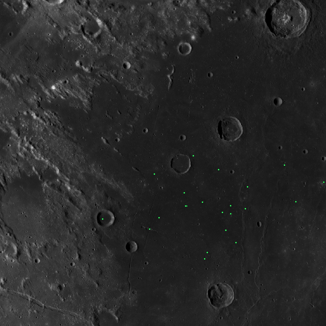
Map of locations of Irregular Mare Patches (IMPs) 100 m or greater in dimension on the lunar nearside as identified by Braden, et al. (2014) using Lunar Reconnaissance Orbiter Camera (LROC) NAC images. IMPs are small, young topographic features with sharp, irregular morphology thought to be related to lunar volcanism. For more information, refer to: Braden, S. E., Stopar, J. D., Robinson, M. S., Lawrence, S. J., Van Der Bogert, C. H., & Hiesinger, H. (2014). Evidence for basaltic volcanism on the Moon within the past 100 million years. Nature Geoscience, 7(11), 787-791. doi:10.1038/ngeo2252
When citing this product, use the following reference: Braden, S. E., Stopar, J. D., Robinson, M. S., Lawrence, S. J., Van Der Bogert, C. H., & Hiesinger, H. (2014). Evidence for basaltic volcanism on the Moon within the past 100 million years. Nature Geoscience, 7(11), 787-791. https://doi.org/10.1038/ngeo2252
Point shapefiles are available in the IAU Moon 2000 Geographic Coordinate System in both the -180 to 180 and 0 to 360 longitude domains.
| Longitude Domain | Product Name |
|---|---|
| 180 | LUNAR_IMP_LOCATIONS_180 |
| 360 | LUNAR_IMP_LOCATIONS_360 |
Shapefile Field Descriptions:
- NAME: Name of the Irregular Mare Patch
- LENGTH: Length in meters
- LAT: Latitude in degrees
- LON: Longitude in degrees (0 to 360)
- HOST_MARE: Mare where IMP is located
- GEO_CONTEX: Notes on the geological context of the IMP
- GRADE: IMP grade (See Braden, et al. 2014)
Irregular Mare Patch (IMP) Locations Shapefile
Extra Downloads
- Zip file containing shapefile for Irregular Mare Patch (IMP) Locations - 360 domain - (950.16 KB)
- PDS Directory For Irregular Mare Patch (IMP) Locations - 360 domain
- README Irregular Mare Patch (IMP) Locations - (1.46 KB)
- Zip file containing shapefile for Irregular Mare Patch (IMP) Locations - 180 domain - (950.18 KB)
- PDS Directory For Irregular Mare Patch (IMP) Locations - 180 domain

