
The two Narrow Angle Cameras (NACs) provide high-resolution (0.5 to 2.0 m/pixel) panchromatic images over a combined 5 km swath. Images acquired over many orbits and multiple months can be combined to create mosaics. NAC images acquired under similar lighting conditions (e.g. high sun/low sun) were map-projected using the GLD100 (WAC derived 100 m/pixel DTM) and LOLA derived crossover corrected ephemeris. In some cases images with similar incidence angles and opposite solar azimuth angles (east and west) were used to increase areal coverage. After map projection, the images were shifted in latitude and longitude to minimize offsets in regions of overlap, and the pixel values were scaled to reduce brightness contrasts caused by differences in illumination angles.
When citing this product, use the following reference:
Robinson, M. S., Speyerer, E. J., Boyd, A., Waller, D., Wagner, R. V., & Burns, K. N. (2012). Exploring the Moon with the lunar reconnaissance orbiter camera. Int. Arch. Photogramm. Remote Sens. Spat. Inf. Sci, 39, B4. https://doi.org/10.5194/isprsarchives-XXXIX-B4-501-2012
For more information about this and other RDRs, see the RDR Software Interface Specification (SIS) at http://lroc.sese.asu.edu/data/LRO-L-LROC-5-RDR-V1.0/LROLRC_2001/DOCUMENT/RDRSIS.PDF.
PDS PRODUCT NAMING CONVENTION
The PRODUCT_ID naming convention for LROC NAC ROIs is:
NAC_ROI_xxxxxxxxSSv_AyyyBzzzz[_##M].IMG where
- NAC_ROI = indicating it's a NAC ROI product
- xxxxxxx = words specifying the sitename (8 characters)
- SS = LO for low Sun angle or HI for high Sun angle
- v = incremental character for distinguishing multiple mosaics with similar lighting of the same region. Letters are used for individual mosaics and numbers are used for composite mosaics composed of mulitiple controlled mosaics.
- A = projection type (E for equirectangular, P for polar stereographic)
- yyy = center latitude to the nearest 10th of a degree
- B = N for northern hemisphere, S for southern hemisphere
- zzzz = center longitude to the nearest tenth of a degree. The longitude domain for all NAC DTMs is 360 positive east.
- [_##M] = indicates the pixel scale in meters; used only for supplementary lower resolution products.
Example: NAC_ROI_APOLLO15LOC_E252N0018.IMG is a NAC ROI of the Apollo 15 landing site with low-Sun. C indicates it's the third low-Sun mosaic of the Apollo 15 landing site produced. This mosaic is centered at latitude=25.2N, longitude=1.8E and is in equirectangular projection.
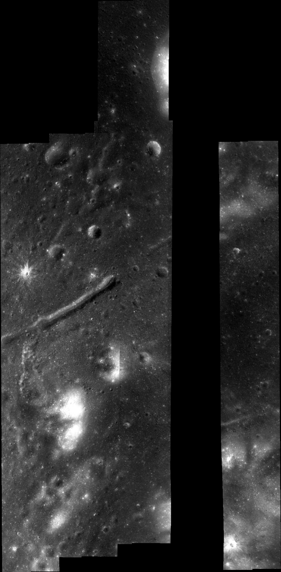
| RDR Name | NAC_ROI_RIMAEPRNHIA_E274N3183 | |||
| Site Name | Rimae Prinz | |||
| Center Lat | 27.4 | |||
| Center Lon | 318.3 | |||
| Pixel Scale | 0.55 m/px | |||
| Image Start Time (UTC) | 2009-10-06 22:35:33.164+00 | |||
| Image Stop Time (UTC) | 2010-08-30 15:23:19.967+00 | |||
| # Images | 10 | |||
| Incidence | High Sun | |||
| Minimum Latitude | 26.78 | |||
| Maximum Latitude | 28.05 | |||
| Minimum Longitude | 317.99 | |||
| Maximum Longitude | 318.69 |
| Image ID | Center Lat | Center Lon | Incidence | Pixel Scale |
| M111870491L | 27.29 | 318.24 | 42° | 0.52 m/px |
| M111870491R | 27.29 | 318.15 | 42° | 0.51 m/px |
| M137821049L | 27.58 | 318.28 | 41° | 0.51 m/px |
| M137821049R | 27.58 | 318.36 | 41° | 0.51 m/px |
| M127206413L | 27.26 | 318.09 | 39° | 0.47 m/px |
| M127206413R | 27.26 | 318.02 | 39° | 0.47 m/px |
| M109507800L | 27.32 | 318.38 | 29° | 0.53 m/px |
| M109507800R | 27.32 | 318.28 | 29° | 0.53 m/px |
| M122482758L | 27.26 | 318.58 | 34° | 0.47 m/px |
| M122482758R | 27.26 | 318.65 | 34° | 0.47 m/px |
Link to browse PNG
NAC_ROI_RIMAEPRNHIA
Rimae Prinz high-Sun semi-controlled NAC mosaic (A)
Mosaic (0.55 m/px) (click for more information)
Lower Resolutions
Supplemental Downloads

